This article relies largely or entirely on a single source .(March 2023) |
This is a list of metropolitan cities in the state of West Bengal, India according to their population.
This article relies largely or entirely on a single source .(March 2023) |
This is a list of metropolitan cities in the state of West Bengal, India according to their population.
| Rank | City | Image | Population (2011) [1] | Area (km²) | Density | District |
|---|---|---|---|---|---|---|
| 1 | Kolkata |  | 14,112,536 | 1,888 | 7,482.79 | Kolkata, North 24 Parganas, South 24 Parganas, Howrah, Hooghly |
| 2 | Asansol |  | 1,243,008 | 1615 | 3,547.20 | West Bardhaman |
| 3 | Siliguri |  | 701,489 | 2222 | 5968.09 | Darjeeling, Jalpaiguri |
| 4 | Durgapur |  | 581,409 | 1550 | 3,772.66 | West Bardhaman |
| 5 | Bardhaman | 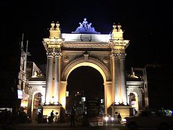 | 347,016 | 157 | 13,194.52 | East Bardhaman |
| 6 | Malda |  | 324,237 | 206 | 13,167.53 | Malda |
| 7 | Berhampore |  | 305,609 | 194 | 6,365.37 | Murshidabad |
| 8 | Kharagpur |  | 293,719 | 127 | 1,884.80 | West Medinipur |
| 9 | Basirhat [2] |  | 206,000 | 56 | 8,400.45 | North 24 Parganas |
| 10 | Haldia |  | 200,762 | 198 | 1,841.85 | East Medinipur |