
Belait District or simply known as Belait, is the largest as well as the westernmost district in Brunei. It has an area of 2,727 square kilometres (1,053 sq mi) and the population of 65,531 as of 2021. The administrative town is Kuala Belait, located at the mouth of the 32 kilometres (20 mi) long Belait River. The district is commonly associated with the oil and gas industry of the country, mainly concentrated near the town of Seria.
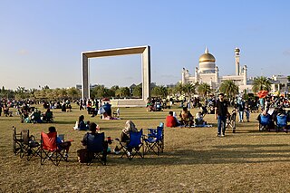
Brunei–Muara District or simply known as Brunei–Muara, is the smallest as well as the most populated district in Brunei. It has an area of 571 square kilometres (220 sq mi) and the population of 318,530 as of 2021. The district is also home to its administrative centre is Bandar Seri Begawan, as well as the Brunei International Airport and Muara Port, the country's only international airport and deep-water port respectively. The Brunei River flows within this district and is home to Kampong Ayer. As the administrative center of Brunei is located in the district, it remains the most developed in the country with the most up-to-date infrastructure, despite not being the center of Brunei's main economic activity.

Tutong District or simply known as Tutong, is the third largest and populated district in Brunei. It has an area of 1,166 square kilometres (450 sq mi) and the population of 47,210 as of 2021. The district is also home to its administrative centre is Tutong Town, as well as the Tutong River and Tasek Merimbun, the country's second longest river and the only ASEAN Heritage Parks in Brunei respectively.

Temburong District or simply known as Temburong, is the second largest and least populated district in Brunei. It has an area of 1,306 square kilometres (504 sq mi) and the population of 9,444 as of 2021. The district is also home to its administrative centre, Bangar Town, as well as the Temburong River and Ulu Temburong National Park, the country's third longest river and a national park in Brunei respectively.

Forestry laws govern activities in designated forest lands, most commonly with respect to forest management and timber harvesting. Forestry laws generally adopt management policies for public forest resources, such as multiple use and sustained yield. Forest management is split between private and public management, with public forests being sovereign property of the State. Forestry laws are now considered an international affair.
The Korea Forest Service is a central administrative agency under the Ministry of Agriculture, Food and Rural Affairs (MAFR), responsible for protecting and nurturing forests, increasing forest resources, developing forest products, conducting research on forest management and improvement, and is located in Daejeon Government Complex. In the past, during the national forestation campaign from 1973 to 1986, it was temporarily under the Ministry of Home Affairs, but returned to the Ministry of Agriculture, Forestry and Fisheries in 1987. However, as the agency's work was focused solely on maintaining and managing successful national forestation policies, questions were raised about its necessity for a period of time. Currently, the agency has transformed its identity into one that strives to generate continuous income through forest resources.

Deforestation in Cambodia has increased in recent years. Cambodia is one of the world's most forest endowed countries, that was not historically widely deforested. However, massive deforestation for economic development threatens its forests and ecosystems. As of 2015, the country has one of the highest rates of deforestation in the world.

One of Bhutan's significant natural resources in the late twentieth century was its rich forests and natural vegetation. Bhutan's location in the eastern Himalayas, with its subtropical plains and alpine terrain, gives it more rainfall than its neighbors to the west, a factor greatly facilitating forest growth. The forests contain numerous deciduous and evergreen species, ranging from tropical hardwoods to predominantly oak and pine forests.

The Ministry of Environmental Conservation and Forestry is a ministry in the government of Myanmar responsible for the country's forestry and logging sectors. From 1948 to 5 March 1992, the Ministry was joined with the Ministry of Agriculture and Irrigation as the Ministry of Agriculture and Forests.

Ulu Temburong National Park is the first national park to be established in Brunei, protected since 1991. The park is in Temburong District in eastern Brunei, and covers about 40% of the district in the south at 550 square kilometres (210 sq mi). It is within the Batu Apoi Forest Reserve. The park contains unspoiled jungle and is known as the "Green Jewel of Brunei", described as "the finest example of the sultanate's successful forest protection policy". The principal rivers are the Temburong and Belalong Rivers. It is an important ecotourism centre in Brunei and hosts the Ulu Ulu Resort. The Peradayan Forest Reserve is also located in the district.

The Institute for Biodiversity and Environmental Research in Brunei Darussalam is a research institute of Universiti Brunei Darussalam (UBD) dedicated to biodiversity and environmental sciences research and education. IBER's location within the northwest Borneo hotspot offers unique opportunities for long-term studies in both terrestrial and marine tropical ecosystems.

Energy in Brunei is related to all of the type of energy and its related infrastructure used in Brunei. Natural gas and diesel are used significantly in Brunei to generate domestic electricity, as well as gasoline and diesel to power its roads. Domestic supplies were undoubtedly still safe, but they were still susceptible to disturbances that would result in power outages and a lack of gasoline. To reduce the country's susceptibility and the economic hazards brought on by interrupted power and fuel shortages, it is crucial to strengthen the dependability of these sources.

Protected areas of Brunei are established by the Government of Brunei, in accordance with national development objectives and global biogeoecological strategies in which forests play an important role. The country's marine protected areas remained at 0.2% in 2022. As of 2011, nearly half of Brunei Darussalam is still primary forest, however this coverage is dwindling and only 17% of the country is officially protected.

Kampong Sungai Liang is a village located in Belait District, Brunei, approximately 40 kilometres (25 mi) from the district's main town, Kuala Belait, and 20 kilometres from the oil town of Seria. With a population of 641 in 2021, it is part of the Mukim Liang area and plays an important role in both agriculture and industry. The village is known for its agricultural contributions, including significant crop production and local handicrafts that have garnered international attention. Additionally, the village's industrial park is a key driver of Brunei's economic diversification, hosting major petrochemical and fertiliser companies that help reduce the country’s reliance on oil and gas.

Luagan Lalak Forest Recreation Park is a protected recreational forest in Mukim Labi, Belait District, Brunei. It is a significant wetland conservation area under the jurisdiction of the Forestry Department, valued for its role in biodiversity protection and ecological importance. Unlike many recreational forest parks that include disturbed or plantation forests, Luagan Lalak remains a natural wetland ecosystem, underscoring its significance in conservation efforts.

Berambang Island is an island at the southern bank of the Brunei River in the Mukim Kota Batu, Brunei-Muara District, Brunei. The island was formerly named Buang Tawer during The Brooke Era from 1841 until 1941. The mausoleum of the 9th Sultan of Brunei, Muhammad Hassan is located on the island, near Kampong Sungai Bunga.

The Forestry Department, also referred to as the Forest Department, is a department overseen by the Ministry of Primary Resources and Tourism (MPRT). Through the department practices sustainable forest management to ensure that forest resources can be used and utilized continuously in addition to balancing environmental, economic and social interests as well as the well-being of the people and the country.

The National Development Plan (NDP) or natively known as Rancangan Kemajuan Negara (RKN), is the name assigned by the government of Brunei to a plan designed to carry out Wawasan Brunei 2035 and diversify the economy by putting projects, programs, and initiatives into action. The RKN and planning were carried out under the direction of the Department of Economic Planning and Statistics (DEPS).

Bukit Shahbandar Forest Recreation Park is a protected recreational forest in Kampong Jerudong 'B', Brunei–Muara District, Brunei. It is characterised primarily by coniferous plantations. Unlike other conservation forests, which focus on preserving biodiversity and primary forest ecosystems, Bukit Shahbandar serves a recreational and educational purpose, though its natural vegetation has been altered.


