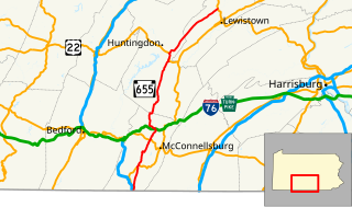
List of quadrant routes in Fulton County, Pennsylvania

Last updated

Quadrant Routes in Pennsylvania are maintained by the Pennsylvania Department of Transportation. This article lists all the routes and their termini in Fulton County. As is the case with the other counties in the state, the route numbers start in the northeast quadrant and go clockwise from the 1000s to the 4000s. Odd numbered roads travel south to north. Even numbered roads travel west to east. There is no specific pattern for numbering order.

Contents

The north-south quadrant dividers is not explicitly delineated. The east-west divider are PA 665 from the Maryland State line to Hustontown and PA 475 from Hustontown to the Huntingdon County line.

1000s

RouteLengthFromViaToNotes
1001Lincoln Way East (PA 16) in McConnelsburg 7th Street, Cito Road U.S. Route 522 in Webster Mills
1002Cito Road (QR 1001)Union Church Road U.S. Route 522
1003Lincoln Way West (QR 1004)Back Run Road U.S. Route 522 Two (2) Peach Road Bridges over the U.S. Route 30 Bypass of McConnellsburg and Patterson Run
1004Junction of Lincoln Way and 2nd Street in McConnelsburg Lincoln Way West Lincoln Highway (The U.S. Route 30 Bypass of McConnellsburg)
1005Grist Mill Road (QR 1010)Aughwick Road (Allens Valley Road) Lincoln Highway (U.S. Route 30)
1006 Lincoln Highway (U.S. Route 30)Lincoln Way EastJunction of the Buchanan Trail PA 16 in McConnelsburg
1007Great Cove Road (U.S. Route 522) near KnobsvilleBreezy Point Road, Patterson Run RoadPleasant Ridge Road (Pennsylvania Route 665) in AndoverShort concurrence on the Lincoln Highway (U.S. Route 30)
1009Croghan Pike (U.S. Route 522) in Burnt Cabins Neeleyton RoadGrist Mill Road (QR 1010)Also includes a Decorum Road Bridge over the South Branch of the Little Aughwick Creek
1010 Huntingdon County lineGrist Mill Road, Fannettburgs RoadCroghan Pike (U.S. Route 522) in Burnt Cabins Continuation of QR 2018 in Huntingdon County
1011 Huntingdon County lineSinoquipe RoadGreat Cove Road (U.S. Route 522) in Fort Littleton Continuation of QR 2003 in Huntingdon County
1012Great Cove Road (U.S. Route 522) in Fort Littleton Plum Hollow RoadNorth Clear Ridge Road (Pennsylvania Route 475)
1016Cito Road (QR 1001)Fulton Drive U.S. Route 522

2000s

RouteLengthFromViaToNotes
2001Big Cove Tannery Road (Pennsylvania Route 928)Heavenly Acres Ridge Road Maryland State LineContinues as Maryland Route 615
2002Big Cove Tannery Road (Pennsylvania Route 928)Tollgate Ridge RoadTimber Ridge Road (QR 2005)
2003 U.S. Route 522 Gem Bridge RoadTollgate Ridge Road (QR 2002)
2004Timber Ridge Road (QR 2005)Johnsons Mill RoadThompson Road (Pennsylvania Route 655)
2005 U.S. Route 522 Timber Ridge RoadThompson Road (Pennsylvania Route 655)

3000s

RouteLengthFromViaToNotes
3001Junction of Pigeon Cove Road (Pennsylvania Route 484) near Warfordsburg Buck Valley Road Maryland State Line
3002Buck Valley Road (Pennsylvania Route 484)Harmonia RoadBuck Valley Road (Pennsylvania Route 484)
3003Bridge carrying Stoneybreak Road over the Minnow Run in Bethel Township
3004Junction of McKees Gap Road PA 731 and Fairview RoadMcKees Gap Road Bedford County lineContinues as Bedford County QR 2006
3005Harmonia Road (QR 3002)High Germany Road Road Maryland State Line
3006Mill Hill RoadRobinson RoadDead-ends in Bethel Township Also includes four (4) bridges carrying Mill Hill Road over Little Tonoloway Creek, I-70, the Tonoloway Creek, and I-70.
3007Junction of PA 655 and Great Cove Road (U.S. Route 522) in Needmore Deneens Gap Road, Thomason Road, Pleasant Grove Road, Thompson RoadJunction of PA 731 and I-70
3008Three (3) bridges carrying Blairs Hill Road over the Foster Creek and the Tonoloway Creek
3009Mays Chapel Road(Klondike Road)Dead-ends in Bethel Township Also includes a bridge carrying Klondike Road over the White Oak Run
3010A bridge carrying Campmeeting Road over the Barton Run in Brush Creek Township
3011Great Cove Road (U.S. Route 522) in Needmore Pigeon Cove RoadJunction of Stillwell Road PA 484 near Warfordsburg
3013Ten (10) bridges carrying Sipes Mill Road over the following streams: the Tonoloway Creek, and unnamed tributary to the Tonoloway Creek, Sawmill Run, Cummings Run, and four (4) unnamed tributaries to the Cummings Run, Barnetts Run, and an unnamed tributary to Barnetts Run
3015Three (3) bridges carrying Wertzville Road over the Cummings Run, an unnamed tributary to the Tonoloway Creek, and Palmer Run
3017 Bedford County lineOld Route 126Junction of I-70 and PA 643 Continuation of Bedford County QR 2024
3019Junction of I-70 and U.S. Route 522 Great Cove RoadBuck Valley Road (Pennsylvania Route 484)
3023Junction of I-70 and PA 915 South Valley RoadOld Route 126 (QR 3017)
3101Layton Road bridge over I-70

4000s

RouteLengthFromViaToNotes
4001The Lincoln Highway (U.S. Route 30 Sipes Mill RoadBlairs Hill Road
4002Bridge carrying Ebenezer Church Road over the Foster Creek
4003The Lincoln Highway (U.S. Route 30 Black Bear RoadSipes Mill Road
4004Waterfall Road (PA 655) near Hustontown N Hess RoadJunction of Little Egypt Road (QR 4007)
4005South Valley Road (PA 915) near AkersvillePleasant Valley RoadSouth Valley Road (PA 915)
4006N Hess RoadMountain House RoadNorth Valley Road (PA 915)
4007Waterfall Road (PA 655)North Hess Road, Little Egypt RoadThe Lincoln Highway (U.S. Route 30
4008 Huntingdon County lineDublin Mills RoadWaterfall Road (PA 655)
4009Waterfall Road (PA 655)King RoadNorth Hess Road (QR 4004)
4010Wells Valley Road (QR 4013)Schneck Road Bedford County lineContinues as Enid Mountain Road in Bedford County
4011Waterfall Road (PA 655) near Waterfall Madden RoadNorth Clear Ridge Road (PA 475)
4012Wells Valley Road (QR 4013)Metzler RoadNorth Valley Road (PA 915)
4013New Grenada Highway (PA 913)Wells Valley RoadNorth Valley Road (PA 915)
4015 Huntingdon County lineHoover RoadNew Grenada Highway (PA 913)Continuation of Huntingdon County QR 3021
4017Hoover Road (QR 4015)Houck RoadNew Grenada Highway (PA 913)
4019Waterfall Road (PA 655) near Waterfall New Grenada Highway PA 913

8000s

RouteLengthFromViaToNotes
8004Ramps for the I-70 and U.S. Route 522 interchange
8006Ramps for the I-70 and PA 713 interchange
8008Ramps for the I-70 and PA 643 interchange
8014Ramps for the I-70 and PA 915 interchange
8022Ramps for the U.S. Route 522 and U.S. Route 30 Bypass of McConnellsburg interchange

9000s

RouteLengthFromViaToNotes
9201Ramps for the I-70 welcome center
9204Ramps for the I-70 south bound rest stop
9302Truck escape ramp off of the Lincoln Highway (U.S. Route 30)
9304Truck escape ramp off of the Lincoln Highway (U.S. Route 30)
9402Ramps off of the Lincoln Highway (U.S. Route 30) for the Sidling Hill picnic area
9404Ramp off of the Lincoln Highway (U.S. Route 30) for scenic overlook
9406Ramp off of the Lincoln Highway (U.S. Route 30) for scenic overlook

See also

Related Research Articles

Pennsylvania Route 655

Pennsylvania Route 655 is an 83-mile-long (134 km) north–south state highway located in central Pennsylvania. The southern terminus of the route is at the Mason–Dixon line in Thompson Township, where the road becomes a local road in Hancock, Maryland. The northern terminus is at State Route 1005, the former alignment of U.S. Route 322, in Reedsville.

The following is a list of former state routes in Pennsylvania. These roads are now either parts of other routes or no longer carry a traffic route number. This list also includes original routes of numbers that were decommissioned and later reactivated in other locations in which most of these are still active today.

References