
Waterloo is a London Underground station located beneath Waterloo National Rail station. As of 2021, it is the 5th busiest station on the London Underground, with 29.87 million users. It is served by four lines: the Bakerloo, Jubilee, Northern and Waterloo & City lines.

Amersham is a London Underground and National Rail station in Amersham in the Chiltern district of Buckinghamshire, England.

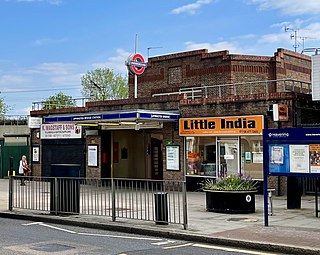
Kew Gardens is a Grade II–listed London Underground and London Overground station in Kew, in the London Borough of Richmond upon Thames. It first opened in 1869 and is now managed by London Underground. The station, which is in Travelcard Zones 3 and 4, is served by both the District line on the London Underground and the North London line on the London Overground, and is situated midway between Gunnersbury and Richmond stations.

West Ham is a London Underground, Docklands Light Railway (DLR) and National Rail intermodal interchange station in West Ham, London, United Kingdom. The station is served by London Underground's District, Hammersmith & City and Jubilee lines, the Stratford International branch of the DLR, and c2c National Rail services.

Stonebridge Park is a London Overground and London Underground station in Tokyngton and Stonebridge, north-west London. It is on both the London Overground Watford DC line and London Underground Bakerloo line. It is located on Argenta Way, and is named after the nearby junction connecting the North Circular Road (A406) with the Harrow Road (A404).

Peterlee is a town in County Durham, England. It lies between Sunderland to the north, Hartlepool to the south, the Durham Coast to the east and Durham to the west. It gained town status in 1948 under the New Towns Act 1946. The act also created the nearby settlement of Newton Aycliffe and later Washington, Tyne and Wear.

Upminster is an interchange station serving the town of Upminster in the London Borough of Havering, Greater London. It is on the London, Tilbury and Southend line (LTSR), 15 miles 20 chains (24.5 km) down the line from London Fenchurch Street; it is the eastern terminus of the District line on the London Underground; and it is the eastern terminus of the Romford to Upminster Line on the London Overground network. Upminster is the easternmost station on the London Underground network as well as the easternmost National Rail station in London.
Upminster Bridge is a London Underground station in the Upminster Bridge neighbourhood of Upminster in the London Borough of Havering, east London. It is on the District line between Hornchurch to the west and Upminster to the east. It is 1.2 kilometres (0.75 mi) along the line from the eastern terminus at Upminster and 33 kilometres (21 mi) to Earl's Court in central London where the line divides into numerous branches. The station was opened on 17 December 1934 by the London, Midland and Scottish Railway on the local electrified tracks between Upminster and Barking that were constructed in 1932. The main station building, on Upminster Road, is of a distinctive polygonal design by William Henry Hamlyn. It has relatively low usage for a suburban station, with approximately 1.15 million passenger entries/exits in 2017.

Walthamstow Central is a London Underground and London Overground interchange station in the town of Walthamstow in the London Borough of Waltham Forest, north-east London. It is the northern terminus of the Victoria line following Blackhorse Road and is the second of five stations on the Chingford branch of the Lea Valley lines operated by London Overground since 2015, 6 miles 16 chains (10.0 km) from London Liverpool Street between St. James Street and Wood Street. The two lines have separate platforms at different levels.

Blackhorse Road is a joint London Overground and London Underground station, located at the junction of Blackhorse Road/Blackhorse Lane with Forest Road in Walthamstow, London, England. It is on the Victoria line of the London Underground and is the penultimate station on the eastern end of that line. Above ground, the station is on the Gospel Oak to Barking line of the London Overground, 7 miles 21 chains (11.7 km) from St Pancras.

Seven Sisters is a National Rail, London Overground and London Underground Victoria line station in the Seven Sisters area of the London Borough of Haringey, north London. The station has two entrances/exits, one on Tottenham High Road and the other on Seven Sisters Road.

Horden is a village and electoral ward in County Durham, England. It is situated on the North Sea coast, to the east of Peterlee, approximately 12 miles south of Sunderland. Horden was a mining village until the closure of the Horden Colliery in 1987. Main features include the Welfare and Memorial Parks and St Mary's church. It is connected to the villages of Blackhall Colliery and Blackhall Rocks to its south by a spectacular rail viaduct which spans Castle Eden Dene near Denemouth. Horden Dene provides Horden's northern boundary with Easington Colliery.

The Durham Coast Line is an approximately 39.5-mile (63.6 km) railway line running between Newcastle and Middlesbrough in North East England. Heavy rail passenger services, predominantly operated Northern Trains, and some freight services operate over the whole length of the line; it provides an important diversionary route at times when the East Coast Main Line is closed. Light rail services of the Tyne and Wear Metro's Green Line also operate over the same tracks between a junction just south of Sunderland station and Pelaw Junction.

Stanlow and Thornton railway station is located within the Stanlow Refinery in Cheshire, England. It lies on the Hooton–Helsby line with services operated by Northern Trains. The station is surrounded by the refinery site, so as a result most station users are refinery employees. In 2018–19 it was the joint least-used railway station in Britain, tied with Denton in Greater Manchester. In 2020/21, the station was also one of the least used stations in Britain, with 0 entries/exits. Since 3 February 2022 the station has been temporarily closed due to safety concerns of the footbridge which is the only entrypoint to the station.

Balham is an interchange station formed of a range of underground entrances for the London Underground ('tube') and a shared entrance with its National Rail station component. The station is in central Balham in the London Borough of Wandsworth, south London, England. The tube can be accessed on each side of the Balham High Road (A24); National Rail on the south side of the road leading east, where the track is on a mixture of light-brick high viaduct and earth embankment, quadruple track and on a brief east–west axis.

Cassiobridge was a proposed London Underground station in Watford, Hertfordshire, England. The station would have been part of the Croxley Rail Link project, a scheme to extend the Metropolitan line to Watford Junction railway station. It would have been served by Metropolitan line trains between Watford Junction and Central London via Baker Street. The railway line would run over Ascot Road via a viaduct and the platforms would have been situated on the east side of the road. Entrance to the station would have been from the west side of the road, with a ticket hall and other facilities at street level. Passengers would gain access to the platforms via stairs and lifts and a short footbridge over the road.

Watford Vicarage Road is a proposed London Underground station in Watford, Hertfordshire. The station is proposed to be part of the approved, but currently suspended due to funding, Croxley Rail Link project, a scheme to extend the Metropolitan line to Watford Junction railway station, served by Metropolitan line trains between Watford Junction and Central London via Baker Street. Originally the station was to be named either Watford Hospital or Watford General Hospital. On 25 January 2017, the Watford Observer newspaper published an update on the Croxley Rail Link confirming work had stopped as there was an ongoing funding issue.

Horden is a railway station on the Durham Coast Line, which runs between Newcastle and Middlesbrough via Hartlepool. The station, situated 10 miles 74 chains (17.6 km) south-east of Sunderland, serves the villages of Horden, Blackhall Colliery and Easington along with the town of Peterlee in County Durham, North East England. It is owned by Network Rail and managed by Northern Trains.
This is a list of railway stations in County Durham, with estimated usage figures gathered from data collected by the Office of Rail and Road (ORR). As of July 2020, there are 17 stations located within County Durham, from which around 6.47 million passenger journeys were made during 2018–19. Note that Horden station opened in 2020 so received no entries and exits in the period covered by the data.


