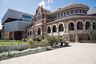
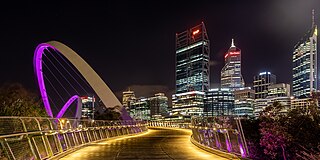
Perth is the capital and largest city of the Australian state of Western Australia (WA). It is the fourth most populous city in Australia and Oceania, with a population of 2.1 million living in Greater Perth in 2020. Perth is part of the South West Land Division of Western Australia, with most of the metropolitan area on the Swan Coastal Plain between the Indian Ocean and the Darling Scarp. The city has expanded outward from the original British settlements on the Swan River, upon which the city's central business district and port of Fremantle are situated. Perth is located on the traditional lands of the Whadjuk Noongar people, where Aboriginal Australians have lived for at least 45,000 years.

Hamersley is a residential suburb 14 kilometres north-northwest of the central business district of Perth, the capital of Western Australia, and six kilometres (4 mi) from the Indian Ocean. The suburb adjoins two major arterial roads—Mitchell Freeway to the west and Reid Highway to the south—and is within the City of Stirling local government area. It was built during the late 1960s and 1970s as part of the Government of Western Australia's response to rapidly increasing land prices across the metropolitan area.

The City of Melville is a local government area in the southern suburbs of the Western Australian capital city of Perth, east of the port city of Fremantle and about 12 kilometres (7.5 mi) south of Perth's central business district. The City covers an area of 52.73 square kilometres (20.36 sq mi) and had a population of about 98,000 as at the 2016 Census.

The City of Vincent is a local government area of Western Australia. It covers an area of approximately 10.4 square kilometres (4.0 sq mi) in metropolitan Perth, the capital of Western Australia, and lies about 3 km from the Perth CBD. The City of Vincent maintains 139 km of roads and 104 ha of parks and gardens. It had a population of over 33,000 at the 2016 Census.

Melbourne is considered to be Australia's garden city, and Victoria as the Garden State. There is an abundance of parks and gardens close to the CBD with a variety of common and rare plant species amid landscaped vistas, pedestrian pathways, and tree lined avenues.

Kings Park, is a 400.6-hectare (990-acre) park overlooking Perth Water and the central business district of Perth, Western Australia.

Crawley is an affluent western suburb of Perth, the capital city of Western Australia. Whole area is part of the local government area of the City of Perth and previously shared between the City of Subiaco and City of Perth. It is about 5.8 kilometres (4 mi) from the Perth CBD via Mounts Bay Road.

Mount Eliza is a hill that overlooks the city of Perth, Western Australia and forms part of Kings Park. It is known as Kaarta Gar-up and Mooro Katta in the local Noongar dialect.
Perth was founded by Captain James Stirling in 1829 as the administrative centre of the Swan River Colony. It gained city status in 1856 and was promoted to the status of a Lord Mayorality in 1929. The city inherited its name due to the influence of Sir George Murray, then Member of Parliament for Perthshire and Secretary of State for War and the Colonies.

The City of Armadale is a local government area in the southeastern suburbs of the Western Australian capital city of Perth, about 28 kilometres (17.4 mi) southeast of Perth's central business district. The City covers an area of 560 square kilometres (216 sq mi), much of which is state forest rising into the Darling Scarp to the east, and had a population of almost 80,000 as at the 2016 Census.
The Botanic Gardens and Parks Authority is a Western Australian Government authority charged with the administration of Kings Park and Bold Park.

Mounts Bay Road is a major road in Perth, Western Australia, extending southwest from the central business district along the north bank of the Swan River, at the base of Kings Park.
The Wildflower Society of Western Australia (Inc.) (WSWA) is a member of the Australian Native Plants Society (Australia). In each of the other states of Australia, there is a region of the ANPS(A) and they share many of the aims of the WSWA.

The Perth tramway network served Perth, the capital city of Western Australia, from 1899 until 1958. The network was initially run by a private company but was taken over by the state government in 1913. From a single line along Hay Street, the network expanded north as far as Osborne Park, east as far as Welshpool, south as far as Como, and west as far as Claremont. The tramways were gradually replaced by buses after World War II.
Tourism in Perth, the capital city of Western Australia, is an important part of the Australian state's economy, contributing to the prosperity of businesses in the city, as well as other regions of the state.
Tourist Drives in Western Australia are routes through areas of scenic or historic significance, designated by route markers with white numbers on a brown shield. Tourist Drives were introduced into Western Australia while Eric Charlton was the state government Minister for Transport in the 1990s. The 28 numbered routes collectively traverse more than 2,000 kilometres (1,200 mi) across the state. In addition to the Tourist Drives, there are unnumbered routes such as the Golden Pipeline Heritage Trail, and local governments may designate and maintain local scenic drives, generally unnamed and unnumbered.

Kensington bushland reserve is a significant remnant of Swan Coastal Plain vegetation, that has been reserved in the suburb of Kensington, in Perth, Western Australia, by the state government.

The Department of Biodiversity, Conservation and Attractions (DBCA) is the Western Australian government department responsible for managing lands and waters described in the Conservation and Land Management Act 1984, the Rottnest Island Authority Act 1987, the Swan and Canning Rivers Management Act 2006, the Botanic Gardens and Parks Authority Act 1998, and the Zoological Parks Authority Act 2001, and implementing the state's conservation and environment legislation and regulations. The Department reports to the Minister for Environment and the Minister for Tourism.
The 2021-22 Australian bushfire season is the ongoing season of summer bushfires in Australia. The outlook for the season was below average in parts of Eastern Australia thanks to a La Niña, with elevated fire danger in Western Australia. Higher than normal winter rainfall has resulted in above average to average stream flows and soil moisture levels through much of eastern Australia. The outlook to the end of spring was also for above average falls over much of the country apart for Western Australia. The Australian Capital Territory, Victoria and southern New South Wales are expected to have a below normal fire potential as a result of vegetation still recovering from the 2020-21 Australian bushfire season. Areas of south eastern Queensland, northern New South Wales and northern Western Australia expect an above normal fire potential caused by crop and grass growth in these areas.
