Related Research Articles

India is the most populous country in the world with one-sixth of the world's population. According to estimates from the United Nations (UN), India has overtaken China as the country with the largest population in the world, with a population of 1,425,775,850 at the end of April 2023.

Punjab, also known as the Land of the Five Rivers, is a geopolitical, cultural, and historical region in South Asia. It is located in the northwestern part of the Indian subcontinent, comprising areas of modern-day eastern-Pakistan and northwestern-India. Punjab's major cities are Lahore, Faisalabad, Rawalpindi, Gujranwala, Multan, Ludhiana, Amritsar, Sialkot, Chandigarh, Shimla, Jalandhar, Patiala, Gurugram, and Bahawalpur.

Gurdaspur district is a district in the Majha region of the state of Punjab, India. Gurdaspur is the district headquarters. It internationally borders Narowal District of Pakistani Punjab, and the districts of Amritsar, Pathankot, Kapurthala and Hoshiarpur. Two main rivers Beas and Ravi passes through the district. The Mughal emperor Akbar is said to have been enthroned in a garden near Kalanaur, a historically important town in the district. The district is at the foothills of the Himalayas.
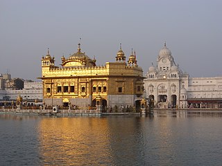
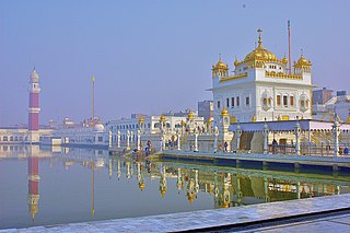
Amritsar district is one of the twenty three districts that make up the Indian state of Punjab. Located in the Majha region of Punjab, the city of Amritsar is the headquarters of this district.

Bathinda district is in Malwa region of Punjab, India. The district encompasses an area of 3,385 square kilometers. By area, Bathinda district is the second-largest in Punjab, after Ludhiana district. It is bounded by Faridkot district and Moga district on the north, Muktsar district on the west, Barnala and Mansa districts on the east, and the state of Haryana on the south. Bathinda is cotton producing belt of Punjab.

Patiala district is one of the twenty three districts in the state of Punjab in north-west India.

Kapurthala district is a district of Punjab state in northern India. The city of Kapurthala is the district headquarters.

Firozpur district, also known as Ferozepur district, is one of the twenty-three districts in the state of Punjab, India. Firozpur district comprises an area of 2,190 km2 (850 sq mi).

The official religion of Pakistan is Islam, as enshrined by Article 2 of the Constitution, and is practised by an overwhelming majority of 96.35% of the country's population. The remaining 3.65% practice Hinduism, Christianity, Ahmadiyya, Sikhism, Zoroastrianism and other religions.

Faridkot district is a district lying in the South-Western part of Punjab, India with Faridkot city as the district headquarters.

Sri Muktsar Sahib district is one of the 23 districts in the Indian state of Punjab. The capital city of district is Sri Muktsar Sahib. The district itself was historically referred to as Khidrane Di Dhaab. There are four tehsils in the district, which consists of a total of 234 villages. The tehsils are Sri Muktsar Sahib, Lambi, Giddarbaha and Malout.
Baidyabati is a city and a municipality of Hooghly district in the State of West Bengal in India. It is under Serampore police station of Srirampore subdivision. It is a part of the area covered by Kolkata Metropolitan Development Authority (KMDA).
Tarn Taran district is one of the districts in the Majha region of Punjab, India. The main cities are Tarn Taran Sahib, Bhikhiwind, Khadur Sahib and Patti. The City of Tarn Taran Sahib is a holy place for Sikhs. Tarn Taran's Sikh population makes it the most heavily concentrated district of Sikhs in India and the world.

Fatehgarh Sahib district is one of the twenty-three districts of the state of Punjab, India, with its headquarters in the town of Fatehgarh Sahib.

The 2011 census of India or the 15th Indian census was conducted in two phases, house listing and population enumeration. The House listing phase began on 1 April 2010 and involved the collection of information about all buildings. Information for National Population Register (NPR) was also collected in the first phase, which will be used to issue a 12-digit unique identification number to all registered Indian residents by Unique Identification Authority of India. The second population enumeration phase was conducted between 9 and 28 February 2011. Census has been conducted in India since 1872 and 2011 marks the first time biometric information was collected. According to the provisional reports released on 31 March 2011, the Indian population increased to 1.21 billion with a decadal growth of 17.70%. Adult literacy rate increased to 74.04% with a decadal growth of 9.21%. The motto of the census was Our Census, Our Future.

Jainism in Pakistan has an extensive heritage and history, with several ancient Jain shrines scattered across the country. Baba Dharam Dass was a holy man whose tomb is located near the bank of a creek called near Chawinda Phatic, behind the agricultural main office in Pasrur, near the city of Sialkot in Punjab, Pakistan. Another prominent Jain monk of the region was Vijayanandsuri of Gujranwala, whose samadhi still stands in the city.

Registrar General and Census Commissioner of India, founded in 1961 by the Government of India Ministry of Home Affairs, for arranging, conducting and analysing the results of the demographic surveys of India including Census of India and Linguistic Survey of India. The position of Registrar General and Census Commisioner is now held by a civil servant holding the rank of Additional Secretary.
References
- ↑ "Census data". Census of India . Retrieved 31 July 2015.