
Bhiwani district is one of the 22 districts of the northern Indian state of Haryana. Created on 22 December 1972, it was the largest district of the state by area, before the creation of Charkhi Dadri as a separate district, as it occupied an area of 4,778 square kilometres (1,845 sq mi) and administered 442 villages with a population of 1,634,445. Sirsa is now the largest district of the state.
Charkhi Dadri is a city and the headquarters of Charkhi Dadri district in the Indian state of Haryana, about 90 km from the national capital Delhi. The town was made by joining the villages of Charkhi and Dadri after urban development. Charkhi Dadri is on NH 148B between Narnaul to Bathinda and NH 348B between Meerut to Pilani segment passing through the city.
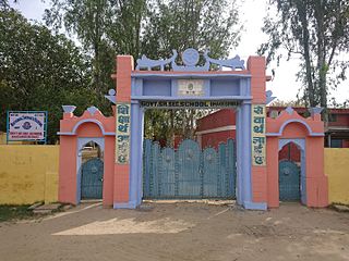
Mahendragarh is a city and a municipal committee in Mahendragarh district in the Indian state of Haryana. It is 100 kilometres (62 mi) from Gurgaon and comes under National Capital Region (India).
Bhiwani–Mahendragarh is one of the ten Lok Sabha (parliamentary) constituencies in Haryana state in northern India. This constituency came into existence in 2008 as a part of the implementation of the recommendations of the Delimitation Commission of India constituted in 2002.

Charkhi Dadri Assembly constituency is one of the 90 Vidhan Sabha constituencies in Haryana state in northern India.
Chandeni is a village in the Charkhi Dadri district of the Indian state of Haryana.Before 2016 It was part of Bhiwani District. But after 2016 Charkhi Dadri become a new district and it become part of Charkhi Dadri.
Khanpur Khurd, is a village, which is the location of Indira Gandhi Super Thermal Power Project, in Matanhail tehsil of Jhajjar District in the state of Haryana in India.
Dhareru is a village in Bhiwani Tehsil in the Bhiwani district of the Indian state of Haryana. Part of the Hisar division, it is located 14 kilometres (8.7 mi) east of the district headquarters of Bhiwani. It lies 13 kilometres (8.1 mi) from Bhiwani and 266 kilometres (165 mi) from the state capital, Chandigarh. Its primary post office is Dhareu.
Nimriwali or Neemriwali is a village in Bhiwani district of the Indian state of Haryana. It lies approximately 09 km south of the district headquarters town of Bhiwani. It's 265 km from State capital Chandigarh and 120 km from Rajdhani Delhi. Neemriwali is a large village of Haryana with total 542 families residing. The Nimriwali village has population of 2945 of which 1563 are males while 1382 are females as per Population Census 2011. In Neemriwali village have a husyant furniture works and Gill shopping mart which has famous in haryana. In Neemriwali village population of children with age 0-6 is 375 which makes up 12.73% of the village population. Average Sex Ratio of Neemriwali village is 884 which is higher than Haryana state average of 879. Child Sex Ratio for the Neemriwali as per census is 838— higher than Haryana average of 834.
Sanwar is a village under new formed district of Charkhi Dadri in Haryana, India. It lies on Charkhi Dari - Rohtak Road and is approximately 12 kilometres (7.5 mi) from Charkhi Dadri.
Badhra is a tehsil, sub-division and assembly constituency in the Charkhi Dadri district of the Indian state of Haryana. It is located 37 kilometres (23 mi) west of district headquarters Charkhi Dadri, 44 kilometres (27 mi) south west of city of Bhiwani and 145 kilometres (90 mi) east of the national capital Delhi. As of the 2011 Census of India, the tehsil had 22,407 households with a total population of 118,084 of which 62,791 were male and 55,293 female.
Gignaw is a village in the Bhiwani district of the Indian state of Haryana. Located in the Loharu tehsil, it lies approximately 47 kilometres (29 mi) south west of the district headquarters town of Bhiwani. As of the 2011 Census of India, the village had 556 households with a total population of 2,357 of which 1,222 were male and 1,135 female.
Dwarka is a village in the Badhra tehsil of the Charkhi Dadri District in the Indian state of Haryana. Located approximately 34 kilometres (21 mi) south west of the town of Bhiwani, as of the 2011 Census of India, the village had 517 households with a total population of 2,705 of which 1,418 were male and 1,287 female.
Umerwas is a village in the Badhra tehsil of Charkhi Dadri district in the Indian state of Haryana. Located approximately 26 kilometres (16 mi) south west of the district headquarters town of Bhiwani, as of the 2011 Census of India, the village had 412 households with a total population of 2,263 of which 1,203 were male and 1,060 female.

Badhra Assembly constituency is one of the 90 Vidhan Sabha constituencies in Haryana state in northern India.
Bhageshwari or Bhagesri is a village in Dadri Tehsil of Charkhi Dadri district, Haryana, India. It is situated 14 kilometres (8.7 mi) away from district headquarter Charkhi Dadri. The Governing body of the village is Gram Panchayat.

Charkhi Dadri District is one of the 22 districts of Haryana state in north west India near Rajasthan border, but not sharing border with Rajasthan. Created on 1 December 2016, the district headquarters is the city of Charkhi Dadri.
National Highway 148B starts at Kotputli, state of Rajasthan and ends at Bathinda, state of Punjab. The major towns are in succession of distance on this highway: Narnaul, Mahendergarh, Charkhi Dadri, Bhiwani, Hansi, Barwala, Bhimewala Tohana, Moonak, Jakhal, Bareta, Budhlada, Bhikhi, Mansa and Maur. This highway meets with National Highway 54 at Bathinda. The highway is 427 km (265 mi) long and runs all within the states of Haryana, Punjab and Rajasthan.
The Trans-Haryana Expressway or the Ambala–Narnaul Expressway (NH-152D) is a 227-km long, 6-lane wide greenfield access-controlled expressway, connecting the cities of Ambala and Narnaul in the state of Haryana. The expressway connects Gangheri village in Kurukshetra district with Surana village on Narnaul Bypass (NH-148B) in Mahendragarh district. It passes via Kaul, Pundri, Assandh, Dhatrath, Kalanaur, Charkhi Dadri and Kanina. It will reduce the distance from Chandigarh to Delhi, Narnaul, and Jaipur, thus decongesting NH-44 and NH-48.

Rudrol is a village in the Charkhi Dadri district of the Indian state of Haryana. Before 2016, it was part of Bhiwani district, but after 2016, Charkhi Dadri become a new district, and it become part of Charkhi Dadri. It is situated 24.9 km away from district headquarter, Charkhi Dadri. As per 2009 stats, Rudrol village is also a gram panchayat.

