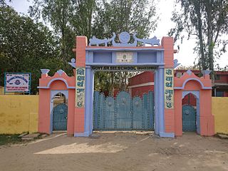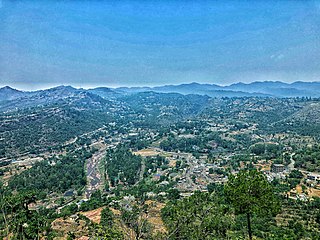
Bhiwani district is one of the 22 districts of the northern Indian state of Haryana. Created on 22 December 1972, it was the largest district of the state by area, before the creation of Charkhi Dadri as a separate district, as it occupied an area of 4,778 square kilometres (1,845 sq mi) and administered 442 villages with a population of 1,634,445. Sirsa is now the largest district of the state.

Mahendragarh district is one of the 22 districts of Haryana state in northern India. The district occupies an area of 1,899 km² and has a population of 922,088 (2021census). District have 4 Sub-divisions : Narnaul, Mahendragarh, Nangal Chaudhary and Kanina
Charkhi Dadri is a city and the headquarters of Charkhi Dadri district in the Indian state of Haryana, about 90 km from the national capital Delhi. The town was made by joining the villages of Charkhi and Dadri after urban development. Charkhi Dadri is on NH 148B between Narnaul to Bathinda and NH 348B between Meerut to Pilani segment passing through the city.
Mahendragarh is a city and a municipal committee in Mahendragarh district in the Indian state of Haryana. It is 100 kilometres (62 mi) from Gurgaon and comes under National Capital Region (India).
Kanina is a famous town and a sub division in Mahendragarh district in the Indian state of Haryana, within the National Capital Region of India.It is one of three administrative blocks of Mahendragarh district and is adjacent to Rewari, Narnaul,Charkhi Dadri, and Jhajjar. It comes in Ahirwal region. It is a municipal committee of Kanina Subdivision in Mahendragarh district.
Chandeni is a village in the Charkhi Dadri district of the Indian state of Haryana. Before 2016 It was part of Bhiwani District. But after 2016 Charkhi Dadri become a new district and it become part of Charkhi Dadri.
Matanhail is a large village and headquarter of eponymous Matanhail Tehsil and Block in Jhajjar District of Haryana, India. It belongs to Rohtak Division. It is located 22 km west of the District headquarters Jhajjar. It is a tehsil headquarter. Matanhail's Pin code is 124106 and postal head office is Matanhail. Matanhail tehsil shares border with Rewari and Charkhi Dadri. Village was founded by Suhag (Sihag) clan jats.
Pota is a village panchayat located in the Mahendragarh district in the Indian state of Haryana.
Badal is a village in the Charkhi Dadri district of the Indian state of Haryana. Located in Charkhi Dadri tehsil, it lies 18 kilometres (11 mi) south of the district headquarters in Charkhi Dadri on the western border with the Jhajjar district. As of the 2011 Census of India, the village had 372 households with a total population of 1,903 of which 1,043 were male and 860 female.
Kari Rupa is a village in the Badhra tehsil of the Charkhi Dadri district in the Indian state of Haryana. Located approximately 37 kilometres (23 mi) south west of the district headquarters town of Charkhi Dadri, as of the 2011 Census of India, the village had 218 households with a total population of 1,203 of which 653 were male and 550 female.
Kari Adu is a village in the Badhra tehsil of the Charkhi Dadri district in the Indian state of Haryana. Located approximately 45 kilometres (28 mi) south west of the district headquarters town of Charkhi Dadri, as of the 2011 Census of India, the village had 255 households with a total population of 1,308 of which 698 were male and 610 female.
Kari Dass is a village in the Badhra tehsil of the Charkhi Dadri district in the Indian state of Haryana. Located approximately 34 kilometres (21 mi) south west of the district headquarters town of Charkhi Dadri, as of the 2011 Census of India, the village had 257 households with a total population of 1,387 of which 720 were male and 667 female.
Ladawas is a village in the Badhra tehsil of the Charkhi Dadri district in the Indian state of Haryana. Located approximately 40 kilometres (25 mi) south west of the district headquarters town of Charkhi Dadri, as of the 2011 Census of India, the village had 430 households with a total population of 1,992 of which 1,049 were male and 943 female.
Jeetpura is a village in the Badhra tehsil of the Charkhi Dadri district in the Indian state of Haryana. Located approximately 46 kilometres (29 mi) south west of the district headquarters town of Charkhi Dadri, as of the 2011 Census of India, the village had 448 households with a total population of 2,258 of which 1,202 were male and 1,056 female.
Kakroli Sardara is a village in the Badhra tehsil of the Charkhi Dadri district in the Indian state of Haryana. Located approximately 34 kilometres (21 mi) from the district headquarters town of Charkhi Dadri, as of the 2011 Census of India, the village had 543 households with a total population of 2,951 of which 1,589 were male and 1,362 female.
Bilawal is a village in the Badhra tehsil of the Charkhi Dadri in the Indian state of Haryana. Located approximately 20 kilometres (12 mi) west of the district headquarters town of Charkhi Dadri, as of the 2011 Census of India, the village had 535 households with a total population of 2,578 of which 1,367 were male and 1,211 female.

Bhageshwari or Bhagesri is a village in Dadri Tehsil of Charkhi Dadri district, Haryana, India. It is situated 14 kilometres (8.7 mi) away from district headquarter Charkhi Dadri. The Governing body of the village is Gram Panchayat.

Charkhi Dadri District is one of the 22 districts of Haryana state in north west India near Rajasthan border, but not sharing border with Rajasthan. Created on 1 December 2016, the district headquarters is the city of Charkhi Dadri.
Chirya is a village in Charkhi Dadri District in the State of Haryana, India. Located on Charkhi Dadri-Kanina road, it is under Badhara constituency. The population of this village is approximately 5604. The village famous for its agriculture and army tradition.

Kalakote is a town located in Rajouri district of Jammu region in the Indian union territory of Jammu and Kashmir. Kalakote is noted for its coal mines and has first Thermal Power Plant of North India. Additionally, the town serves as the headquarters for various administrative entities, including a tehsil, sub-division, block, municipal committee, and constituency, all bearing the name Kalakote.


