Related Research Articles
Jalandhar is a city in the state of Punjab in India. With a considerable population, it ranks as the third most-populous city in the state and is the largest city in the Doaba region. Jalandhar lies alongside the historical Grand Trunk Road and is a well-connected junction for both rail and road networks.

Nakodar is a town and a municipal council in Jalandhar district in the Indian state of Punjab.
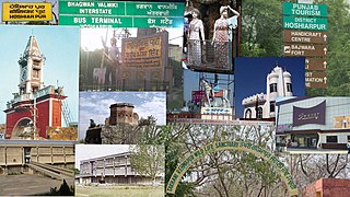
Hoshiarpur is a city and a municipal corporation in Hoshiarpur district in the Doaba region of the Indian state of Punjab. It was founded, according to tradition, during the early part of the fourteenth century. In 1809, it was occupied by the forces of Maharaja Karanvir Singh and was united into the greater state of Punjab in 1849.
Hoshiarpur district is a district of Punjab state in northern India. Hoshiarpur, one of the oldest districts of Punjab, is located in the North-east part of the Punjab state and shares common boundaries with Gurdaspur district in the north-west, Jalandhar district and Kapurthala district in south-west, Kangra district and Una district of Himachal Pradesh in the north-east. Hoshiarpur district comprises 4 sub-divisions, 10 community development blocks, 9 urban local bodies and 1417 villages. The district has an area of 3365 km2. and a population of 1,586,625 persons as per census 2011.

Jalandhar district is a district in Doaba region of the state of Punjab, India. The district headquarters is the city of Jalandhar.
Adampur is a town, a municipal council and a sub-tehsil in Jalandhar district in the Indian state of Punjab.
Hussainpur is a census town in Jalandhar district in the Indian state of Punjab. It is situated in Jalandhar II Tehsil. The village code is 030405.
Shahkot is a small city and one of the five tehsils of Jalandhar district in Punjab, India. Shahkot is situated on Jalandhar-Moga-Barnala-Sirsa National Highway 703. Shahkot is administered by the Municipal Committee. About 176 villages belong to Shahkot tehsil.
Banga is a town and Municipal council in the Shaheed Bhagat Singh Nagar district of Punjab, India. Banga is also one of the sub-division (tehsil) headquarters of the district. Banga is located on Phagwara-Rupnagar section of National Highway 344A. It is currently estimated to have a population of about 23,000 and is classified as a class 2 Municipality. The town also incorporates the former village of Jindowal apart from Banga town.
Apra, also known as The Golden City Apra, is a census town in Phillaur Tehsil in Jalandhar district of Punjab State, India. The town is known for gold jewelry and paddy crops which are produced in large amounts. It is located 46 kilometres (29 mi) towards East from Jalandhar, 12 kilometres (7.5 mi) from Phillaur and 110 kilometres (68 mi) from Chandigarh. Apra is the largest town as compared to other surrounding villages and has the main marketplace. The town is administrated by Sarpanch an elected representative of the village.
Chak Sahbu is a small village in Jalandhar District of Punjab State, India. The village is administrated by Sarpanch who is elected representative of village. It is located 49 km towards East from Jalandhar, 14 km from Phillaur and 119 km from Chandigarh. The nearest census town and marketplace is located 1 km in Apra, Punjab. The nearest train station is situated 13.9 km away in Phillaur, nearest domestic airport is at Ludhiana and the nearest international airport is 143 km away in Amritsar.
Rasulpur is a village in the jalandhar district of Punjab, India. It is located in the phillaur tehsil.
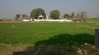
Anihar is a village in Phillaur tehsil of Jalandhar District of Punjab State, India. It is located 6.4 km away from postal head office Bara Pind. The village is 10 km away from Goraya, 35 km from Jalandhar, and 125 km from state capital Chandigarh and 165 KM from Wahga Border of Pakistan-India. The village is administrated by a sarpanch who is an elected representative of village as per Panchayati raj (India).
Jajo Mazara or Jajo Majara is a small size village with the population of only 13 people in Phillaur tehsil of Jalandhar District of Punjab State, India. It is located 11 km away from Goraya, 22.8 km from Phillaur, 30.5 km from district headquarter Jalandhar and 122 km from state capital Chandigarh. The village is administrated by a sarpanch who is an elected representative of village as per Panchayati raj (India).
Bainapur is a small size village in Phillaur tehsil of Jalandhar district of Punjab State, India. It is located 25 km away from Phillaur, 5.8 km from Nurmahal, 27.7 km from district headquarter Jalandhar and 147 km from state capital Chandigarh. The village is administrated by a sarpanch who is an elected representative of the village, as per Panchayati raj (India).
Bakapur is a village in Phillaur tehsil of Jalandhar district of Punjab State, India. It is located 7 km away from postal head office in Phillaur, 10 km from Goraya, 41.5 km from district headquarter Jalandhar and 115 km from state capital Chandigarh. The village is administrated by a sarpanch who is an elected representative of the village as per Panchayati raj (India).
Killi is a village in Shahkot in Jalandhar district of Punjab State, India. It is located 4 kilometres (2.5 mi) from Shahkot, 22 kilometres (14 mi) from Nakodar, 46 kilometres (29 mi) from district headquarter Jalandhar and 177 kilometres (110 mi) from state capital Chandigarh. The village is administrated by a sarpanch who is an elected representative of village as per Panchayati raj (India).
Manko is a village in Jalandhar district of Punjab State, India. It is located 30 kilometres (19 mi) from district headquarter Jalandhar and 156 kilometres (97 mi) from state capital Chandigarh. The village is administered by a sarpanch who is an elected representative of village as per Panchayati raj (India).
Lasuri is a village in Shahkot in Jalandhar district of Punjab State, India. It is located 7 kilometres (4.3 mi) from Shahkot, and 52 kilometres (32 mi) from the district headquarters of Jalandhar. The village is administered by a sarpanch who is an elected representative of village as per Panchayati raj (India).
Baghela is a village in Nakodar in Jalandhar district of Punjab State, India. It is located 19 kilometres (12 mi) from sub district headquarter and 44 kilometres (27 mi) from district headquarter. The village is administrated by Sarpanch an elected representative of the village as per Panchayati raj (India).
References
- ↑ District Census Handbook - Jalandhar - Village and Town Directory (Report). Vol. 2011 Census of India. Directorate of Census Operations Punjab. 2011. pp. 224–225.