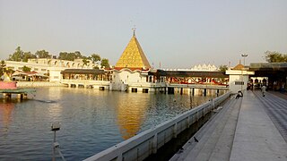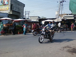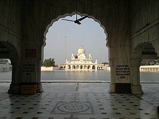
Jalandhar is a city in the Indian state of Punjab. Jalandhar lies alongside the Grand Trunk Road and is a well-connected rail and road junction. Jalandhar is 146 km northwest of Chandigarh, the state capital of Punjab and Haryana and 82.5 km (51.2 mi) South-East of Amritsar.

Ashoknagar District is a district of Madhya Pradesh state in central India. The city of Ashoknagar is the administrative headquarters of the district. Ashoknagar district was formed in 2003.

Doda is a town and a notified area committee in Doda district in the Indian union territory of Jammu and Kashmir. It is the Headquarter of Doda District. Doda is located at 33.13°N 75.57°E and has an average elevation of 1,107 metres (3631 feet).

Suryapet(listen) is a city in the Indian state of Telangana. It is a municipality and the headquarters of its eponymous district. The Government of India announced Suryapet to be developed under the Atal Mission for Rejuvenation and Urban Transformation (AMRUT) scheme. Suryapet has been awarded the "Cleanest city" in South India by the Ministry of Urban development in Swachh Survekshan 2017. It is also known as "Gateway of Telangana". It is located about 134 kilometres (83 mi) east of the state capital, Hyderabad and also it is located about 138 kilometres (86 mi) West of Vijayawada.

Badagaon Dhasan is a town and a Nagar Parishad in Tikamgarh district in the state of Madhya Pradesh, India.

Doiwala is a town and a Nagar Palika in Dehradun district in the state of Uttarakhand, India.

Garhdeviwala is a town and a municipal council in Hoshiarpur district in the state of Punjab, India.

Goraya is a city in Jalandhar district and Tehsil of the Indian state of Punjab. It lies between Jalandhar and (Ludhiana) stretch of National Highway 44, Grand Trunk Road.

Jaitu is a historical city. Jaitu is a municipal council in Faridkot district in the Indian state of Punjab. It is subdivision in Ferozepur Division. It is 30 km (19 mi) from Bathinda, 130 km (81 mi) from Ludhiana, 150 km (93 mi)from Amritsar, 180 km (110 mi) from Patiala and 234 km (145 mi) from Chandigarh.

Naraingarh is a city, municipal committee and assembly constituency in the Ambala district of the Indian state of Haryana, located on the border with the Indian state of Himachal Pradesh. Due to its geographical location, the Naraingarh plays an important role in local tourism, being located 52 km of Chandigarh, the state capital, 144 km of Shimla, and 230 km of New Delhi.

Polasara is a town and a notified area council in Ganjam district in the Indian state of Odisha.

Purusottampur is a town and a notified area committee in Ganjam district in the Indian state of Odisha.

Suratgarh is a city and a municipality in Ganganagar district in the Indian state of Rajasthan. Founded by Maharaja Surat Singh. Hindi, Bagri and Punjabi are the widely spoken languages of the city.

Goluwala is a city in Hanumangarh district of Rajasthan, India. It belongs to Bikaner division. It is divided into two suburbs– Niwadan (24JRK) and Sihagan (22JRK). It is an industrial town located some 31 km west of Hanumangarh and around 51 km off to Sri Ganganagar. Total Population of Goluwala Niwadan(24JRK) & Sihagan(22JRK) is 14960 (9753+5207) in 2011 census. Goluwala can be reached from Pilibangan, the nearest railway station. It is 18 km off National Highway 62 (India) and 431 km from State capital Jaipur.It is popular as name "Goluwala the Golden City".

Punjab is a state in northern India. Forming part of the larger Punjab region of the Indian subcontinent, the state is bordered by the Indian states of Himachal Pradesh to the north and northeast, Haryana to the south and southeast, and Rajasthan to the southwest, by the Indian union territory of Chandigarh to the east, and by the region of Jammu and Kashmir administered by India as a union territory, to the north. It is bordered by Punjab, a province of Pakistan to the west. The state covers an area of 50,362 square kilometres, 1.53% of India's total geographical area. It is the 20th-largest Indian state by area. With over 27 million inhabitants, Punjab is the 16th-largest state by population, comprising 23 districts. Punjabi, written in the Gurmukhi script, is the most widely spoken and official language of the state. The main ethnic group are the Punjabis, with Sikhs and Hindus as the dominant religious groups. The state capital is Chandigarh, a Union Territory and also the capital of the neighbouring state of Haryana. The five tributary rivers of the Indus River from which the region took its name are the Sutlej, Ravi, Beas, Chenab and Jhelum rivers; the Sutlej, Ravi and Beas rivers flow through the Indian Punjab.
Sri Gurusar Modia is a village in the Indian state of Rajasthan situated near borders of Rajasthan, Haryana and Punjab states and the international border of India and Pakistan. This village is located in the tehsil Suratgarh of district Sriganganagar. Suratgarh, once known as Sodhal was believed to be surrounded by the confluence of Saraswati and Drishyati rivers but now the land is a deserted one lying amidst the expanse of The great Indian Thar desert. Suratgarh is famous for its agriculture, air force and army base stations, largest thermal power plant of Rajasthan and largest radio station of Rajasthan called as "Cotton City Channel". Sri Gurusar Modia came into limelight when a controversial self-proclaimed saint and spiritual leader Gurmeet Ram Rahim Singh was believed to be incarnated there and crowned to the throne of Dera Sacha Sauda at Sirsa in 1991. With setting up of Shah Satnam Schools for both boys and girls, super speciality hospitals etc. this village became nationwide popular

Karahe Wala is a small village in Moga district of Punjab state of India.

Apra is a census town in Phillaur Tehsil in Jalandhar district of Punjab State, India. The town is known for gold jewelry and paddy crops which are produced in large amounts. It is located 46 kilometres (29 mi) towards East from Jalandhar, 12 kilometres (7.5 mi) from Phillaur and 110 kilometres (68 mi) from Chandigarh. Apra is the largest town as compared to other surrounding villages and has the main marketplace. The town is administrated by Sarpanch an elected representative of the village.

Nathumajra is a village located in Malerkotla Tehsil of Sangrur district in Punjab, India. It is situated 15 kilometres (9.3 mi) away from sub-district headquarter Malerkotla and 50 kilometres (31 mi) away from district headquarter Sangrur. As per 2016 stats, Nathu Majra village is also a gram panchayat.
Vakilan Wala is the northernmost village of the Indian state of Punjab situated near Zira City, Punjab, and the international border of India and Pakistan. It is the administrative headquarters of Ferozepur District.


