Related Research Articles

India is the second most populated country in the world with nearly a fifth of the world's population. According to the 2019 revision of the World Population Prospects the population stood at 1,352,642,280.

Jammu and Kashmir was a state of India from 1954 to 2019, constituting the southern and southeastern portion of the larger Kashmir region, which has been the subject of a dispute between India, Pakistan and China since the mid-20th century. The underlying region of this state were parts of the former princely state of Jammu and Kashmir, whose western districts, now known as Azad Kashmir, and northern territories, now known as Gilgit-Baltistan, are administered by Pakistan. The Aksai Chin region in the east, bordering Tibet, has been under Chinese control since 1962.

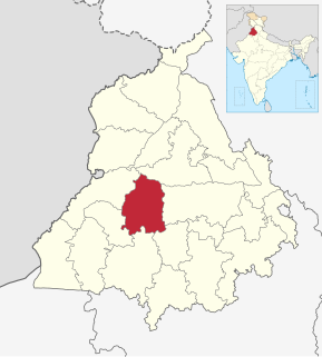
Bathinda district is in Malwa region of Punjab, India. The district encompasses an area of 3,385 square kilometers. By area, Bathinda district is the second-largest in Punjab, after Ludhiana District. It is bounded by Faridkot district and Moga district on the north, Mukatsar district on the west, Barnala and Mansa districts on the east, and the state of Haryana on the south. Bathinda is cotton producing belt of Punjab.
The decennial Census of India has been conducted 15 times, as of 2011. While it has been undertaken every 10 years, beginning in 1872 under British Viceroy Lord Mayo, the first complete census was taken in 1881. Post 1949, it has been conducted by the Registrar General and Census Commissioner of India under the Ministry of Home Affairs, Government of India. All the censuses since 1951 were conducted under the 1948 Census of India Act. The last census was held in 2011, whilst the next will be held in 2021. But it is postponed due to the covid-19 pandemic.

Chuhar Chak is a town located in the Moga district of Punjab, India.
Moga district is one of the twenty-two districts in the state of Punjab, India. It became the 17th district of Punjab State on 24 November 1995 cut from Faridkot district. Moga District is among the largest producers of wheat and rice in Punjab, India. People from Moga City and Moga District belong to the Malwa culture.
Bhadaur is a village in Barnala district in the state of Punjab, India. It is part of the Bhadaur Assembly Constituency.
In India and some other countries, a census town is designated as a town that satisfies certain characteristics.

RannaBelagali is a Pattan Panchayat Town in the southern state of Karnataka, India. It is located in the Mudhol taluka of Bagalkot district in Karnataka
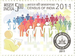
The 15th Indian Census was conducted in two phases, house listing and population enumeration. The House listing phase began on 1 April 2010 and involved the collection of information about all buildings. Information for National Population Register (NPR) was also collected in the first phase, which will be used to issue a 12-digit unique identification number to all registered Indian residents by Unique Identification Authority of India (UIDAI). The second population enumeration phase was conducted between 9 and 28 February 2011. Census has been conducted in India since 1872 and 2011 marks the first time biometric information was collected. According to the provisional reports released on 31 March 2011, the Indian population increased to 1.21 billion with a decadal growth of 17.70%. Adult literacy rate increased to 74.04% with a decadal growth of 9.21%. The motto of the census was 'Our Census, Our future'.
Chuhar is a village in Nakodar in Jalandhar district of Punjab State, India. It is located 12 km from Nakodar, 23 km from Kapurthala, 24 km from district headquarter Jalandhar and 168 km from state capital Chandigarh. The village is administrated by a sarpanch who is an elected representative of village as per Panchayati raj (India).

Jharauli Khurd is a village located in Shahabad Markanda town of Kurukshetra district in Haryana state of India. It is about 4 km aside from Grand Trunk Road.The village is surrounded by Babain Tehsil towards East, Ambala Tehsil towards North, Thanesar Tehsil towards South, Kurukshetra Tehsil towards South. According to Census 2011, its population is 1301 out of which 515 are schedules castes population. Total families are 241 in numbers, only two of them are Muslim families. While the area of village is 345 hectares, there is one primary school, one middle school and one veterinary dispensary in the village. The Literacy rate is 75.31 % which is slightly lower than that of Haryana. The village is administrated by an elected Sarpanch. Mr. Hartinder Pal Singh is the present Sarpanch of the village. Wheat, paddy and sugar cane are main yields of the village. The village code of Jharauli Khurd is 58347.
Sardar Chuhar Singh of Jharauli was a prominent general of Shaheedan Misl and a close relative of Sikh warriors Baba Deep Singh and Rai Singh Bhangi. He originally came from the village Chung, situated about 45 km south of Amritsar. Under the command of Jassa Singh Ahluwalia, he fought from Shaheedan Misl in the Battle of Sirhind (1764) against Mughal Faujdar of Sirhind, Zain Khan Sirhindi. He secured Jharauli, Fatehgarh Atri, Ajrana and seven other villages in the bet tracts of Markanda River as his share of battle. He had two sons, Karam Singh and Mohar Singh. The younger Mohar Singh became in charge of the Jharauli estate. His elder son Karam Singh took control of the family estate at Chung that was finally incorporated to Lahore Darbar by Ranjit Singh after his death as issueless in 1808. Mohar Singh lost seven villages of the Jharauli estate to Bhunga Singh of Thanesar in 1780. The Jharauli estate remained under the Court of Wards during 1885-1893 and again between 1922-1947.

Jammu and Kashmir is a region administered by India as a union territory and consisting of the southern portion of the larger Kashmir region, which has been the subject of a dispute between India and Pakistan since 1947, and between India and China since 1962. The Line of Control separates Jammu and Kashmir from the Pakistani-administered territories of Azad Kashmir and Gilgit-Baltistan in the west and north. It lies to the north of the Indian states of Himachal Pradesh and Punjab and to the west of Ladakh, which is also subject to the dispute as a part of Kashmir, and administered by India as a union territory.
Chung is a historical village of Bikhiwind town of the Indian state of Punjab. Before 1947, it was part of Kasur tehsil of Lahore district. Rice and wheat are the most cultivated crops.