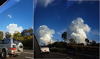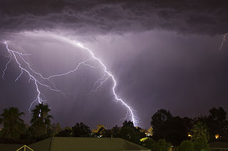
A tornado is a violently rotating column of air that is in contact with both the surface of the Earth and a cumulonimbus cloud or, in rare cases, the base of a cumulus cloud. It is often referred to as a twister, whirlwind or cyclone, although the word cyclone is used in meteorology to name a weather system with a low-pressure area in the center around which, from an observer looking down toward the surface of the Earth, winds blow counterclockwise in the Northern Hemisphere and clockwise in the Southern. Tornadoes come in many shapes and sizes, and they are often visible in the form of a condensation funnel originating from the base of a cumulonimbus cloud, with a cloud of rotating debris and dust beneath it. Most tornadoes have wind speeds less than 180 kilometers per hour, are about 80 meters across, and travel several kilometers before dissipating. The most extreme tornadoes can attain wind speeds of more than 480 kilometers per hour (300 mph), can be more than 3 kilometers (2 mi) in diameter, and can stay on the ground for more than 100 km (62 mi).

A wildfire, forest fire, or a bushfire is an unplanned, uncontrolled and unpredictable fire in an area of combustible vegetation. Depending on the type of vegetation present, a wildfire may be more specifically identified as a bushfire, desert fire, grass fire, hill fire, peat fire, prairie fire, vegetation fire, or veld fire. Some natural forest ecosystems depend on wildfire. Modern forest management often engages in prescribed burns to mitigate fire risk and promote natural forest cycles. However, controlled burns can turn into wildfires by mistake.

A dust devil is a strong, well-formed, and relatively short-lived whirlwind. Its size ranges from small to large. The primary vertical motion is upward. Dust devils are usually harmless, but can on rare occasions grow large enough to pose a threat to both people and property.

A firestorm is a conflagration which attains such intensity that it creates and sustains its own wind system. It is most commonly a natural phenomenon, created during some of the largest bushfires and wildfires. Although the term has been used to describe certain large fires, the phenomenon's determining characteristic is a fire with its own storm-force winds from every point of the compass towards the storm's center, where the air is heated and then ascends.

A waterspout is a rotating column of air that occurs over a body of water, usually appearing as a funnel-shaped cloud in contact with the water and a cumuliform cloud. There are two types of waterspout, each formed by distinct mechanisms. The most common type is a weak vortex known as a "fair weather" or "non-tornadic" waterspout. The other less common type is simply a classic tornado occurring over water rather than land, known as a "tornadic", "supercellular", or "mesocyclonic" waterspout, and accurately a "tornado over water". A fair weather waterspout has a five-part life cycle: formation of a dark spot on the water surface; spiral pattern on the water surface; formation of a spray ring; development of a visible condensation funnel; and ultimately, decay. Most waterspouts do not suck up water.

A fire whirl, fire devil or fire tornado is a whirlwind induced by a fire and often composed of flame or ash. These start with a whirl of wind, often made visible by smoke, and may occur when intense rising heat and turbulent wind conditions combine to form whirling eddies of air. These eddies can contract to a tornado-like vortex that sucks in debris and combustible gases.

Landspout is a term created by atmospheric scientist Howard B. Bluestein in 1985 for a tornado not associated with a mesocyclone. The Glossary of Meteorology defines a landspout:

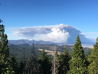
The cumulonimbus flammagenitus cloud (CbFg), also known as the pyrocumulonimbus cloud, is a type of cumulonimbus cloud that forms above a source of heat, such as a wildfire, nuclear explosion, or volcanic eruption, and may sometimes even extinguish the fire that formed it. It is the most extreme manifestation of a flammagenitus cloud. According to the American Meteorological Society’s Glossary of Meteorology, a flammagenitus is "a cumulus cloud formed by a rising thermal from a fire, or enhanced by buoyant plume emissions from an industrial combustion process."

A dry thunderstorm is a thunderstorm that produces thunder and lightning, but where all or most of its precipitation evaporates before reaching the ground. Dry lightning refers to lightning strikes occurring in this situation. Both are so common in the American West that they are sometimes used interchangeably.

Wildfire modeling is concerned with numerical simulation of wildfires to comprehend and predict fire behavior. Wildfire modeling aims to aid wildfire suppression, increase the safety of firefighters and the public, and minimize damage. Wildfire modeling can also aid in protecting ecosystems, watersheds, and air quality.
Janice Coen is a Project Scientist at the National Center for Atmospheric Research in Boulder, Colorado. Her work focuses on understanding and predicting wildland fire behavior through the use of wildfire modeling software. She has made major contributions to the field through her coupled weather—wildland fire computer simulation models.

The 2020 Loyalton Fire was a large wildfire in Lassen, Plumas and Sierra counties in California and Washoe County in Nevada. After it was ignited by lightning on August 14, 2020, the fire burned 47,029 acres (19,032 ha) in the Tahoe National Forest and the Humboldt-Toiyabe National Forest before it was fully contained on August 26. The Loyalton Fire was notable for generating three fire tornadoes on August 15, necessitating first-of-their-kind warnings by the National Weather Service.

The 2020 Creek Fire was a very large wildfire in central California's Sierra National Forest, in Fresno and Madera counties. One of the most significant fires of California's record-setting 2020 wildfire season, it began on September 4, 2020, and burned 379,895 acres (153,738 ha) over several months until it was declared 100% contained on December 24, 2020. The Creek Fire is the sixth-largest wildfire in recorded California history and the third-largest single fire—i.e. not part of a larger wildfire complex—following the 2021 Dixie Fire.

The Bobcat Fire was a large wildfire in Los Angeles County during the 2020 California wildfire season. The fire ignited on September 6, 2020, and burned 115,997 acres (46,942 ha) before it was fully contained by November 27. The Bobcat Fire primarily burned in the central San Gabriel Mountains, in and around the Angeles National Forest, and is one of the largest fires on record in Los Angeles County to date.

The Bootleg Fire, named after the nearby Bootleg Spring, was a large wildfire that started near Beatty, Oregon, on July 6, 2021. Before being fully contained on August 15, 2021, it had burned 413,765 acres. It is the third-largest fire in the history of Oregon since 1900. At the fire's fastest growth in mid July, it grew at about 1,000 acres (400 ha) per hour, and it became the second largest wildfire in the United States of the 2021 wildfire season.

The 2021 Dixie Fire was an enormous wildfire in Butte, Plumas, Lassen, Shasta, and Tehama counties in Northern California. Named after a nearby Dixie Road, the fire began in the Feather River Canyon near Cresta Dam in Butte County on July 13, 2021, and burned 963,309 acres (389,837 ha) before it was declared 100 percent contained on October 25, 2021. It was the largest single source wildfire in recorded California history, and the second-largest wildfire overall, The fire damaged or destroyed several communities, including Greenville on August 4, Canyondam on August 5, and Warner Valley on August 12.

The Beckwourth Complex was a wildfire complex that burned in the Plumas National Forest in Plumas and Lassen counties. The two major fires of the complex, the Dotta Fire and the Sugar Fire, started on June 30 and July 2 northeast of Beckwourth, California. Started by lightning strikes, the two fires collectively burned 105,670 acres (42,763 ha). The complex resulted in the evacuation of numerous residential areas and the closure of portions of Plumas National Forest. In the community of Doyle, California, 33 homes were destroyed.

The Mosquito Fire was California's largest wildfire in 2022. The fire began on September 6, burned 76,788 acres in Placer and El Dorado counties in September and October, and was pronounced fully contained on October 22. It affected the Tahoe and Eldorado National Forests and destroyed 78 structures in the rural communities of Michigan Bluff, Foresthill, and Volcanoville. The fire suppression effort cost more than $180 million, and at its peak involved more than 3,700 firefighters. The precise cause of the fire is not known, but the possible role of Pacific Gas & Electric Company (PG&E) equipment is the subject of multiple civil lawsuits and a Forest Service investigation. The Mosquito Fire was one of 7,477 wildfires in California in 2022, which burned a combined 331,358 acres (134,096 ha).

The Chisholm fire was a forest fire in the Canadian province of Alberta that burned in the late spring of 2001. It is known for its exceptional intensity and fire behavior. In fact, at the time, it had the highest head fire intensity ever recorded. The fire was declared under control on June 4, 2001, with a total burned area of 116,000 hectares. It was notable for its record-setting intensity and several research papers were conducted regarding this fire and its unique pyrocumulonimbus cloud. It was one of the first fires to have known to penetrate the tropopause in recorded history.

In the evening hours of July 26, 2018, a large fire tornado formed inside of the Carr Fire. The fire tornado, which had peak windspeeds of 143 miles per hour (230 km/h), killed at least three people and injured five others while on the ground for approximately thirty minutes. The fire tornado was the most powerful in California history, and was the deadliest fire tornado to ever form as part of a larger event. In addition, the fire tornado was the second ever to be recorded, after one that occurred in the 2003 Canberra bushfires. The tornado trapped several bulldozer operators in their vehicles, resulting in the death of Jeremy Stoke, 37, a bulldozer operator who was killed as the fire tornado tracked over him. Don Smith was also killed by the fire under unknown circumstances. The tornado also impacted the outskirts of Redding; it is unknown if more fatalities would have been reported had the tornado tracked through the downtown area of Redding.


