Listed buildings in Penarth

Last updated

Aerial view of Penarth Pier and seafront Penarth aerial photograph 2006.jpg
Aerial view of Penarth Pier and seafront

There are many listed buildings in Penarth, a seaside town in the Vale of Glamorgan, Wales. Penarth was popular with holidaymakers from far afield, but also a popular place to live for the wealthy business owners of Penarth and nearby Cardiff. The town has a wealth of Victorian and Edwardian architecture.

Contents

A listed building is one considered to be of special architectural, historical or cultural significance, and has restrictions on amendments or demolition. Buildings are listed as either Grade I, II* and II buildings lists, with the Grade I being the most important. [1]

Key

GradeCriteria [2]
Grade IBuildings of exceptional, usually national, interest (generally the top 2%).
Grade II*Particularly important buildings of more than special interest.
Grade IIBuildings of special interest, which warrant every effort being made to preserve them.    

Grade I and II* listed buildings

NamePhotographGradeDateLocationDescription
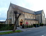
St Augustine's Church,
Church Place
St. Augustine's church, Penarth.jpg I1866 Penarth Head
51°26′28″N3°10′04″W / 51.4410°N 3.1679°W / 51.4410; -3.1679 (St Augustine's Church)
Designed by architect William Butterfield and built between 1865 and 1866, replacing a ruined medieval church which was no longer large enough for the growing parish. [3]
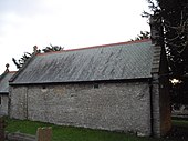
St Peter's Church, off Sully Road Church of St Peter, Old Cogan (geograph 2762851).jpg II*1100s Old Cogan
51°25′39″N3°11′45″W / 51.4275°N 3.1958°W / 51.4275; -3.1958 (St Peter's Church)
12th-century church extended in the early 1500s and restored in 1888-1894 by architect William Frame. [4]

Grade II listed buildings

According to the British Listed Buildings website there are 44 buildings in Penarth listed as Grade II, in addition to a bridge, a cenotaph, a pillar box and five telephone boxes. These include:

NamePhotographGradeDateLocationDescription
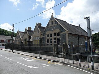
Albert Road Infants School, Albert Road Penarth and around, February 2018 21.jpg II1876 Penarth Head
51°26′28″N3°10′16″W / 51.4410°N 3.1712°W / 51.4410; -3.1712 (Albert Road School)
Later enlarged in the early 1900s by local architect J. Coates Carter. [5]
Baron's Court or Cogan Pill House Baron's Court, Medieval Hall, Cogan, Penarth.jpg II1500 Cogan
51°26′52″N3°11′18″W / 51.4479°N 3.1884°W / 51.4479; -3.1884 (Baron's_Court)
Late 15th or early 16th-century hall house, originally known as Cogan Pill, with later 19th-century additions. Owned by the Herbert family of St Fagans Castle for many generations. [6] It is the only medieval hall building in South Wales to still be open from floor to roof. [7] Now a pub and restaurant.
Cenotaph, Alexandra Park Cenotaph, Alexandra Gardens, Penarth.jpg II1924 Penarth
51°26′09″N3°10′09″W / 51.4359°N 3.1691°W / 51.4359; -3.1691 (Cenotaph)
Designed by Sir W. Goscombe John and completed in 1924, the Cenotaph is located at the high point of Alexandra Park. It is made from white granite and has a bronze statue of Winged Victory on the east face. Commemorates those who died in the two world wars. [8]
Coastguard Cottage, Marine Parade Coastguard Cottage, Marine Parade, Penarth.jpg II1840 Penarth
51°25′57″N3°10′11″W / 51.4324°N 3.1697°W / 51.4324; -3.1697 (Coastguard Cottage)
Built c. 1840 by The Admiralty as accommodation for the local coastguard. It is well preserved with an original Georgian staircase and large cellars. [9] The house is located high above the seafront with a view over the sea. It adjoins a row of terraced houses (15 Tower Hill Avenue) which were also built as coastguard accommodation and are similarly Grade II listed. [10]
Custom House, Docks Road Custom House, Penarth Marina - geograph.org.uk - 960335.jpg II1865 Penarth Marina
51°26′41″N3°10′02″W / 51.4446°N 3.1671°W / 51.4446; -3.1671 (Custom House)
Located west of Marine Buildings at the entrance to the old Penarth Dock, a Renaissance style building completed c. 1865 probably designed by the dock designer Samuel Dobson. [11]
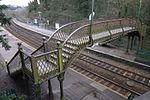
Footbridge at Cogan railway station Footbridge at Cogan railway station, Penarth.jpg II1888 Cogan
51°26′46″N3°11′15″W / 51.4461°N 3.1876°W / 51.4461; -3.1876 (Footbridge)
Late 19th century cast iron footbridge over a section of the railway to Barry which opened in December 1888. The bridge has Corinthian columns, ball finials to the balustrade and pierced quatrefoils in the stair risers. [12]
Former Penarth Baths and Supervisor's Office, Beach Road Penarth Swimming Baths (geograph 7378304).jpg II1885 Penarth (sea front)
51°26′08″N3°10′05″W / 51.4356°N 3.1681°W / 51.4356; -3.1681 (Penarth Baths)
Building on Beach Road, designed and built by H C Harris and H Snell, 1883-85. Inside it included a small pool and a large pool. A Supervisor's house is behind the building on the south west corner. The building was subsequently converted to a pub and restaurant in 1991. [13]
Headlands School, Paget Place Headlands School, Penarth (geograph 3753099).jpg II1868 Penarth Head
51°26′33″N3°09′57″W / 51.4424°N 3.1659°W / 51.4424; -3.1659 (Headlands School)
Originally the Penarth Hotel, built by Taff Vale Railway Company. Purchased after the First World War, becoming a nautical training school known as the J A Gibbs Home; later renamed The Headlands School. Four storey building in grey stone. [14]
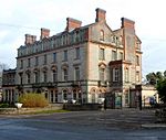
Marine Buildings, Docks Road Marine Building of Penarth Dock (geograph 1945923).jpg II1865 Penarth Marina
51°26′41″N3°09′59″W / 51.4446°N 3.1665°W / 51.4446; -3.1665 (Marine Buildings)
Next door to the Customs House at the entrance to Penarth Docks, built in a French Renaissance style c. 1865 probably designed by the dock designer Samuel Dobson. [15] The building was used as a hotel and later offices until the early 1980s. There were plans in the 2010s to convert the derelict building into a hotel. [16]
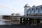
Penarth Pier and Pavilion, The Esplanade Penarth Pier Refurbished.jpg II1895 / 1929 Penarth (sea front)
51°26′05″N3°09′54″W / 51.4346°N 3.1650°W / 51.4346; -3.1650 (Penarth Pier)
Originally completed in 1895 but substantially altered since. The current Pavilion building was completed in 1929. [17] Restoration efforts took place in 1994-98 and again in the 2010s. [18] The Pavilion was re-roofed and refurbished to include a cinema, exhibition space and cafe, reopening in December 2013. [19]
Penarth Public Library, Stanwell Road Penarth Public Library - geograph.org.uk - 1972806.jpg II1906 Penarth (centre)
51°26′13″N3°10′20″W / 51.4370°N 3.1721°W / 51.4370; -3.1721 (Public Library)
Designed by the architect of the Windsor estate, H. Snell, and paid for by a Carnegie Foundation grant. [20]
Post Office building, Albert Road Old Post Office Building, Penarth.jpg II1936 Penarth (centre)
51°26′22″N3°10′24″W / 51.4394°N 3.1734°W / 51.4394; -3.1734 (Post Office)
Designed by HM Office of Works architect, A R Myers, in an Art Deco style. [21] Later used as a restaurant after the Post Office closed.
St Joseph's Church, Grove Terrace St. Joseph's RC church, Penarth - geograph.org.uk - 3345867.jpg II1915 Penarth (centre)
51°26′19″N3°10′48″W / 51.4387°N 3.1800°W / 51.4387; -3.1800 (St Joseph's)
The main body of the church was completed by 1915, though the church was not fully built until after World War I. Designed by London architect, F. A. Walters, in an Italian Romanesque style. [22]
Trinity Methodist Church, Stanwell Road Trinity Methodist Church, Penarth - geograph.org.uk - 1972570.jpg II1901 Penarth
51°26′10″N3°10′37″W / 51.4362°N 3.1770°W / 51.4362; -3.1770 (Trinity Methodist Church)
In a Perpendicular style, by Cardiff architect Harry Budgen. [23]
Turner House Gallery, Plymouth Road Ffotogallery - Turner House, Penarth - geograph.org.uk - 1151910.jpg II1888 Penarth (centre)
51°26′07″N3°10′21″W / 51.4353°N 3.1725°W / 51.4353; -3.1725 (Turner House Gallery)
Designed by Cardiff architect Edwin Seward to display a collection of J. M. W. Turner paintings. [24]
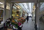
Windsor Arcade Building, Windsor Terrace Windsor Arcade, Penarth.jpg II1898 Penarth (centre)
51°26′19″N3°10′21″W / 51.4386°N 3.1726°W / 51.4386; -3.1726 (Windsor Arcade)
Adjoining the Grade II listed Lloyds Bank in the town centre, the neo-Classical building was designed by Edward Webb and dates to 1898. The shopping arcade is described as "Penarth's most significant C19 commercial building". [25]
Yacht Club House, Esplanade Penarth boat houses.JPG II1884-95 Penarth (sea front)
51°25′57″N3°10′03″W / 51.4324°N 3.1676°W / 51.4324; -3.1676 (Yacht Club)
North section built c. 1884 and south section added in 1895. Built as a clubhouse for Penarth Boat Club. [26]

See also

Related Research Articles

<span class="mw-page-title-main">Vale of Glamorgan</span> County borough in Wales

The Vale of Glamorgan, locally referred to as The Vale, is a county borough in the south-east of Wales. It borders Bridgend County Borough to the west, Cardiff to the east, Rhondda Cynon Taf to the north, and the Bristol Channel to the south. With an economy based largely on agriculture and chemicals, it is the southernmost unitary authority in Wales. Attractions include Barry Island Pleasure Park, the Barry Tourist Railway, Medieval wall paintings in St Cadoc's Church, Llancarfan, Porthkerry Park, St Donat's Castle, Cosmeston Lakes Country Park and Cosmeston Medieval Village. The largest town is Barry. Other towns include Penarth, Llantwit Major, and Cowbridge. There are many villages in the county borough.

<span class="mw-page-title-main">Ewenny Priory</span> Former monastery in Wales

Ewenny Priory, in Ewenny in the Vale of Glamorgan, Wales, was a monastery of the Benedictine order, founded in the 12th century. The priory was unusual in having extensive military-style defences and in its state of preservation; the architectural historian John Newman described it as “the most complete and impressive Norman ecclesiastical building in Glamorgan”. Following the Dissolution of the Monasteries, parts of the priory were converted into a private house by Sir Edward Carne, a lawyer and diplomat. This Elizabethan house was demolished between 1803 and 1805 and replaced by a Georgian mansion, Ewenny Priory House. The house is still owned by the Turbervill family, descendants of Sir Edward. The priory is not open to the public apart from the Church of St Michael, the western part of the priory building, which continues to serve as the parish church for the village. The priory is in the care of Cadw and is a Grade I listed building.

<span class="mw-page-title-main">Penarth</span> Human settlement in Wales

Penarth is a town and community in the Vale of Glamorgan, Wales, approximately 3 miles (4.8 km) south of Cardiff city centre on the west shore of the Severn Estuary at the southern end of Cardiff Bay.
<span class="mw-page-title-main">Cogan railway station</span> Railway station in the Vale of Glamorgan, Wales

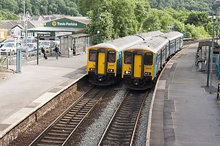
Cogan railway station is a railway station serving Cogan in the Vale of Glamorgan, Wales. It is on the Vale of Glamorgan Line 2+34 miles (4.4 km) south of Cardiff Central on the way to Barry Island and Bridgend.

<span class="mw-page-title-main">Grangetown, Cardiff</span> District and community in Cardiff, Wales

Grangetown is a district and community in the south of Cardiff, capital of Wales. It is one of the largest districts in the south of the city and is bordered by Riverside, Canton and Butetown. The River Taff winds its way through the area. Adjacent to the city's Cardiff Bay area, Grangetown is experiencing a period of gentrification and improvements in its infrastructure. Its population as of 2011 was 19,385 in 8,261 households. One of the "five towns of Cardiff", the others are Butetown, Crockherbtown, Newtown and Temperance Town.
<span class="mw-page-title-main">Llandough, Penarth</span> Village in Wales

Llandough is a village, community and electoral ward in the Vale of Glamorgan, Wales, approximately 2.3 miles (3.7 km) south west of Cardiff city centre, and approximately 1.3 miles (2 km) north west of Penarth.
<span class="mw-page-title-main">Cogan, Vale of Glamorgan</span> Suburb of Penarth, Wales

Cogan is a suburb of Penarth in the Vale of Glamorgan, Wales 2.5 miles (4 km) south of the centre of the Welsh capital city of Cardiff. Cogan contains one of the vale's four major leisure centres.

The Vale of Glamorgan has 740 listed buildings of which 4% are Grade I listed, 10% Grade II* listed and remainder Grade II listed.

<span class="mw-page-title-main">Penarth Pier</span>

Penarth Pier is a Victorian era pier in the town of Penarth, Vale of Glamorgan, South Wales. The pier was opened in 1898 and was a popular attraction to seaside-goers at the time, who also enjoyed trips on pleasure steamers that operated from the pier. It has on several occasions been damaged by vessels colliding with the structure and in 1931, a fire broke out in one of the pavilions. This wooden pavilion was never replaced, but a concrete pavilion has been used over the years as a concert hall, ballroom, cinema and for other purposes. It is currently home to the Penarth Pier Pavilion.

<span class="mw-page-title-main">Listed buildings in Cardiff</span> Protected buildings in Cardiff, Wales

There are around 1,000 listed buildings in Cardiff, the capital city of Wales. A listed building is one considered to be of special architectural, historical or cultural significance, which is protected from being demolished, extended or altered, unless special permission is granted by the relevant planning authorities. The Welsh Government makes decisions on individual cases, taking advice from the heritage agency Cadw, the Royal Commission on the Ancient and Historical Monuments of Wales and local councils.
<span class="mw-page-title-main">Grade I listed buildings in Gwynedd</span>

In the United Kingdom, the term listed building refers to a building or other structure officially designated as being of special architectural, historical, or cultural significance; Grade I structures are those considered to be "buildings of exceptional interest". Listing was begun by a provision in the Town and Country Planning Act 1947. Once listed, strict limitations are imposed on the modifications allowed to a building's structure or fittings. In Wales, the authority for listing under the Planning Act 1990 rests with Cadw.

<span class="mw-page-title-main">Grade I listed buildings in Rhondda Cynon Taf</span> List of buildings in county borough of Wales

Rhondda Cynon Taf is a county borough in South Wales. It is located to the north-west of Cardiff and covers an area of 424 km2 (164 sq mi). In 2021 the population was approximately 237,500.

<span class="mw-page-title-main">Grade I listed buildings in the Vale of Glamorgan</span>

There are 33 Grade I listed buildings in the Vale of Glamorgan all of which are churches and priory buildings, castles, country or manor houses and associated structures such as churchyard crosses and a dovecote.

<span class="mw-page-title-main">Grade II* listed buildings in the Vale of Glamorgan</span>

In the United Kingdom, the term listed building refers to a building or other structure officially designated as being of special architectural, historical, or cultural significance; Grade II* structures are those considered to be "particularly important buildings of more than special interest". Listing was begun by a provision in the Town and Country Planning Act 1947. Once listed, strict limitations are imposed on the modifications allowed to a building's structure or fittings. In Wales, the authority for listing under the Planning Act 1990 rests with Cadw.

<span class="mw-page-title-main">St Augustine's Church, Penarth</span> Church in Wales

St Augustine's Church is a Grade I-listed Gothic Revival nineteenth-century parish church in Penarth, Vale of Glamorgan, Wales.

<span class="mw-page-title-main">Sea Roads</span>

Sea Roads is a detached house in Penarth in the Vale of Glamorgan noted for its distinctive Modernist design.

<span class="mw-page-title-main">Registered historic parks and gardens in Merthyr Tydfil County Borough</span> List of buildings in county borough of Wales

Merthyr Tydfil County Borough is located in the historic county of Glamorgan in Wales and takes its name from its largest town. The county borough covers an area of 111 km2 (43 sq mi) and had a population of approximately 58,900 in 2021. There are three sites on the register of parks and gardens in Merthyr Tydfil County Borough. Two are listed at Grade II*, and one is Grade II.

<span class="mw-page-title-main">Registered historic parks and gardens in the Vale of Glamorgan</span> List of buildings in county borough of Wales

The Vale of Glamorgan is a county borough in south-east Wales. It covers an area of 331 km2 (128 sq mi) and in 2021 the population was approximately 132,500.

References

  1. "Buildings & Conservation Areas: Listing". Cadw. 2011. Retrieved 30 March 2013.
  2. Listed Buildings in Wales: What is Listing? (PDF) (third ed.), Cadw, 2005, p. 6, retrieved 19 March 2013
  3. "St Augustine's Parish Church, Church Place, Penarth". British Listed Buildings. Retrieved 24 February 2016.
  4. "St Peter's Church, Penarth". British Listed Buildings. Retrieved 24 February 2016.
  5. "Albert Road County Infants School, Albert Road, Penarth". British Listed Buildings. Retrieved 6 March 2016.
  6. "Barons Court PH, Penarth". British Listed Buildings. Retrieved 26 February 2016.
  7. John Newman (1995), The Buildings of Wales: Glamorgan, University of Wales Press, p. 50, ISBN   0-14-071056-6
  8. "Cenotaph, Alexander Park, Penarth". British Listed Buildings. Retrieved 27 February 2016.
  9. "Coastguard Cottage (No.2 Marine Parade) Tower Hill Avenue, Penarth". British Listed Buildings. Retrieved 27 February 2016.
  10. "No.1 Tower Hill Avenue, Penarth". British Listed Buildings. Retrieved 27 February 2016.
  11. "Customs House, Docks Road, Penarth". British Listed Buildings. Retrieved 24 February 2016.
  12. "Footbridge at Cogan Station, Cogan Hill, Penarth". British Listed Buildings. Retrieved 26 February 2016.
  13. "Inn at the Deep End (former Penarth Baths & Supervisor's Office)". British Listed Buildings. Retrieved 1 March 2024.
  14. "Headlands School, Paget Place, Penarth". British Listed Buildings. Retrieved 6 March 2016.
  15. "Marine Buildings, Docks Road, Penarth". British Listed Buildings. Retrieved 24 February 2016.
  16. "Four-star future for derelict Bay building". Wales Online. 14 December 2011. Retrieved 24 February 2016.
  17. "Penarth Pier (Including Pavilion & Shops) the Esplanade, Penarth". British Listed Buildings. Retrieved 24 February 2016.
  18. "Penarth Pier, The Esplanade, Penarth". RCAHMW. Retrieved 24 February 2016.
  19. "Revamped Penarth pier pavilion opens doors again". BBC News. 22 September 2011. Retrieved 24 February 2016.
  20. "Penarth Pier (Including Pavilion & Shops) the Esplanade, Penarth". British Listed Buildings. Retrieved 24 February 2016.
  21. "Post Office". British Listed Buildings. Retrieved 29 February 2024.
  22. "St. Joseph's Church, Penarth". British Listed Buildings. Retrieved 24 February 2016.
  23. "Trinity Methodist Church, Stanwell Road, Penarth". British Listed Buildings. Retrieved 6 March 2016.
  24. "Turner House Art Gallery, Plymouth Road, Penarth". British Listed Buildings. Retrieved 24 February 2016.
  25. "Windsor Arcade Building, Penarth". British Listed Buildings. Retrieved 26 February 2016.
  26. "Penarth Yacht Club House, The Esplanade, Penarth". British Listed Buildings. Retrieved 24 February 2016.

Sources