
Ravalli County is a county in the southwestern part of the U.S. state of Montana. As of the 2020 census, the population was 44,174. Its county seat is Hamilton.

Flathead County is in the U.S. state of Montana. At the 2020 census, its population was 104,357, making it the state's fourth most populous county. Its county seat is Kalispell. Its numerical designation is 7. Its northern border is on the state's north border, making it contiguous with the Canada–US border, facing British Columbia.

Darby is a town in Ravalli County, Montana, United States. The population was 783 at the 2020 census. Darby is located near the southwestern border of Montana and Idaho, along the Continental Divide.

Hamilton is a city that serves as the county seat of Ravalli County, Montana, United States. The population was 4,659 at the 2020 census.

The Bitterroot Range is a mountain range and a subrange of the Rocky Mountains that runs along the border of Montana and Idaho in the northwestern United States. The range spans an area of 24,223 square miles (62,740 km2) and is named after the bitterroot, a small pink flower that is the state flower of Montana.

The Clark Fork, or the Clark Fork of the Columbia River, is a river in the U.S. states of Montana and Idaho, approximately 310 miles (500 km) long. The largest river by volume in Montana, it drains an extensive region of the Rocky Mountains in western Montana and northern Idaho in the watershed of the Columbia River. The river flows northwest through a long valley at the base of the Cabinet Mountains and empties into Lake Pend Oreille in the Idaho Panhandle. The Pend Oreille River in Idaho, Washington, and British Columbia, Canada which drains the lake to the Columbia in Washington, is sometimes included as part of the Clark Fork, giving it a total length of 479 miles (771 km), with a drainage area of 25,820 square miles (66,900 km2). In its upper 20 miles (32 km) in Montana near Butte, it is known as Silver Bow Creek. Interstate 90 follows much of the upper course of the river from Butte to Saint Regis. The highest point within the river's watershed is Mount Evans at 10,641 feet (3,243 m) in Deer Lodge County, Montana along the Continental Divide.

The Confederated Salish and Kootenai Tribes of the Flathead Reservation are a federally recognized tribe in the U.S. state of Montana. The government includes members of several Bitterroot Salish, Kootenai and Pend d'Oreilles tribes and is centered on the Flathead Indian Reservation.

The Selway–Bitterroot Wilderness is a protected wilderness area in the states of Idaho and Montana, in the northwestern United States. At 1.3 million acres (5,300 km²), it is one of the largest designated wilderness areas in the United States.

The Bitterroot River is a northward flowing 84-mile (135 km) river running through the Bitterroot Valley, from the confluence of its West and East forks near Conner in southern Ravalli County to its confluence with the Clark Fork River near Missoula in Missoula County, in western Montana. The Clark Fork River is tributary to the Columbia River and ultimately, the Pacific Ocean. The Bitterroot River is a Blue Ribbon trout fishery with a healthy population of native westslope cutthroat trout and bull trout. It is the third most fly fished river in Montana behind the Madison and Big Horn Rivers.

The Beaverhead–Deerlodge National Forest is the largest of the National Forests in Montana, United States. Covering 3.36 million acres (13,600 km2), the forest is broken into nine separate sections and stretches across eight counties in the southwestern area of the state. President Theodore Roosevelt named the two forests in 1908 and they were merged in 1996. Forest headquarters are located in Dillon, Montana. In Roosevelt's original legislation, the Deerlodge National Forest was called the Big Hole Forest Reserve. He created this reserve because the Anaconda Copper Mining Company, based in Butte, Montana, had begun to clearcut the upper Big Hole River watershed. The subsequent erosion, exacerbated by smoke pollution from the Anaconda smelter, was devastating the region. Ranchers and conservationists alike complained to Roosevelt, who made several trips to the area. (Munday 2001)

Bitterroot National Forest comprises 1.587 million acres (6,423 km2) in west-central Montana and eastern Idaho of the United States. It is located primarily in Ravalli County, Montana, but also has acreage in Idaho County, Idaho (29.24%), and Missoula County, Montana (0.49%).
Gem Air is a commuter airline based in Salmon, Idaho, United States. The company has been operating in Idaho since 1982. Between 2009 and 2014, the company offered limited charter and contract services. In 2014, Gem Air again started offering a full fleet of charter, scheduled, and cargo services. Gem Air mainly serves the mountain west: Idaho, Montana, Wyoming, Utah, Washington, and Oregon.

The Treaty of Hellgate was a treaty agreement between the United States and the Bitterroot Salish, Upper Pend d'Oreille, and Lower Kutenai tribes. The treaty was signed at Hellgate on 16 July 1855. Signatories included Isaac Stevens, superintendent of Indian affairs and governor of Washington Territory; Victor, chief of the Bitterroot Salish; Alexander, chief of the Pend d'Oreilles; Michelle, chief of the Kutenais; and several subchiefs. The treaty was ratified by Congress, signed by President James Buchanan, and proclaimed on 18 April 1859. It established the Flathead Indian Reservation.
The following is an alphabetical list of articles related to the U.S. state of Montana.
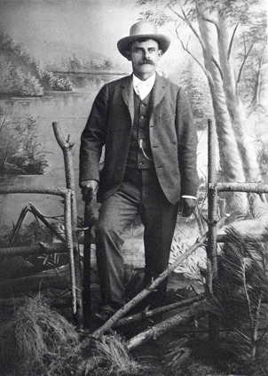
John Bernhard Leiberg was a Swedish-American botanical explorer, forester, and bryologist. He was a self-taught naturalist who worked in the northwestern United States.
Marion is a census-designated place and unincorporated community in Flathead County, Montana, United States. Its population was 1,119 as of the 2020 census. Marion has a post office with ZIP code 59925.
Little Bitterroot Lake is a census-designated place (CDP) in Flathead County, Montana, United States. The population was 194 at the 2010 census. The town is next to Little Bitterroot Lake.
Little Bitterroot River is in northwestern Montana. It in the mountains west of Kalispell north of Marion or about 25 miles (40 km) west-northwest of Flathead Lake. It flows south-southeastward for 65 miles (105 km) to the Flathead River, which goes into the Clark Fork of the Columbia. The basin covers about 600 square miles (1,600 km2), or about 385,000 acres (156,000 ha). The upper basin as mountainous area with interior plains, from 1 to 8 miles wide and about 100 square miles (260 km2) in extent. The plain area traversed by the 40 miles (64 km) its length. The Little Bitterroot valley, is an arm of the Lake Missoula glacial plain south of Flathead Lake.

