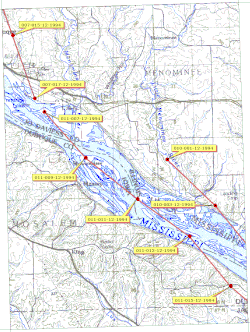
Little Menominee River | |
---|---|
Little Menominee River (USGS) | |
Physical characteristics | |
Main source | Grant County, northwest of Hazel Green, Wisconsin 943 ft (287 m) 42°33′42″N90°32′10″W / 42.5616667°N 90.5361111°W |
River mouth | Confluence with the Mississippi west of Galena, Illinois 591 ft (180 m) 42°25′31″N90°32′04″W / 42.4252778°N 90.5344444°W Coordinates: 42°25′31″N90°32′04″W / 42.4252778°N 90.5344444°W |
Length | 14 mi (23 km) |
Basin features | |
Progression | Little Menominee River → Mississippi → Gulf of Mexico |
GNIS ID | 412371 |
The Little Menominee River is a 13.9-mile-long (22.4 km) [1] tributary of the Upper Mississippi River, which it joins in Jo Daviess County, Illinois. [2]
The Upper Mississippi River is the portion of the Mississippi River upstream of Cairo, Illinois, United States. From the headwaters at Lake Itasca, Minnesota, the river flows approximately 2000 kilometers (1250 mi) to Cairo, where it is joined by the Ohio River to form the Lower Mississippi River.
Jo Daviess County is a county located in the northwest corner of U.S. state of Illinois. According to the 2010 census, it had a population of 22,678. Its county seat is Galena.
The Little Menominee rises in Grant County, Wisconsin. It flows south, to the east of the Menominee River, into Illinois. It crosses the northwestern corner of Illinois for about six miles before joining the Mississippi at the southern end of East Dubuque. The town of Menominee, Illinois is located on the river.
Grant County is a county located in the U.S. state of Wisconsin. As of the 2010 census, the population was 51,208. Its county seat is Lancaster.
The Menominee River is an 11.3-mile-long (18.2 km) tributary of the Mississippi River, which it joins in Jo Daviess County, Illinois.
East Dubuque is a city in Jo Daviess County, Illinois, United States. The population was 1,704 at the 2010 census, down from 1,995 in 2000. East Dubuque is located alongside the Mississippi River. Across the river is the city of Dubuque, Iowa. About three miles north of the city is the Illinois – Wisconsin border.
The name "Menominee" refers to the Menominee, a Native American people. The name means "good seed" or "wild rice".
Native Americans, also known as American Indians, Indigenous Americans and other terms, are the indigenous peoples of the United States, except Hawaii. There are over 500 federally recognized tribes within the US, about half of which are associated with Indian reservations. The term "American Indian" excludes Native Hawaiians and some Alaska Natives, while Native Americans are American Indians, plus Alaska Natives of all ethnicities. Native Hawaiians are not counted as Native Americans by the US Census, instead being included in the Census grouping of "Native Hawaiian and other Pacific Islander".
The river is part of the Driftless Area of Illinois and Wisconsin. This region escaped the glaciation experienced by areas to the east and west during the last ice age.
The Driftless Area is a region in southeastern Minnesota, southwestern Wisconsin, northeastern Iowa, and the extreme northwestern corner of Illinois, of the American Midwest. The region escaped glaciation during the last ice age and, consequently, is characterized by steep, forested ridges, deeply-carved river valleys, and karst geology characterized by spring-fed waterfalls and cold-water trout streams. Ecologically, the flora and fauna of the Driftless Area are more closely related to those of the Great Lakes region and New England rather than those of the broader Midwest and central Plains regions. Colloquially, the term includes the incised Paleozoic Plateau of southeastern Minnesota and northeastern Iowa. The region includes elevations ranging from 603 to 1,719 feet at Blue Mound State Park and covers an area of 24,000 square miles (62,200 km2). The rugged terrain is due both to the lack of glacial deposits, or drift, and to the incision of the upper Mississippi River and its tributaries into bedrock.
The Wisconsin Glacial Episode, also called the Wisconsinan glaciation, was the most recent glacial period of the North American ice sheet complex. This advance included the Cordilleran Ice Sheet, which nucleated in the northern North American Cordillera; the Innuitian ice sheet, which extended across the Canadian Arctic Archipelago; the Greenland ice sheet; and the massive Laurentide ice sheet, which covered the high latitudes of central and eastern North America. This advance was synchronous with global glaciation during the last glacial period, including the North American alpine glacier advance, known as the Pinedale glaciation. The Wisconsin glaciation extended from approximately 75,000 to 11,000 years ago, between the Sangamon interglacial and the current interglacial, the Holocene. The maximum ice extent occurred approximately 25,000–21,000 years ago during the last glacial maximum, also known as the Late Wisconsin in North America.
The Illinois River is a principal tributary of the Mississippi River, approximately 273 miles (439 km) long, in the U.S. state of Illinois. The river drains a large section of central Illinois, with a drainage basin of 28,756.6 square miles (74,479 km2). The drainage basin extends into Wisconsin, Indiana, and a very small area of southwestern Michigan. This river was important among Native Americans and early French traders as the principal water route connecting the Great Lakes with the Mississippi. The French colonial settlements along the rivers formed the heart of the area known as the Illinois Country. After the construction of the Illinois and Michigan Canal and the Hennepin Canal in the 19th century, the role of the river as link between Lake Michigan and the Mississippi was extended into the era of modern industrial shipping. It now forms the basis for the Illinois Waterway.
Green Bay is an arm of Lake Michigan, located along the south coast of Michigan's Upper Peninsula and the east coast of Wisconsin. It is separated from the rest of the lake by the Door Peninsula in Wisconsin, the Garden Peninsula in Michigan, and the chain of islands between them, all formed by the Niagara Escarpment. Green Bay is some 120 miles (193 km) long, with a width ranging from about 10 miles (16 km) to 20 mi (32 km). It is 1,626 square miles (4,210 km2) in area.
The Fox River is a 202-mile-long (325 km) tributary of the Illinois River, flowing from southeastern Wisconsin to Ottawa, Illinois in the United States. The Wisconsin section was known as the Pishtaka River in the 19th century. There are two other "Fox Rivers" in southern Illinois: the Fox River and a smaller "Fox River" that joins the Wabash River near New Harmony, Indiana.
The Rock River is a tributary of the Mississippi River, approximately 299 miles (481 km) long, in the U.S. states of Wisconsin and Illinois. The river was known as the Sinnissippi to Sauk and Fox Indians; the name means "rocky waters".
The Sugar River is a tributary of the Pecatonica River, approximately 91 miles (146 km) long, in the U.S. states of Wisconsin and Illinois.
The Pecatonica River is a tributary of the Rock River, 194 miles (312 km) long, in southern Wisconsin and northern Illinois in the United States.
The Kaskaskia River is a tributary of the Mississippi River, approximately 325 miles (523 km) long, in central and southern Illinois in the United States. The second largest river system within Illinois, it drains a rural area of farms, as well as rolling hills along river bottoms of hardwood forests in its lower reaches. The lower reaches of the river have been canalized to allow barge traffic.
Illinois is in the midwestern United States. Surrounding states are Wisconsin to the north, Iowa and Missouri to the west, Kentucky to the south, and Indiana to the east. Illinois also borders Michigan, but only via a northeastern water boundary in Lake Michigan. Nearly the entire western boundary is the Mississippi River, except for a few areas where the river has changed course. Illinois' southeastern and southern boundary is along the Wabash River and the Ohio River. Whereas, its northern boundary and much of its eastern boundary are straight survey lines. Illinois has a maximum north-south distance of 390 miles and 210 miles east-west. Its total area is 57,918 square miles (150,010 km2).
The Little Osage River is an 88-mile-long (142 km) tributary of the Osage River in eastern Kansas and western Missouri in the United States. Via the Osage and Missouri rivers, it is part of the watershed of the Mississippi River.
The Galena River, also known as the Fevre or Fever River, is a 52.4-mile-long (84.3 km) river which flows through the Midwestern United States.
The Plum River is a tributary of the Mississippi River, about 46.6 miles (75.0 km) long, in northwestern Illinois in the United States. It rises in Jo Daviess County and flows generally south-southwestwardly into Carroll County, where it joins the Mississippi at Savanna. Among its several short tributaries are:
The Little Wabash River is a 240-mile-long (390 km) tributary of the Wabash River in east-central and southeastern Illinois in the United States. Via the Wabash and Ohio rivers, it is part of the watershed of the Mississippi River. It is the third largest tributary after the White River and the Embarras River.
The Apple River is a tributary of the Mississippi River, about 55 miles (89 km) long, in southwestern Wisconsin and northwestern Illinois in the United States. It rises in Lafayette County, Wisconsin, and flows for most of its length in Illinois, through Jo Daviess and Carroll Counties. Along its course it passes through Apple River Canyon State Park and the town of Hanover. It flows into the Mississippi River about 7 mi (11 km) northwest of Savanna.
The Black River is a river in west-central Wisconsin and tributary of the Mississippi River. The river is approximately 190 miles (310 km) long. During the 19th century, pine logs were rafted down the Black, heading for sawmills at La Crosse and points beyond.
The Sinsinawa River is a 21.1-mile-long (34.0 km) tributary of the Mississippi River. It rises in Grant County, Wisconsin, with headwaters just outside Cuba City, flowing southwards into Jo Daviess County, Illinois, joining the Mississippi a few miles west of Galena.
Menominee Township is one of twenty-three townships in Jo Daviess County, Illinois, USA. As of the 2010 census, its population was 1,122 and it contained 419 housing units.
West Galena Township is one of twenty-three townships in Jo Daviess County, Illinois, USA. As of the 2010 census, its population was 3,323 and it contained 1,849 housing units.
The Yellow River is a 62.3-mile-long (100.3 km) tributary of the Kankakee River in northern Indiana in the United States. Via the Kankakee and Illinois rivers, it is part of the watershed of the Mississippi River, draining an area of 427 square miles (1,110 km2). The river's name possibly derives from a translation of the Shawnee name for the river, We-thau-ka-mik, meaning "yellow waters", a description perhaps owing to the presence of sand in the riverbed.
This article related to a river in Illinois is a stub. You can help Wikipedia by expanding it. |
This article related to a river in Wisconsin is a stub. You can help Wikipedia by expanding it. |