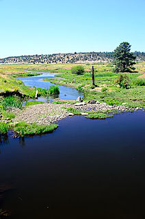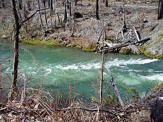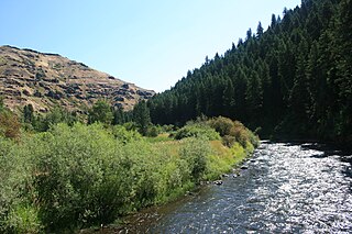
The Grande Ronde River is a tributary of the Snake River, 182 miles (293 km) long, in northeastern Oregon and southeastern Washington in the United States. It drains an area southeast of the Blue Mountains and northwest of the Wallowa Mountains, on the Columbia Plateau. It flows through the agricultural Grande Ronde Valley in its middle course and through a series of scenic canyons in its lower course.

The Wallowa River is a tributary of the Grande Ronde River, approximately 55 miles (89 km) long, in northeastern Oregon in the United States. It drains a valley on the Columbia Plateau in the northeast corner of the state north of Wallowa Mountains.

The Salmon River is a 33.5-mile (53.9 km) river in the Cascade Range in the U.S. state of Oregon that drains part of southwestern Mount Hood. The entire length of the river is a protected National Wild and Scenic River. Several portions are in protected wilderness. It is affluent to the Sandy River, a tributary of the Columbia River.

The Lostine River is a 31.4-mile-long (50.5 km) tributary of the Wallowa River in northeastern Oregon in the United States. It drains a portion of the Eagle Cap Wilderness of the Wallowa Mountains in the Wallowa–Whitman National Forest and joins the Wallowa River at Wallowa.

The Imnaha River is a 73.3-mile-long (118.0 km) tributary of the Snake River in the U.S. state of Oregon. Flowing generally east near the headwaters and then north through Wallowa County, the entire river is designated Wild and Scenic. It follows a geologic fault to the Snake River, and in addition to land in the Wallowa–Whitman National Forest and private land, its corridor includes parts of three special management areas: the Eagle Cap Wilderness, Hells Canyon National Recreation Area, and Hells Canyon Scenic Byway. The Imnaha flows by the unincorporated community of Imnaha, the only settlement along its course, and enters the Snake River roughly 4 miles (6 km) from the larger river's confluence with the Salmon River of Idaho and 192 miles (309 km) from its confluence with the Columbia River.

Catherine Creek is a 32.4-mile-long (52.1 km) creek in northeastern Oregon, United States. A tributary of the Grande Ronde River, it is the second-longest stream in the Grande Ronde Valley. Originating in the foothills of the Wallowa Mountains, it flows generally northwest through Catherine Creek State Park and the city of Union before joining the river.

The Little White Salmon River is a tributary, about 19 miles (31 km) long, of the Columbia River in the U.S. state of Washington. Its headwaters are in the Monte Cristo Range in Gifford Pinchot National Forest. The river flows from this part of the Cascade Range into Drano Lake, an arm of the Bonneville Pool of the Columbia. The river drains a basin of 136 square miles (350 km2) The basin's population was an estimated 513 in 2000.

The Little Wenatchee River is the southern and smaller of the two rivers that flow into the west end of Lake Wenatchee. The northern and larger one is the White River. A large number of place names in the Little Wenatchee River basin, including the river's name itself, were given by Albert H. Sylvester.

The Little North Santiam River is a 27-mile (43 km) tributary of the North Santiam River in western Oregon in the United States. It drains 113 square miles (290 km2) of the Cascade Range on the eastern side of the Willamette Valley east of Salem.

Roaring River is a tributary of the South Fork McKenzie River in Lane County in the U.S. state of Oregon. It begins along the west side of Roaring River Ridge in the Cascade Range and flows generally north through the Willamette National Forest to meet the larger stream about 22 miles (35 km) from its confluence with the McKenzie River.

The North Fork Siuslaw River is a tributary of the Siuslaw River in Lane County in the United States state of Oregon. It is formed by the confluence of Sam Creek and West Branch in the Siuslaw National Forest of the Central Oregon Coast Range. The former community of Pawn was once at the juncture of the two creeks. From here, the river flows about 2 miles (3 km) southeast, then about 25 miles (40 km) southwest to meet the main stem 1.2 miles (1.9 km) east of Florence.

Beaver Creek is a tributary of the Crooked River in the U.S. state of Oregon. It is formed by the confluence of its two forks in southeastern Crook County, a sparsely populated part of Central Oregon. North Fork Beaver Creek flows south and then west around Laughlin Table. South Fork Beaver Creek drains the slopes of Snow Mountain and Funny Butte in southwestern Grant County before joining the North Fork.

The South Fork Burnt River is a tributary of the Burnt River in Baker County in the U.S. state of Oregon. Its headwaters lie in the Monument Rock Wilderness and the Wallowa–Whitman National Forest of the Blue Mountains. It flows generally northeast for about to meet the main stem at Unity Reservoir, north of Unity. The river, about 12 miles (19 km) long, crosses under U.S. Route 26 about 3 miles (5 km) northwest of Unity.

The North Fork Umatilla River is a tributary of the Umatilla River in Union and Umatilla counties in the U.S. state of Oregon. Its headwaters lie in the Umatilla National Forest in the Blue Mountains of northeastern Oregon. It flows generally northwest to meet the South Fork Umatilla River near Graves Butte. Together the two forks form the main stem Umatilla.

The North Fork Smith River is 28-mile (45 km) tributary of the Smith River that begins in the U.S. state of Oregon and ends in the U.S. state of California. Arising near Chetco Peak in the Klamath Mountains, it flows generally south to meet the Middle Fork Smith River at Gasquet, California. The combined streams form the Smith River.

Eagle Creek is a tributary, 41 miles (66 km) long, of the Powder River in the northeastern part of the U.S. state of Oregon. Beginning at Eagle Lake in the Wallowa Mountains, the creek flows generally southwest and then southeast to meet the river near the small city of Richland. The creek's headwaters are in the Eagle Cap Wilderness within the Wallowa–Whitman National Forest. The upper 28.9 miles (46.5 km) of the creek, from Eagle Lake to the national forest boundary at Skull Creek, are part of the National Wild and Scenic Rivers System.

The South Fork Wenaha River is a tributary of the Wenaha River in the U.S. state of Oregon. The river begins in the Blue Mountains south of Bone Spring in Wallowa County near its border with Union County. From there it flows generally northeast through the Wenaha–Tucannon Wilderness of the Umatilla National Forest to meet the North Fork Wenaha River. The combined forks form the main stem Wenaha, a tributary of the Grande Ronde River.

Big Creek is a stream that enters the Pacific Ocean along the coast of Lane County in the U.S. state of Oregon. Beginning at Saddle Mountain Spring in the Central Oregon Coast Range, it flows generally west through the Siuslaw National Forest to the ocean north of Heceta Head. Near its mouth, it passes under Big Creek Bridge, which carries U.S. Route 101.

Fall Creek is a 34-mile (55 km) tributary of the Middle Fork Willamette River in Lane County in the U.S. state of Oregon. Beginning in the Cascade Range, the creek flows generally west through the Willamette National Forest to enter the Middle Fork upstream of Jasper, southeast of Springfield and Eugene.


