
The Great Lakes, also called the Laurentian Great Lakes and the Great Lakes of North America, are a series of interconnected freshwater lakes primarily in the upper mid-east region of North America, on the Canada–United States border, which connect to the Atlantic Ocean through the Saint Lawrence River. They comprise Lakes Superior, Michigan, Huron, Erie, and Ontario. Hydrologically, there are only four lakes, because Lakes Michigan and Huron join at the Straits of Mackinac. The lakes form the Great Lakes Waterway.

The Ottawa River is a river in the Canadian provinces of Ontario and Quebec. It is named in honour of the Algonquin word 'to trade', as it was the major trade route of Eastern Canada at the time. For most of its length, it defines the border between these two provinces. It is a major tributary of the St. Lawrence River and the longest river in Quebec.
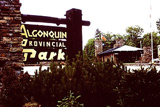
Algonquin Provincial Park is a provincial park located between Georgian Bay and the Ottawa River in Ontario, Canada, mostly within the Unorganized South Part of Nipissing District. Established in 1893, it is the oldest provincial park in Canada. Additions since its creation have increased the park to its current size of about 7,653 square kilometres (2,955 sq mi). For comparison purposes, this is larger than the state of Delaware or about one and a half times the size of Prince Edward Island or about a quarter of the size of Belgium. The park is contiguous with several smaller, administratively separate provincial parks that protect important rivers in the area, resulting in a larger total protected area.

The Mississippi River is a tributary of the Ottawa River in Eastern Ontario, Canada which has no relation with the Mississippi River in the United States. It is 200 kilometres (120 mi) in length from its source at Mackavoy Lake, has a drainage area of 4,450 square kilometres (1,720 sq mi), and has a mean discharge of 40 cubic metres per second (1,400 cu ft/s). There are more than 250 lakes in the watershed.

The York River is a river in Renfrew County, Hastings County and Haliburton County in Ontario, Canada. The river is in the Saint Lawrence River drainage basin, and flows from the southern extension of Algonquin Provincial Park to the Madawaska River.

The French River is a river in Central Ontario, Canada. It flows 110 kilometres (68 mi) from Lake Nipissing west to Georgian Bay. The river largely follows the boundary between the Parry Sound District and the Sudbury District, and in most contexts is considered the dividing line between Northern Ontario and Southern Ontario. The French River was designated a Canadian Heritage River in 1986.
A riverboat is a watercraft designed for inland navigation on lakes, rivers, and artificial waterways. They are generally equipped and outfitted as work boats in one of the carrying trades, for freight or people transport, including luxury units constructed for entertainment enterprises, such as lake or harbour tour boats. As larger water craft, virtually all riverboats are especially designed and constructed, or alternatively, constructed with special-purpose features that optimizes them as riverine or lake service craft, for instance, dredgers, survey boats, fisheries management craft, fireboats and law enforcement patrol craft.

The Mississagi River is a river in Algoma and Sudbury Districts, Ontario, Canada, that originates in Sudbury District and flows 266 kilometres (165 mi) to Lake Huron at Blind River, Algoma District.

Eastern Ontario is a secondary region of Southern Ontario in the Canadian province of Ontario which lies in a wedge-shaped area between the Ottawa River and St. Lawrence River. It shares water boundaries with Quebec to the north and New York State to the east and south, as well as a small land boundary with the Vaudreuil-Soulanges region of Quebec to the east.
Black River may refer to several rivers by that name in the province of Ontario, Canada:
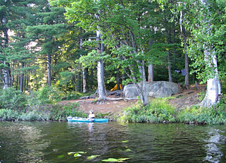
Canoe camping is a combination of canoeing, long-distance travel, and camping. Like backpacking, canoe campers carry enough with them to travel and camp for several days, but do so via canoes or kayaks. Canoe camping is primarily practiced in North America.

The Chippewa River in Wisconsin flows approximately 183 miles (294 km) through west-central and northwestern Wisconsin. It was once navigable for approximately 50 miles (80 km) of its length, from the Mississippi River, by Durand, northeast to Eau Claire. Its catchment defines a portion of the northern boundary of the Driftless Area. The river is easily accessible for bikers and pleasure seekers via the Chippewa River State Trail which follows the river from Eau Claire to Durand.

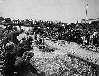
Timber rafting is a method of transporting felled tree trunks by tying them together to make rafts, which are then drifted or pulled downriver, or across a lake or other body of water. It is arguably, after log driving, the second cheapest means of transporting felled timber. Both methods may be referred to as timber floating.
McLaren v Caldwell was a landmark decision of the Judicial Committee of the Privy Council that upheld provincial jurisdiction in matters of a local or private nature, as well as over property and civil rights. It has been described as "a decision in a non-constitutional legal context that had indirect non-legal, but profound, constitutional consequences."

The bighead carp is a species of freshwater fish, one of several Asian carps. It is one of the most intensively exploited fishes in aquaculture, with an annual worldwide production of over three million tonnes in 2013, principally from China.

The Black River is a river in west-central Wisconsin and tributary of the Mississippi River. The river is approximately 190 miles (310 km) long. During the 19th century, pine logs were rafted down the Black, heading for sawmills at La Crosse and points beyond.

Carlow/Mayo is a township in northern Hastings County in Eastern Ontario, Canada. It was formed in 2001 by the amalgamation of the townships of Carlow and Mayo.

Neys Provincial Park is a Natural Environment Class provincial park on the north shore of Lake Superior, just west of Marathon, Ontario, Canada. This 5,383-hectare (13,300-acre) park includes the historic Coldwell Peninsula and the surrounding island system consisting of Pic Island, Detention Island, and the Sullivan Islands.
The Ottawa, Arnprior and Parry Sound Railway, or OA&PS, is a historic railway that operated in central and eastern Ontario, Canada from 1897 until 1959. It was, for a time, the busiest railway route in Canada, carrying both timber and wood products from today's Algonquin Provincial Park areas, as well as up to 40% of the grain traffic from the Canadian west from Depot Harbour at Parry Sound through to the St. Lawrence River valley.
The Finkbine-Guild Lumber Company was established to harvest and market the virgin longleaf pine stands of southern Mississippi during the early 20th century. The main sawmills were located in Wiggins and D'Lo, Mississippi. When the local timber supply dwindled, the company tried to utilize redwood trees from California, but that operation failed because of high transportation costs. Other attempts were made at promoting a more diversified use of the cutover timberlands; some ventures were successful while others were not.
