Little Neshaminy Creek

Last updated

Little Neshaminy Creek
Little Neshaminy Creek east of PA 263.jpeg
Little Neshaminy Creek in Warwick Township
USA Pennsylvania relief location map.svg
Red pog.svg
Little Neshaminy Creek
Location
Country United States
State Pennsylvania
County Montgomery, Bucks
Township Horsham
Montgomery
Warrington
Warminster
Warwick
Northampton
Physical characteristics
Source 
  coordinates 40°13′48″N75°14′49″W / 40.23000°N 75.24694°W / 40.23000; -75.24694
  elevation450 feet (140 m)
Mouth  
  coordinates
40°15′21″N75°1′59″W / 40.25583°N 75.03306°W / 40.25583; -75.03306
  elevation
125 feet (38 m)
Length15.5 miles (24.9 km)
Basin size43 square miles (110 km2)
Basin features
ProgressionLittle Neshaminy Creek → Neshaminy CreekDelaware RiverDelaware Bay
River system Delaware River
LandmarksWindlestrae Park
Nikesite Park
Lower Nike Park
Bradford Reservoir
Kemper Park
Barness Park
Tributaries 
  right Park Creek
WaterbodiesBradford Reservoir
Slope20.97 feet per mile (3.972 m/km)

Little Neshaminy Creek is a tributary of the Neshaminy Creek, part of the Delaware River Watershed rising near the intersection of U.S. Route 202 and Pennsylvania Route 309 near Montgomeryville, Pennsylvania and meets its confluence with Neshaminy Creek at the Neshaminy's 24.10 River mile.

Contents

History

There were a number of mills erected on the Little Neshaminy including the Old Hartsville Mill and the Upper and Lower Mearns' Mills. In 1942 there were ten bridges across the creek. [1]

Statistics

The watershed of the Little Neshaminy Creek is 43 square miles (110 km2), passing through suburban residential and commercial areas, as well as four public parks in Montgomery County, and Bucks County. The Geographic Name Information System I.D. is 1179624, [2] U.S. Department of the Interior Geological Survey I.D. is 02638. [3]

Course

Rising in Montgomery Township the Little Neshaminy Creek runs generally east for about 3.5 miles (5.6 km) passing through Windlestrae Park on the way where it meets unnamed tributary from the left, and another unnamed tributary from the right to the east of the park, then it runs southeast for 1.5 miles (2.4 km) touching Nike Park, then the Bradford Reservoir Recreation Area and dam where it meets another tributary from the right in the reservoir and meets Park Creek from the right below the reservoir at the Little Neshaminy's 6.32 river mile. Finally, it runs generally east for about 6.25 miles (10.06 km) picking up one tributary from the left and five on the right where it meets its confluence at the Neshaminy Creek's 24.10 River mile. [4]

Geology

The Little Neshaminy lies entirely within the Lockatong geologic formation, consisting of argillite, shale, limestone, and calcareous shale. [5]

Named tributaries

Municipalities

Crossings and bridges

CrossingNBI NumberLengthLanesSpansMaterial/DesignBuiltReconstructedLatitudeLongitude
Pennsylvania Route 309 (Bethlehem Pike)---------
Pennsylvania Route 463 (Horsham Road)---------
Stump Road278839 metres (30 ft)22Stringer/multi-beam or girder, concrete continuous1916---
Springhouse Court-_-------
Kenas Road (SR 2014)2760611 metres (36 ft)21slab design concrete1959---
Pennsylvania Route 152 (Limekiln Pike)2732213 metres (43 ft)22Arch Deck, stone masonry-2012-
County Line Road726816 metres (52 ft)31Box Beam or Girder - multiple, prestressed concrete1985-40°14'10"N75°10'44"W
Kansas Road753111 metres (36 ft)21Box Beam or Girder - multiple, prestressed concrete1979-40°13'27"N75°8'42"W
Pennsylvania Route 611 (Easton Road)705932 metres (105 ft)52Box Beam or Girder - multiple, prestressed concrete1963-40°13'31"N75°8'25"W
Paul Valley Road5369024.4 metres (80 ft)--Concrete Box Beam or girders - single or spread, concrete cast-in-place decking2008-40°13'29"N75°8'4"W
Pennsylvania Route 132 (West Street Road)690452 metres (171 ft)23Stringer multi-beam or girder, prestressed concrete continuous19601995--
Valley Road793040 metres (130 ft)23Box Beam or Girder, prestressed concrete1965-40°13'44"N75°7'12"W
West Bristol Road4073691 metres (299 ft)23Stringer/Multi-beam or Girder, steel continuous1999-40°13'57"N75°6'7"W
Old York Road764925 metres (82 ft)21Stringer/Multi-beam or Girder, steel1930200040°14'4"N75°5'28"W
Pennsylvania Route 263 (York Road)--------
Almshouse Road733343 metres (141 ft)22Box Beam or Girder, prestressed concrete1963201140°14'21"N75°3'40"W
Sacketts Ford Road735629 metres (95 ft)21Stringer/Multi-beam or Girder, steel1973-40°15'20"N75°2'2"W

See also

Related Research Articles

<span class="mw-page-title-main">Tohickon Creek</span> River in Pennsylvania, United States

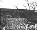
Tohickon Creek is a 29.5-mile-long (47.5 km) tributary of the Delaware River. Located entirely in Bucks County, in southeastern Pennsylvania, it rises in Springfield Township and has its confluence with the Delaware at Point Pleasant. It is dammed to form Lake Nockamixon.

<span class="mw-page-title-main">Neshaminy Creek</span> River in Pennsylvania, United States

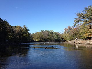
Neshaminy Creek is a 40.7-mile-long (65.5 km) stream that runs entirely through Bucks County, Pennsylvania, rising south of the borough of Chalfont, where its north and west branches join. Neshaminy Creek flows southeast toward Bristol Township and Bensalem Township to its confluence with the Delaware River. The name "Neshaminy" originates with the Lenni Lenape and is thought to mean "place where we drink twice". This phenomenon refers to a section of the creek known as the Neshaminy Palisades, where the course of the water slows and changes direction at almost a right angle, nearly forcing the water back upon itself. These palisades are located in Dark Hollow Park, operated by the county, and are flanked by Warwick Township to the south and Buckingham Township to the north.

<span class="mw-page-title-main">Cabin Run (Tohickon Creek tributary)</span> River in Pennsylvania, United States

Cabin Run is a tributary of the Tohickon Creek in Bucks County, Pennsylvania, rising in the southwestern portion of Bedminster Township to its confluence with the Tohickon Creek in northeastern Plumstead Township. Its course is approximately 4.5 miles (7.2 km)

<span class="mw-page-title-main">Newtown Creek (Neshaminy Creek tributary)</span> River in Pennsylvania, United States

Newtown Creek is a tributary, rising near Stoop Road in Newtown Township, Bucks County, Pennsylvania, United States. It is part of the Delaware River watershed and is located entirely in Bucks County, Pennsylvania. The Newtown Creek Bridge over Centre Avenue was added to the National Register of Historic Places in 1988.

Mill Creek is a tributary of Neshaminy Creek rising in Upper Southampton Township in Bucks County, Pennsylvania, United States. It is one of at least six creeks in Bucks County bearing the same name. The upper portion of Mill Creek was formerly known as Broad Axe Creek.

Pine Creek is a tributary of Mill Creek, which, in turn, is a tributary of the Neshaminy Creek, part of the Delaware River watershed.

Ironworks Creek is a tributary of Mill Creek in Northampton Township, Bucks County, Pennsylvania, part of the Neshaminy Creek, and of the Delaware River watersheds.

Mill Creek is a tributary of Neshaminy Creek, one of three tributaries of the Neshaminy which all share the same name, and one of six in Bucks County, Pennsylvania which share the name. The Geographic Name Information System I.D. is 1181118, U.S. Department of the Interior Geological Survey I.D. is 02596.

Robin Run is a dammed headwater major tributary of the Delaware River with a drainage area of 22.69 square miles that is 1.69 miles north 1.69 miles north of Mill Creek's Confluence with the Neshaminy Creek on the border of Buckingham and Wrightstown Townships), The headwaters originate in Buckingham Township, Bucks County, Pennsylvania and the stream flows generally southeast to its confluence with Mill Creek in Wrightstown Township.

<span class="mw-page-title-main">Park Creek (Little Neshaminy Creek tributary)</span> River in Pennsylvania, United States

Park Creek is a tributary of the Little Neshaminy Creek, part of the Delaware River Watershed meeting its confluence at the Little Neshaminy's 9.00 river mile.

Mill Creek is one of the three tributaries of the Neshaminy Creek bearing the name and one of six Mill Creeks in Bucks County, Pennsylvania. Rising in Doylestown Township, Mill Creek runs about 2 miles (3.2 km) to its confluence at Neshaminy Creek's 36.40 river mile.

Cooks Run is a tributary of the Neshaminy Creek. Rising in Doylestown Township, Bucks County, Pennsylvania, it runs about 2 miles (3.2 km) to its confluence with the Neshaminy Creek.

Pine Run is a tributary of the North Branch Neshaminy Creek, part of the Delaware River watershed. Pine Run flows entirely in Bucks County, Pennsylvania, rising in Plumstead Township, passing through Buckingham Township and New Britain Township, meeting its confluence with the North Branch in the Borough of Chalfont.

West Branch Neshaminy Creek is one of two branches of the Neshaminy Creek, the other being the North Branch, part of the Delaware River watershed. It is located in Bucks and Montgomery Counties in Pennsylvania.

Mill Creek is a 11.04 miles (17.77 km) long tributary of the Delaware River and is one of six streams in Bucks County, Pennsylvania by the same name. Mill Creek rises just east of Core Creek Park in Middletown Township and reaches its confluence at the Delaware River's 118.87 river mile in Bristol Borough.

Paunnacussing Creek is a tributary of the Delaware River contained wholly within Bucks County, Pennsylvania in the United States. It rises from a pond north of Mechanicsville, in Buckingham Township and drains into the Delaware at Bull Island just upstream of Lumberville in Solebury Township.

Core Creek is a tributary of the Neshaminy Creek in Bucks County, Pennsylvania. Rising in Lower Makefield Township, it flows in the Stockton Formation until it meets its confluence with the Neshaminy in Middletown Township. At one time it powered seven mills along its length.

Geddes Run is a tributary of the Tohickon Creek contained wholly within Plumstead Township, Bucks County, Pennsylvania, in the United States.

Beaver Creek is a tributary of Tinicum Creek in Bridgeton, Nockamixon, and Tinicum Townships in Bucks County, Pennsylvania, in the United States. The creek is part of the Delaware River watershed.

Rapp Creek is a tributary of Tinicum Creek in Nockamixon Township, Bucks County, Pennsylvania in the United States. Rapp Creek is part of the Delaware River watershed.

References

  1. MacReynolds, George, Place Names in Bucks County, Pennsylvania, Doylestown, Bucks County Historical Society, Doylestown, PA, 1942, P229.
  2. "Domestic Names | U.S. Geological Survey". Usgs.gov. Retrieved February 2, 2022.
  3. "Pennsylvania Gazetteer of Streams" (PDF). p. 87. Retrieved February 2, 2022.
  4. "Little Neshaminy Creek · Pennsylvania". Google.com. Retrieved February 2, 2022.
  5. "Pennsylvania Geological Survey". Gis.dcnr.state.pa.us. Pennsylvania Department of Conservation and Natural Resources. Archived from the original on April 9, 2021. Retrieved November 19, 2017.