Little Walker River

Last updated

Coordinates: 38°22′46″N119°27′05″W / 38.37944°N 119.45139°W / 38.37944; -119.45139 [1] The Little Walker River is a tributary of the West Walker River, approximately 15 mi (24 km) long, in eastern California in the United States. It drains part of the Sierra Nevada mountains in the watershed of Walker Lake.

Geographic coordinate system Coordinate system

A geographic coordinate system is a coordinate system that enables every location on Earth to be specified by a set of numbers, letters or symbols. The coordinates are often chosen such that one of the numbers represents a vertical position and two or three of the numbers represent a horizontal position; alternatively, a geographic position may be expressed in a combined three-dimensional Cartesian vector. A common choice of coordinates is latitude, longitude and elevation. To specify a location on a plane requires a map projection.

West Walker River river in the United States of America

The West Walker River is a tributary of the Walker River, approximately 95 miles (153 km) long, in eastern California and western Nevada in the United States. It drains part of the Sierra Nevada range along the California-Nevada border in the watershed of Walker Lake in the Great Basin. The river derives its name from Joseph R. Walker, a mountain man.

California State of the United States of America

California is a state in the Pacific Region of the United States. With 39.6 million residents, California is the most populous U.S. state and the third-largest by area. The state capital is Sacramento. The Greater Los Angeles Area and the San Francisco Bay Area are the nation's second and fifth most populous urban regions, with 18.7 million and 9.7 million residents respectively. Los Angeles is California's most populous city, and the country's second most populous, after New York City. California also has the nation's most populous county, Los Angeles County, and its largest county by area, San Bernardino County. The City and County of San Francisco is both the country's second-most densely populated major city after New York City and the fifth-most densely populated county, behind only four of the five New York City boroughs.

It rises from snowmelt in northwestern Mono County, north of Yosemite National Park in the Toiyabe National Forest. It flows north, joining the West Walker River from the south approximately 10 mi (16 km) south of Walker.

Mono County, California County in California, United States

Mono County (MOH-noh) is a county located in the east central portion of the U.S. state of California. As of the 2010 census, the population was 14,202. making it the fifth-least populous county in California. The county seat is Bridgeport. The county is located east of the Sierra Nevada between Yosemite National Park and Nevada.

Yosemite National Park National park in California, United States

Yosemite National Park is an American national park located in the western Sierra Nevada of Central California, bounded on the southeast by Sierra National Forest and on the northwest by Stanislaus National Forest. The park is managed by the National Park Service and covers an area of 747,956 acres and sits in four counties: centered in Tuolumne and Mariposa, extending north and east to Mono and south to Madera County. Designated a World Heritage site in 1984, Yosemite is internationally recognized for its granite cliffs, waterfalls, clear streams, giant sequoia groves, lakes, mountains, meadows, glaciers, and biological diversity. Almost 95% of the park is designated wilderness.

Walker, Mono County, California census-designated place in California, United States

Walker is a census-designated place in Mono County, California. It is located 3 miles (4.8 km) south of Coleville, at an elevation of 5403 feet. The ZIP Code is 96107, and mail to Walker should be addressed Coleville. The town was likely named for pioneer Joseph R. Walker, who started his ascension of the Sierra Nevada range in nearby Bridgeport. The population was 721 at the 2010 census, up from 558 as of 2000, according to the Mono County's government website.

See also

Related Research Articles

California Aqueduct

The Governor Edmund G. Brown California Aqueduct is a system of canals, tunnels, and pipelines that conveys water collected from the Sierra Nevada Mountains and valleys of Northern and Central California to Southern California. Named after California Governor Edmund Gerald "Pat" Brown Sr., the over 400-mile (640 km) aqueduct is the principal feature of the California State Water Project.

Duck Creek (Ohio) river in the United States of America

Duck Creek is a tributary of the Ohio River, approximately 30 mi (50 km) long, in southeastern Ohio in the United States. Via the Ohio River, it is part of the Mississippi River watershed. It drains an area of the Unglaciated Allegheny Plateau, between the watersheds of the Muskingum and Little Muskingum Rivers.

Feather River river in the United States of America

The Feather River is the principal tributary of the Sacramento River, in the Sacramento Valley of Northern California. The river's main stem is about 73 miles (117 km) long. Its length to its most distant headwater tributary is just over 210 miles (340 km). The main stem Feather River begins in Lake Oroville, where its four long tributary forks join together—the South Fork, Middle Fork, North Fork, and West Branch Feather Rivers. These and other tributaries drain part of the northern Sierra Nevada, and the extreme southern Cascades, as well as a small portion of the Sacramento Valley. The total drainage basin is about 6,200 square miles (16,000 km2), with approximately 3,604 square miles (9,330 km2) above Lake Oroville.

Hoover Wilderness

The Hoover Wilderness is a wilderness area in the Inyo and Humboldt-Toiyabe National Forests. It lies to the east of the crest of the central Sierra Nevada in California, to the north and east of Yosemite National Park - a long strip stretching nearly to Sonora Pass on the north and Tioga Pass on the south.

The Mackenzie Highway is a Canadian highway in northern Alberta and the Northwest Territories. It begins as Alberta Highway 2 at Mile Zero in Grimshaw, Alberta. After the first 4.0 km (2.5 mi), it becomes Alberta Highway 35 for the balance of its length through Alberta and then becomes Northwest Territories Highway 1.

Little Beaver Creek stream in Ohio

The Little Beaver Creek is a wild and scenic area in Ohio. The Little Beaver Creek watershed is located primarily in Columbiana County in eastern Ohio, and in portions of Carroll County, Mahoning County, and western Pennsylvania, draining approximately 605 mi² (1,567 km²), of which 503 mi² (1,303 km²) are in Ohio. The watershed in total size covers an area of approximately 510 square miles, with about 80% of this being situated in Ohio. The great majority land in the watershed is privately owned. Within the watershed are roughly 808 miles of linear streams.

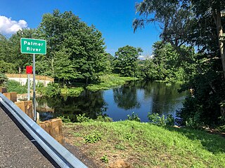
Palmer River (Massachusetts–Rhode Island) river in the United States of America

The Palmer River is a river in the U.S. states of Massachusetts and Rhode Island. It flows approximately 17 km (11 mi).

Little Yosemite Valley valley in Mariposa County, United States of America

Little Yosemite Valley is a smaller glacial valley upstream in the Merced River drainage from the Yosemite Valley in Yosemite National Park. The Merced River meanders through the 3.5 mi (5.6 km) long flat valley, draining out over Nevada Fall and Vernal Fall before emptying into the main Yosemite Valley. It can be reached by a day hike from the main valley, and is the most popular area in the Yosemite Wilderness. The Valley provides access to nearby destinations such as the back side of Half Dome, Clouds Rest and the High Sierra Camp at Merced Lake.

Białobrzegi-Kolonia Village in Lublin, Poland

Białobrzegi-Kolonia is a village in the administrative district of Gmina Kock, within Lubartów County, Lublin Voivodeship, in eastern Poland. It lies approximately 6 kilometres (4 mi) west of Kock, 25 km (16 mi) north-west of Lubartów, and 46 km (29 mi) north of the regional capital Lublin.

Idzikowice, Opoczno County Village in Łódź, Poland

Idzikowice is a village in the administrative district of Gmina Drzewica, within Opoczno County, Łódź Voivodeship, in central Poland. It lies approximately 9 kilometres (6 mi) west of Drzewica, 9 km (6 mi) north-east of Opoczno, and 72 km (45 mi) south-east of the regional capital Łódź.

Motyl, Łódź Voivodeship Village in Łódź, Poland

Motyl is a village in the administrative district of Gmina Mokrsko, within Wieluń County, Łódź Voivodeship, in central Poland. It lies approximately 6 kilometres (4 mi) south of Mokrsko, 14 km (9 mi) south-west of Wieluń, and 102 km (63 mi) south-west of the regional capital Łódź.

Myczków Village in Subcarpathian, Poland

Myczków is a village in the administrative district of Gmina Solina, within Lesko County, Subcarpathian Voivodeship, in south-eastern Poland. It lies approximately 5 kilometres (3 mi) west of Solina, 13 km (8 mi) south-east of Lesko, and 79 km (49 mi) south of the regional capital Rzeszów.

Wólka Tarnowska, Masovian Voivodeship Village in Masovian, Poland

Wólka Tarnowska is a village in the administrative district of Gmina Magnuszew, within Kozienice County, Masovian Voivodeship, in east-central Poland. It lies approximately 3 kilometres (2 mi) north of Magnuszew, 26 km (16 mi) north-west of Kozienice, and 55 km (34 mi) south-east of Warsaw.

Myślibory Village in Masovian, Poland

Myślibory is a village in the administrative district of Gmina Nur, within Ostrów Mazowiecka County, Masovian Voivodeship, in east-central Poland. It lies approximately 7 kilometres (4 mi) south-east of Nur, 38 km (24 mi) south-east of Ostrów Mazowiecka, and 105 km (65 mi) north-east of Warsaw.

Kobyla Góra, Greater Poland Voivodeship Village in Greater Poland, Poland

Kobyla Góra is a village in Ostrzeszów County, Greater Poland Voivodeship, in west-central Poland. It is the seat of the gmina called Gmina Kobyla Góra. It lies approximately 12 kilometres (7 mi) west of Ostrzeszów and 130 km (81 mi) south-east of the regional capital Poznań.

Binińskie Huby Village in Greater Poland, Poland

Binińskie Huby is a village in the administrative district of Gmina Ostroróg, within Szamotuły County, Greater Poland Voivodeship, in west-central Poland. It lies approximately 6 kilometres (4 mi) west of Ostroróg, 15 km (9 mi) west of Szamotuły, and 46 km (29 mi) north-west of the regional capital Poznań.

Łutowiec Village in Silesian, Poland

Łutowiec is a village in the administrative district of Gmina Niegowa, within Myszków County, Silesian Voivodeship, in southern Poland. It lies approximately 4 kilometres (2 mi) south-west of Niegowa, 11 km (7 mi) north-east of Myszków, and 53 km (33 mi) north-east of the regional capital Katowice.

Podbiele, Lubusz Voivodeship Settlement in Lubusz, Poland

Podbiele is a settlement in the administrative district of Gmina Sulęcin, within Sulęcin County, Lubusz Voivodeship, in western Poland. It lies approximately 13 kilometres (8 mi) east of Sulęcin, 32 km (20 mi) south of Gorzów Wielkopolski, and 59 km (37 mi) north of Zielona Góra.

Ucisko Village in Pomeranian, Poland

Ucisko ,(German: Ucisk) is a village in the administrative district of Gmina Kartuzy, within Kartuzy County, Pomeranian Voivodeship, in northern Poland. It lies approximately 6 kilometres (4 mi) north of Kartuzy and 29 km (18 mi) west of the regional capital Gdańsk.

References