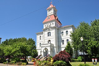
The Calapooia River is an 80-mile (130 km) tributary of the Willamette River in the U.S. state of Oregon.

The Luckiamute River is a tributary of the Willamette River, about 61 miles (98 km) long, in western Oregon in the United States. It drains an area of Central Oregon Coast Range and the western Willamette Valley northwest of Corvallis.
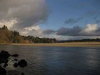
The Salmon River flows from the Central Oregon Coast Range to the Pacific Ocean coast of northwest Oregon in the United States. About 24 miles (39 km) long, it begins and ends in Lincoln County but also flows briefly through western Polk and southern Tillamook counties. Much of its course lies within the Siuslaw National Forest.
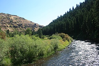
The Minam River is a tributary of the Wallowa River, 51 miles (82 km) long, in northeastern Oregon in the United States. It drains a rugged wilderness area of the Wallowa Mountains northeast of La Grande.

West Little Owyhee River is a 63.1-mile-long (101.5 km) tributary of the Owyhee River in the U.S. state of Oregon. The source of the river is at an elevation of 6,508 feet (1,984 m) near McDermitt, while the mouth is at an elevation of 4,373 feet (1,333 m) in the Owyhee Desert. West Little Owyhee River has a 310-square-mile (800 km2) watershed.
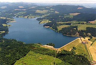
Scoggins Creek, formerly known as "Scoggin Creek", is a 19-mile (31 km) tributary of the Tualatin River in Tillamook and Washington counties in the U.S. state of Oregon. It is named for pioneer settler Gustavus Scoggin.

The North Fork Alsea River is a 16-mile (26 km) tributary of the Alsea River in the U.S. state of Oregon. It begins at Klickitat Lake, fed by Klickitat and Lake creeks in the Central Oregon Coast Range, and flows generally south to near Alsea, where it joins the South Fork Alsea River to form the main stem. For most of its course, the North Fork winds through the Siuslaw National Forest in Lincoln County and then Benton County. It passes under Oregon Route 34 northeast of Alsea.

The Little Pudding River is a tributary of the Pudding River in Marion County in the U.S. state of Oregon. It begins in the Waldo Hills near Macleay, east of Salem, and flows generally north to meet the larger river west of Mt. Angel. The confluence is about 37 miles (60 km) from the Pudding River's mouth on the Molalla River.

The East Fork Salmon River is a short tributary of the Salmon River in Clackamas County, in the U.S. state of Oregon. It begins on the southern slopes of Mount Hood at an elevation of about 4,300 feet (1,300 m) and flows generally southwest into the main stem at Red Top Meadow, slightly east of Trillium Lake. Its entire course lies within the Mount Hood National Forest. It has no named tributaries.

The Treat River is a short tributary of the Salmon River in Lincoln County, in the U.S. state of Oregon. It begins in the Siuslaw National Forest in the Central Oregon Coast Range and flows generally northwest. It enters the larger stream between the H. B. Van Duzer Forest State Scenic Corridor along Oregon Route 18 and the unincorporated community of Rose Lodge. It has no named tributaries.

The South Fork Roaring River is a 4.6-mile (7.4 km) tributary of the Roaring River in Clackamas County in the U.S. state of Oregon. Beginning at Rock Lakes in the Mount Hood National Forest in the Cascade Range, it flows generally northwest along the base of Indian Ridge to meet the main stem. The South Fork has no named tributaries.
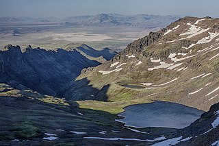
Wildhorse Creek is a tributary of Alvord Lake in Harney County in the U.S. state of Oregon. It originates at a spring on Steens Mountain and flows generally south through Wildhorse Canyon to the shallow alkaline lake, south of the Alvord Desert and north of the unincorporated community of Fields.

The Little Chetco River is a tributary of the Chetco River in Curry County in the U.S. state of Oregon. Its headwaters lie in the Kalmiopsis Wilderness near the border with Josephine County west of Cave Junction. It flows generally northwest through the Rogue River – Siskiyou National Forest in the Klamath Mountains.

The North Fork Wenaha River is a tributary, 16 miles (26 km) long, of the Wenaha River in the U.S. states of Washington and Oregon. The river begins in the Blue Mountains in Columbia County, Washington, and flows generally southeast through the Wenaha–Tucannon Wilderness to meet the South Fork Wenaha River in Wallowa County, Oregon. The combined forks form the main stem Wenaha, a tributary of the Grande Ronde River.

The Lake Fork West Owyhee River is a short tributary of the West Little Owyhee River in the U.S. state of Oregon. The river begins near Cat, Bend, and Pedroli springs near the eastern boundary of the Fort McDermitt Indian Reservation in southern Malheur County. It flows generally northeast to meet the larger river in Louse Canyon. The Lake Fork has no named tributaries.

The Little Clatskanie River is a short tributary of the Clatskanie River in Columbia County in the U.S. state of Oregon. It begins near Sarafin Point in the Northern Oregon Coast Range northwest of St. Helens and flows generally north to meet the larger stream near the unincorporated community of Apiary. The mouth of the Little Clatskanie is about 16 miles (26 km) from the main stem Clatskanie's confluence with the Columbia River. The Little Clatskanie has no named tributaries.

The Little Minam River is a tributary of the Minam River in Union County in the U.S. state of Oregon. It begins at the base of Cartwheel Ridge in the Wallowa Mountains and flows generally north through the Wallowa–Whitman National Forest to meet the main stem river at the north end of Backbone Ridge.

The Middle Fork Rogue River is a tributary of the South Fork Rogue River in the U.S. state of Oregon. It begins in Klamath County in the Sky Lakes Wilderness of the Cascade Range and flows generally northwest through the Rogue River – Siskiyou National Forest to meet the South Fork south of Prospect. The Middle Fork enters the South Fork about 4 miles (6 km) from the South Fork's confluence with the Rogue River.

