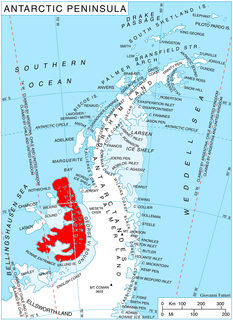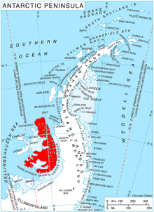
The Neptune Range is a mountain range, 112 km (70 mi) long, lying WSW of Forrestal Range in the central part of the Pensacola Mountains in Antarctica. The range is composed of Washington Escarpment with its associated ridges, valleys and peaks, the Iroquois Plateau, and the Schmidt and Williams Hills. It was discovered and photographed on January 13, 1956 on a US Navy transcontinental plane flight from McMurdo Sound to Weddell Sea and return.

The Prince Charles Mountains are a major group of mountains in Mac. Robertson Land in Antarctica, including the Athos Range, the Porthos Range, and the Aramis Range. The highest peak is Mount Menzies. Other prominent peaks are Mount Izabelle and Mount Stinear. These mountains together with other scattered peaks form an arc about 260 miles long, extending from the vicinity of Mount Starlight in the north to Goodspeed Nunataks in the south.
Wilson Hills is a group of scattered hills, nunataks and ridges that extend NW-SE for about 110 kilometres (68 mi) between Matusevich Glacier and Pryor Glacier in Antarctica. They were discovered by Lieutenant Harry Pennell, Royal Navy, on the Terra Nova Expedition in February 1911 during Robert Falcon Scott's last expedition, and named after Dr. Edward A. Wilson, a zoologist with the expedition, who perished with Scott on the return journey from the South Pole.

Dufek Massif is a rugged, largely snow-covered massif 27 nautical miles (50 km) long, standing west of the Forrestal Range in the northern part of the Pensacola Mountains. It was discovered and photographed on January 13, 1956 on a transcontinental patrol plane flight of U.S. Navy Operation Deep Freeze from McMurdo Sound to the vicinity of the Weddell Sea and return, and named by the Advisory Committee on Antarctic Names for Rear Admiral George J. Dufek, U.S. Navy, who was in direct operational command of U.S. Navy Task Force 43 during that operation. The entire Pensacola Mountains were mapped by the U.S. Geological Survey in 1967 and 1968 from ground surveys and U.S. Navy tricamera aerial photographs taken in 1964.

Shaw Nunatak is a nunatak rising to 500 m in Nichols Snowfield, northern Alexander Island, Antarctica. It is situated 5.3 km north-northeast of Rachenitsa Nunatak, 4.23 km east-southeast of Tipits Knoll and 7 km southeast of Mount Kliment Ohridski in Sofia University Mountains, 7.5 km southwest of Lizard Nunatak and 8.1 km northwest of Tegra Nunatak. The feature was photographed from the air by Ronne Antarctic Research Expedition in 1947–48, and mapped from these photographs by D. Searle of Falkland Islands Dependencies Survey, 1960. The nunatak was named by United Kingdom Antarctic Place-Names Committee in 1977 after Colin Shaw (1944–78), British Antarctic Survey surveyor who worked in Alexander Island, from 1975 to 1976.

Simon Peak is a mountain rising to about 1,000 m on the west side of the Havre Mountains, situated in the northwest portion of Alexander Island, Antarctica. The peak lies northeast of Umber Island, an island situated in Lazarev Bay off the west coast of Alexander Island. It is situated 9.9 km east-southeast of Buneva Point, 6.4 km northeast of Kamhi Point, 14.65 km west of Mount Pontida and 6.15 km north-northeast of Gazey Nunatak, and surmounts Pipkov Glacier to the north and Oselna Glacier to the southwest. Possibly sighted by FAE, 1908–10, in January 1909; surveyed by British Antarctic Survey in 1975-76. Named after Alec Edward Simon, British Antarctic Survey aircraft mechanic, who worked on nearby Adelaide Island during the summers of years 1972 to 1976.

The Appalachia Nunataks are a group of nunataks rising to about 600 metres (2,000 ft) on the west side of the Elgar Uplands, Alexander Island, Antarctica. They are situated 5.62 km southwest of Lyubimets Nunatak, 9 km southwest of Kozhuh Peak and 9.65 km north of Atanasov Ridge, and surmount Nichols Snowfield to the west. The feature was named by the United Kingdom Antarctic Place-Names Committee in 1977 after Appalachia, the 1902 Frederick Delius composition, in association with Delius Glacier and the names of composers in this area.

Borchgrevink Nunatak is a nunatak 1.5 nautical miles (3 km) long which rises to 650 metres (2,130 ft), standing at the south side of the entrance to Richthofen Pass, on the east coast of Graham Land. It was discovered in 1902 by the Swedish Antarctic Expedition under Otto Nordenskiöld, who named it for C.E. Borchgrevink, leader of the British Antarctic Expedition, 1898–1900, to Victoria Land.

Mount Wilbye is the highest peak of the Lassus Mountains in the north part of Alexander Island, Antarctica. It is situated 10.24 km north by west of Mount Devol. The mountain was first mapped from air photos taken by the Ronne Antarctic Research Expedition in 1947–48, by Searle of the Falkland Islands Dependencies Survey in 1960. Named by United Kingdom Antarctic Place-Names Committee after John Wilbye (1574–1638), English madrigal composer.
Delius Glacier is a glacier, 6 nautical miles (11 km) long and 2 nautical miles (4 km) wide, flowing west from the Elgar Uplands into Nichols Snowfield, in the northern part of Alexander Island, Antarctica. It was first seen from the air and roughly mapped by the British Graham Land Expedition in 1937. It was more accurately mapped from air photos taken by the Ronne Antarctic Research Expedition, 1947–48, by D. Searle of the Falkland Islands Dependencies Survey in 1960, and from U.S. Landsat imagery of February 1975. It was named by the UK Antarctic Place-Names Committee after Frederick Delius, the British composer.

Faulkner Nunatak is a distinctive nunatak, about 200 metres (660 ft) high, just west of Beagle Peak and 9.5 km west by south of Mount Devol in the Lassus Mountains, in the northwest part of Alexander Island, Antarctica. The feature appears in U.S. Navy aerial photographs obtained in 1966. It was named by the Advisory Committee on Antarctic Names after Harold T. Faulkner, U.S. Navy, Leading Chief of Squadron VXE-6 Photo Division on Operation Deep Freeze, 1969.
Mount Monique is a mountain, about 600 m high, with a prominent rocky north face and ice-covered south slopes, at the western end of the Marion Nunataks on the north coast of Charcot Island in the east Bellinghausen Sea of Antarctica.
Gerasimou Glacier is a steep-walled tributary glacier, 5 nautical miles (9 km) long, entering the west side of Shackleton Glacier opposite the Gemini Nunataks, in the Queen Maud Mountains of Antarctica. It was named by the Texas Tech Shackleton Glacier Expedition, 1964–65, for Helen Gerasimou, a polar personnel specialist with the Office of Antarctic Programs, National Science Foundation.
High Nunatak is an isolated nunatak 4 nautical miles (7 km) east of the Liberty Hills in the Heritage Range of the Ellsworth Mountains, Antarctica. It was named by the Advisory Committee on Antarctic Names for Elmer High, a helicopter crew chief with the 62nd Transportation Detachment, who assisted the University of Minnesota geological party in this area in 1963–64.
Hesperus Nunatak is a sharp-pointed nunatak lying 2 nautical miles (4 km) southwest of Titania Peak and about 18 nautical miles (33 km) west of Venus Glacier in the southeastern portion of Alexander Island, Antarctica. It was mapped by the Directorate of Overseas Surveys from satellite imagery supplied by the U.S. National Aeronautics and Space Administration in cooperation with the U.S. Geological Survey, and was named by the UK Antarctic Place-Names Committee from association with Venus Glacier, Hesperus being a variant name for the "evening star," Venus.

Serpent Nunatak is a nunatak which is seen in the shape of a reverse letter S, rising to about 750 m just west of Tufts Pass lying within the Nichols Snowfield, in the northern portion of Alexander Island, Antarctica. It is situated 6.4 km northeast of Lizard Nunatak and 6.23 km south of Lesnovo Hill. The feature was descriptively named by United Kingdom Antarctic Place-Names Committee in 1977 because of the nunataks shape, the reverse letter S supposedly resembles a Serpent.
Selene Nunatak is a nunatak rising to about 1,200 m west of Lunar Crag, situated within the mountain range Planet Heights, in eastern Alexander Island, Antarctica. The nunatak was named in association with nearby Lunar Crag by the United Kingdom Antarctic Place-Names Committee in 1988 after Selene, the Greek goddess of the Moon.
Sowle Nunatak is a nunatak situated in the Rambo Nunataks, lying 5.5 nautical miles (10 km) southeast of Wagner Nunatak on the west side of Foundation Ice Stream, in the Pensacola Mountains, Edith Ronne Land, Antarctica. The geographical feature was first mapped by United States Geological Survey (USGS) from surveys and U.S. Navy air photos, 1956-66. Named by Advisory Committee on Antarctic Names (US-ACAN) for Melvin L. Sowle, construction mechanic at Plateau Station, winter 1967.
Kenfield Nunatak is an isolated nunatak which lies about 8 nautical miles (15 km) southeast of the head of Cosgrove Ice Shelf and 17 nautical miles (31 km) east-northeast of Pryor Cliff, at the extreme northern end of the Hudson Mountains, Antarctica. It was mapped by the United States Geological Survey (USGS) from ground surveys and U.S. Navy air photos, 1960–66, and was named by the Advisory Committee on Antarctic Names for Richard E. Kenfield, a USGS topographic engineer working from Byrd Station in the 1963–64 season.


