Ljunghusen

Last updated
Ljunghusen

Ljunghusen beach.JPG

Beach huts by Ljunghusen beach
Sweden Scania location map.svg
Red pog.svg
Ljunghusen
Sweden location map.svg
Red pog.svg
Ljunghusen
Coordinates: 55°24′N12°55′E / 55.400°N 12.917°E / 55.400; 12.917 Coordinates: 55°24′N12°55′E / 55.400°N 12.917°E / 55.400; 12.917
Country Sweden
Province Skåne
County Skåne County
Municipality Vellinge Municipality
Area [1]
  Total 3.81 km2 (1.47 sq mi)
Population (31 December 2010) [1]
  Total 2,555
  Density 670/km2 (1,700/sq mi)
Time zone CET (UTC+1)
  Summer (DST) CEST (UTC+2)
Train station, the track went on the road visible in the foreground. Ljunghusens station idag.jpg
Train station, the track went on the road visible in the foreground.

Ljunghusen is a locality situated in Vellinge Municipality, Skåne County, Sweden with 2,555 inhabitants in 2010. [1] It is located west of Höllviken and east of Skanör-Falsterbo. The town is notable for its beaches and for its golf course, Ljunghusens GK, which on several occasions has been ranked among Sweden's five best courses.

An urban area or tätort in Sweden has a minimum of 200 inhabitants and may be a city, town or larger village. It is a purely statistical concept, not defined by any municipal or county boundaries. Urban areas referred to as cities or towns for statistical purposes have a minimum of 10,000 inhabitants. In 2010, there were 1,956 urban areas in Sweden, covering 85% of the Swedish population.

Vellinge Municipality Municipality in Skåne County, Sweden

Vellinge Municipality is a municipality in Skåne County in southern Sweden. Its seat is located in Vellinge.

Skåne County County (län) of Sweden

Skåne County, sometimes referred to as Scania County in English, is the southernmost county or län, of Sweden, basically corresponding to the traditional province Skåne. It borders the counties of Halland, Kronoberg and Blekinge and connected to Capital Region, Denmark by the Oresund Bridge. The seat of residence for the Skåne Governor is the city of Malmö. The headquarters of Skåne Regional Council is the town of Kristianstad.

Contents

Ljunghusen had a train station between 1904 and 1971, and between 1905 and 1924 a horsetrack went from the train station in the north of the village to the beach in the south.

Etymology

Ljunghusen The town has been named after two houses built in the beginning of the 19th century, north of the main road to Skanör-Falsterbo, approximately a little south of the former railway station house. These two houses had their own chapter "Ljunghusen" (The heather houses) in the parish register already 1837. Heather house with reference to the large big heath covered with heather, "Skanörs Ljung", today a nature reserve. The two houses are long since gone.

Skanörs Ljung Nature Reserve is situated in the South-Western part of the Scania province of Sweden, in the Vellinge Municipality between Ljunghusen and Skanör-Falsterbo. Skanörs Ljung became a designated nature reserve 1969 and encompasses a total area of 5.75 km2 of which 2.122 km2 is the marine portion.

The Norra and Södra Ljunghuset Along the western limit of the town but in the neighbour parish Skanör-Falsterbo there were and are still today two old houses Norra Ljunghuset (Northern Heather house) built 1796 and Södra Ljunghuset (Southern Heather house) built 1850 . The two houses were built by Skanör-Falsterbo as lodges for gate keepers and cattle shepherds, along their eastern town limit straight across the heath, one at the main road in the north and the other close to the sea in the south.

The Norra Ljunghuset, used to be the last building before the heath between the town and Skanör-Falsterbo. Today, the town has expanded, but the house is still the last building along the main road to Skanör-Falsterbo. At the turn of the century, a speakeasy was also housed and active in the building and many stories were told about the heath's own troll, the so-called "Gya troll". Today there is a road named Lönnkrogsvägen (Speakeasy road) and there is also a residential area in the neighbour town Höllviken named "Gya". The Norra Ljunghuset burned down partly in 1950 but was repaired and is today home to a family.

Höllviken Place in Skåne, Sweden

Höllviken is a locality situated in Vellinge Municipality, Skåne County, Sweden with 10,607 inhabitants in 2010. It is located close to both Malmö and the Øresund Bridge which connects Sweden and Denmark.

Södra Ljunghuset, was used as a club house for the local golf club Ljunghusens GK, from the founding of the club in 1932 until the new club house was ready in 1965. Today, the house is used as a workshop for the club's greenkeepers. It also houses an apartment, that usually is occupied by someone employed by the golf club.

The area

Ljungskogens strandbad

The part of Ljunghusen that can be reached through the Storvägen is called Ljungskogens strandbad. This is the westernmost part of the town. It has some unique features since there are only unpaved roads without street lights, and all the houses have very big lots, and previously there were rules how near the road the buildings could be built, and there is a general prohibition on making hammer noises during all the summer. All this gives the area a forestry feeling. Most of the unsettled lots in this area are being owned by persons who want to preserve the unique character of the area. However, in the latest years, a large number of these unsettled lots have been sold off. This has resulted in the increased new building of detached houses.

The area north of County Road 100

North of the County Road 100 lies a grocery shop, a bakery, a former railway station and some apartments and terraced houses for the elderly and also a handful of detached houses.

The area between Ljungskogens strandbad and the channel

This area has a more classic suburban style, especially around the Elvabo road, where all the houses are identical and the road is relatively wide. The area is also illuminated by street lightning. Ljungsäter Hospital is found in this area, as well as the Hostel Lotsvillan.

The Ljungsäter Hospital

The County Council in Lund constructed a tuberculosis sanatorium in Ljunghusen in 1921. This sanatorium was called the Ljungsäter Hospital. The name is derived from the Ljungsäter farm, which also has given its name to the road where the house lies today, the Ljungsäter Road. The hospital could take 110 patients and employed 20 persons, of which the majority came from the University Hospital in Lund. Patients could be picked up by a trolley at the railway siding from the railroad to Falsterbo, and at the same time it also transported beach bathers down, towards the hospital, which was close by the beach. The transport was a horse-drawn trolley, the same kind as the one used on the tracks in the Storvägsområdet. The hospital closed down when the Falsterbo channel was built in 1940. The reason was that the channel needed to be built through the building itself. The only remaining building in the hospital area is the Doctor's house, which is still being used today, although being very decayed.

Transportation

Today, the transportation from Ljunghusen to Malmö are good. There are two bus stops in the area, and the buses comes every ten minutes during rush hours. At other times, the bus either stops at every 20th minute or every hour during slow hours. The stops are called Elvabovägen and Storvägen.

Malmö Place in Scania, Sweden

Malmö is the largest city of the Swedish county of Skåne County, the third-largest city in Sweden, after Stockholm and Gothenburg, and the sixth-largest city in Scandinavia, with a population of 316,588 inhabitants out of a municipal total of 338,230 in 2018. The Malmö Metropolitan Region is home to over 700,000 people, and the Øresund Region, which includes Malmö, is home to 4 million people.

There was a railway station named "Ljunghusen" here between 1904 and 1971 and the station was part of the Hvellinge-Skanör-Falsterbo railroad. The railroad track was removed in 1971. There was also a horse-drawn tram going from the railroad station along "Storvägen" down to the beach where it was divided into two lines, one going east, the other one going west.

The water tower in Ljunghusen

The water tower in Ljunghusen is also the town's water reservoir. The cylindrical-shaped tower is painted in white and it is located in the western part of the town, close to Skanörs ljung. The tower is about 40 m high and is also used to create water pressure for Höllviken. Before the Falsterbo water tower was constructed, it also used to serve Skanör-Falsterbo.

Related Research Articles

Bethnal Green district in East London, England

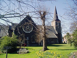
Bethnal Green is a district in the East End of London and is 3.3 miles (5.3 km) northeast of Charing Cross. Bethnal Green forms the north-west part of the London Borough of Tower Hamlets and extends from the City fringe to Victoria Park with the south eastern side referred to as Globe Town, with Bethnal Green Road serving as the district centre. The area emerged from the hamlet which developed around the Green, much of which survives today as Bethnal Green Gardens.

Høje-Taastrup Municipality Municipality in Capital Region, Denmark

Høje-Taastrup Kommune is a municipality in Region Hovedstaden on the island of Zealand (Sjælland) in eastern Denmark. The municipality covers an area of 78 km² (30 mi²), and has a total population of 50,676. It was formed by the 1970 Danish Municipal Reform, and its 1974 adjustment, by merging the parish municipalities of Høje Taastrup, Sengeløse, the Fløng part of Hvedstrup-Fløng and the Reerslev part of Reerslev-Vindinge. Since 1 January 2006 the mayor of the municipality has been Michael Ziegler, a member of the Conservative People's Party political party.

Camberley town in Surrey, England

Camberley is a town in Surrey, England, 31 miles (50 km) southwest of Central London, between the M3 and M4 motorways. The town is in the far west of the county, close to the borders of Hampshire and Berkshire; the boundaries intersect on the western edge of the town where all three counties converge on the A30 national route. It is the main town in the borough of Surrey Heath. Camberley's suburbs include Crawley Hill, York Town, Diamond Ridge, Heatherside, and Old Dean.

Haywards Heath town in West Sussex, England

Haywards Heath is a town in the Mid Sussex District of West Sussex, within the historic county of Sussex, England. It lies 36 miles (58 km) south of London, 14 miles (23 km) north of Brighton, 13 miles (21 km) south of Gatwick Airport and 31 miles (50 km) east northeast of the county town of Chichester. Nearby towns include Burgess Hill to the southwest, Horsham to the northwest, Crawley north-northwest and East Grinstead north-northeast. Being a commuter town with only a relatively small number of jobs available in the immediate vicinity, mostly in the agricultural or service sector, many of the residents commute daily via road or rail to London, Brighton, Crawley or Gatwick for work.

Ramsey, Isle of Man town on the Isle of Man

Ramsey is a coastal town in the north of the Isle of Man. It is the second largest town on the island after Douglas. Its population is 7,309 according to the 2006 census. It has one of the biggest harbours on the island, and has a prominent derelict pier, called the Queen's Pier. It was formerly one of the main points of communication with Scotland. Ramsey has also been a route for several invasions by Vikings and Scots.

Belvedere, London area and electoral ward in South East London

Belvedere is a town in the London Borough of Bexley, in the historic county of Kent and ceremonial county of Greater London. It lies South of the River Thames, East of Abbey Wood and Thamesmead, West of Erith, and North of Bexleyheath.

Sölvesborg Place in Blekinge, Sweden

Sölvesborg is a locality and the seat of Sölvesborg Municipality in Blekinge County, Sweden with 10,024 inhabitants in 2013.

Skanör med Falsterbo Place in Scania, Sweden

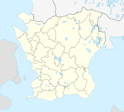
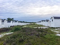
Skanör med Falsterbo is a statistical locality, situated in Vellinge Municipality, Skåne County, Sweden with 6,937 inhabitants in 2010. It consists of the two old towns of Skanör and Falsterbo which have grown together, but are still regarded as different communities by locals. The preposition med means with. Thanks to its southerly and maritime position, the locality is the mildest in Sweden, with winter lows barely averaging frosts.

Bracebridge Heath village in the United Kingdom

Bracebridge Heath is a commuter village located approximately 2 miles (3 km) south from the city and county town of Lincoln, England. It lies at the junction of two major roads the A15 to Sleaford and the A607 to Grantham, and was part of the Boothby Graffoe Wapentake. The village sits on top of Lincoln Cliff, overlooking Lincoln and the valley of the River Witham. The Viking Way runs along the cliff top, a 147 miles (237 km) long footpath, which runs from the Humber Bridge to Oakham. Its population at the 2001 census was 4,530, increasing to 5,656 at the 2011 census.

Heath Town

Heath Town is a district of Wolverhampton, West Midlands, England, located ENE of the city centre. It is also a ward of Wolverhampton City Council. The ward forms part of the Wolverhampton North East constituency.

Falsterbo city

Falsterbo is a town located at the south-western tip of Sweden in Vellinge Municipality in Skåne. Falsterbo is situated in the southern part of the Falsterbo peninsula. It is part of Skanör med Falsterbo, one of Sweden's historical cities.

Järntorget (Stockholm) square in Gamla stan, Stockholm, Sweden

Järntorget is a small public square in Gamla stan, the old town in central Stockholm, Sweden. Located in the southernmost corner of the old town, the square connects the thoroughfares Västerlånggatan and Österlånggatan, while the two alleys, Södra Bankogränd and Norra Bankogränd, stretches east to connect the square to Skeppsbron, and two other alleys, Järntorgsgatan and Triewaldsgränd, leads south to Slussplan and Kornhamnstorg respectively.

Beach Road, Singapore

Beach Road is a road located within the planning areas of Kallang, Rochor and the Downtown Core in Singapore.

Benickebrinken street in Gamla stan, Stockholm, Sweden

Södra/Norra Benickebrinken are two sloping streets in Gamla stan, the old town in central Stockholm, Sweden, stretching from Österlånggatan up to Svartmangatan.

George Town, Chennai Neighbourhood in Chennai District, Tamil Nadu, India

George Town is a neighbourhood in Chennai city, Tamil Nadu, India. It is near the Fort Saint George, Chennai. It is also known as Muthialpet and Parry's corner. It is a historical area of Chennai city from where its expansion began in the 1640s. It extends from the Bay of Bengal in the east to Park town on the west. The Fort St. George is on the south, to Royapuram in the North. The Fort St. George houses the Tamil Nadu Legislative Assembly and the Secretariat. The High court of Tamil Nadu at Chennai, Dr. Ambedkar Law College, Stanley Medical College and Hospital are located here.

Södra Ängby urban district in Stockholm, Sweden

Södra Ängby is a residential area blending functionalism with garden city ideals, located in western Stockholm, Sweden, forming part of the Bromma borough.

Falsterbo Lighthouse lighthouse at Falsterbo, Vellinge Municipality, Sweden

Falsterbo Lighthouse. To the north-east of the lighthouse is the city of Skanör-Falsterbo, to the south-east of the lighthouse are some of the finest sandy beaches in Sweden and surrounding the lighthouse is the golf course of the Falsterbo Golf Club.

Stöcksjö Place in Västerbotten, Sweden

Stöcksjö is a locality situated in Umeå Municipality, Västerbotten County, Sweden with 215 inhabitants in 2010.

Bixley Heath

Bixley Heath is a 5.1 hectare biological Site of Special Scientific Interest on the eastern outskirts of Ipswich in Suffolk. It is also a Local Nature Reserve owned and managed by Ipswich Borough Council.

References

  1. 1 2 3 "Tätorternas landareal, folkmängd och invånare per km2 2005 och 2010" (in Swedish). Statistics Sweden. 14 December 2011. Archived from the original on 10 January 2012. Retrieved 10 January 2012.

Commons-logo.svg Media related to Ljunghusen at Wikimedia Commons