Dean Village is a former village immediately northwest of the city centre of Edinburgh, Scotland. It was known as the "Water of Leith Village" and was a successful grain milling area for more than 800 years. At one time there were no fewer than eleven working mills there, driven by the strong currents of the Water of Leith.

The River Ness is a river in Highland, Scotland, UK. It flows from Loch Dochfour, at the northern end of Loch Ness, north-east to the mouth of the Beauly Firth at Inverness, a distance of about 6 miles, with a fall in height of about 16 metres. The river is the origin of the name of Inverness which is from Scottish Gaelic: Inbhir Nis, meaning "Mouth of the Ness".

The Caledonian Canal connects the Scottish east coast at Inverness with the west coast at Corpach near Fort William in Scotland. The canal was constructed in the early nineteenth century by Scottish engineer Thomas Telford.

The A82 is a major road in Scotland that runs from Glasgow to Inverness via Fort William. It is one of the principal north-south routes in Scotland and is mostly a trunk road managed by Transport Scotland, who view it as an important link from the Central Belt to the Scottish Highlands and beyond. The road passes close to numerous landmarks, including; Loch Lomond, Rannoch Moor, Glen Coe, the Ballachulish Bridge, Ben Nevis, the Commando Memorial, Loch Ness, and Urquhart Castle.

The A87 is a major road in the Highland region of Scotland.

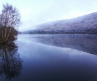
Loch Garry is a freshwater Loch 25 km north of Fort William, Lochaber, Scotland. Loch Garry is 11 km long and 50 m deep. It is fed by waters from Loch Quoich 10 km upstream on the River Garry, and drains into Loch Oich in the Great Glen just 5 km downstream. Loch Garry is much photographed from the A87 for its romantic setting and also because a quirk of perspective makes it appear like a map of Scotland.

Loch Cluanie is a loch in the Northwest Highlands of Scotland at the south-east end of Glen Shiel. It is a reservoir, contained behind the Cluanie Dam, constructed by Mitchell Construction and completed in 1957 as part of the North of Scotland Hydro-Electric Board's Glenmoriston project to generate hydroelectricity. Water feeds the dam from the west via two flows, from a tunnel from the dammed Loch Loyne and via the River Moriston.
Loch Oich is a freshwater loch in the Highlands of Scotland which forms part of the Caledonian Canal, of which it is the highest point. This narrow loch lies between Loch Ness and Loch Lochy in the Great Glen. It is fed by the River Garry from the west, and feeds the River Oich from its northern end. The Laggan locks separate it from Loch Lochy.

Loch Tummel is a long, narrow loch, seven kilometres northwest of Pitlochry in the council area of Perth and Kinross, Scotland. It is fed and drained by the River Tummel, which flows into the River Tay about 13 km (8 mi) south-east of the Clunie Dam at the loch's eastern end.
Tomdoun is a settlement on the north side of the River Garry, near the western end of Loch Garry, in Glen Garry in the Highlands of Scotland. The name comes from the Gaelic for "the brown hillock".
The Bridge of Awe was a triple-spanned arch bridge near Taynuilt in Argyll, Scotland.

Aonach Meadhoin is a Munro mountain situated in the Kintail region of Scotland. It stands on the northern side of Glen Shiel some 31 kilometres south east of Kyle of Lochalsh.

Glenmoriston or Glen Moriston is a river glen in the Scottish Highlands, that runs from Loch Ness, at the village of Invermoriston, westwards to Loch Cluanie, where it meets with Glen Shiel. The A887 and A87 roads pass through Glenmoriston.
The Tummel hydro-electric power scheme is an interconnected network of dams, power stations, aqueducts and electric power transmission in the Grampian Mountains of Scotland. Roughly bounded by Dalwhinnie in the north, Rannoch Moor in the west and Pitlochry in the east it comprises a water catchment area of around 1,800 square kilometres (690 sq mi) and primary water storage at Loch Ericht, Loch Errochty, Loch Rannoch and Loch Tummel, in Perth and Kinross. Water, depending on where it originates and the path it takes, may pass through as many as five of the schemes nine power stations as it progresses from north-west to south-east. The scheme was constructed in the 1940s and 50s incorporating some earlier sites. It is currently managed by SSE plc.

Loch Errochty is a man made freshwater loch situated within the Perth and Kinross council area at the edge of the Scottish Highlands near the Highland Boundary Fault where the topography changes to lowland.

Glen Shiel is a glen in the Northwest Highlands of Scotland.
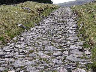
A network of military roads, sometimes called General Wade's Military Roads, was constructed in the Scottish Highlands during the middle part of the 18th century as part of an attempt by the British Government to bring order to a part of the country which had risen up in the Jacobite rebellion of 1715.

Duror,, occasionally Duror of Appin is a small, remote coastal village that sits at the base of Glen Duror, in district of Appin, in the Scottish West Highlands, within the council area of Argyll and Bute in Scotland. Duror is known for the first building of the Telford Parliamentary churches by the Scottish civil engineer, architect and stonemason, Thomas Telford, from 1826, the first in a series of 32, built in Scotland. William Thomson was the architect. Duror is the location of the famous Appin Murder. Although no direct evidence for this connection exists, the murder event and the kidnap of James Annesley, supposedly provided the inspiration for Robert Louis Stevenson writing the novel Kidnapped.

Erbusaig Bay is a remote coastal embayment, on a 266° orientation, located on the west coast of the Lochalsh peninsula, in Ross and Cromarty in Scottish Highlands in the west coast of Scotland. At the western side of Erbusaig Bay is the small township of Erbusaig.

Glasgow Corporation Water Works and its successors have provided a public water supply and sewerage and sewage treatment services to the Scottish city of Glasgow. There were several schemes in the early part of the 1800s, with the Glasgow Company which was established in 1806 pumping filtered water from the River Clyde into the city. The Gorbals Gravitation Water Company was established in 1846, and brought water from reservoirs to the south-west of the city. However, an outbreak of cholera in 1848/1849, in which 4,000 people died, concentrated the minds of Glasgow Council, and in 1855 a scheme to use water from Loch Katrine, 36 miles (58 km) to the north, was authorised. The work required at Loch Katrine was quite modest, and the major construction work was the building of an aqueduct to carry the water to the city by gravity.

