Loch is the Scottish Gaelic, Scots and Irish word for a lake or sea inlet. It is cognate with the Manx lough, Cornish logh, and one of the Welsh words for lake, llwch.

The Highlands is a historical region of Scotland. Culturally, the Highlands and the Lowlands diverged from the Late Middle Ages into the modern period, when Lowland Scots replaced Scottish Gaelic throughout most of the Lowlands. The term is also used for the area north and west of the Highland Boundary Fault, although the exact boundaries are not clearly defined, particularly to the east. The Great Glen divides the Grampian Mountains to the southeast from the Northwest Highlands. The Scottish Gaelic name of A' Ghàidhealtachd literally means "the place of the Gaels" and traditionally, from a Gaelic-speaking point of view, includes both the Western Isles and the Highlands.

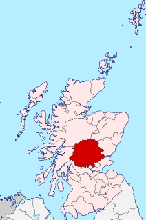
Perthshire, officially the County of Perth, is a historic county and registration county in central Scotland. Geographically it extends from Strathmore in the east, to the Pass of Drumochter in the north, Rannoch Moor and Ben Lui in the west, and Aberfoyle in the south; it borders the counties of Inverness-shire and Aberdeenshire to the north, Angus to the east, Fife, Kinross-shire, Clackmannanshire, Stirlingshire and Dunbartonshire to the south and Argyllshire to the west. It was a local government county from 1890 to 1930.

Sutherland is a historic county, registration county and lieutenancy area in the Highlands of Scotland. Its county town is Dornoch. Sutherland borders Caithness and Moray Firth to the east, Ross-shire and Cromartyshire to the south and the Atlantic to the north and west. Like its southern neighbour Ross-shire, Sutherland has some of the most dramatic scenery in the whole of Europe, especially on its western fringe where the mountains meet the sea. These include high sea cliffs, and very old mountains composed of Precambrian and Cambrian rocks.

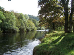
Callander is a small town in the council area of Stirling, Scotland, situated on the River Teith. The town is located in the historic county of Perthshire and is a popular tourist stop to and from the Highlands.

The Stirling council area is one of the 32 council areas of Scotland, and has a population of about 94,330. It was created under the Local Government etc (Scotland) Act 1994 with the boundaries of the Stirling district of the former Central local government region, and it covers most of Stirlingshire and the south-western portion of Perthshire. Both counties were abolished for local government purposes under the Local Government (Scotland) Act 1973.

Loch Lubnaig is a small freshwater loch near Callander in the Stirling council area, Scottish Highlands. It lies in the former county of Perthshire. It is part of the Loch Lomond and The Trossachs National Park.

The Trossachs generally refers to an area of wooded glens, braes, and lochs lying to the east of Ben Lomond in the Stirling council area of Scotland. The name is taken from that of a small woodland glen that lies at the centre of the area, but is now generally applied to the wider region.

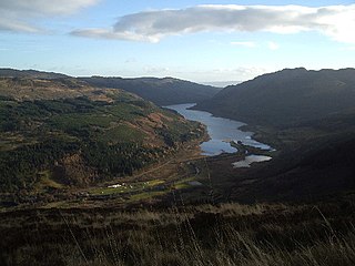
Balquhidder is a small village in Perthshire located 10 miles (16 km) north-west of Callander. It is administered by the Stirling council area of Scotland and is overlooked by the dramatic mountain terrain of the 'Braes of Balquhidder', at the head of Loch Voil. Balquhidder Glen is also popular for fishing, nature watching and walking.

Loch Achray is a small freshwater loch 11 km (6.8 mi) west of Callander in Stirling district, Scotland.

Lochearnhead is a village in Perthshire on the A84 Stirling to Crianlarich road at the foot of Glen Ogle, 14 miles north of the Highland Boundary Fault. It is situated at the western end of Loch Earn where the A85 road from Crieff meets the A84.

Clan MacLaren is a Highland Scottish clan. Traditional clan lands include the old parish of Balquhidder which includes the villages of Lochearnhead and Strathyre, and is about 18 miles (29 km) long and 7 miles (11 km) broad, spanning 54,675 acres (22,126 ha), long known as "Maclaren Country".

Breadalbane – from Scottish Gaelic Bràghad Albainn, "the upper part of Alba" – is a region of the southern/central Scottish Highlands, traditionally comprising the watershed of Loch Tay. The Breadalbane Hydro-Electric Scheme lies within the region.

Strathyre is a district and settlement in the Stirling local government district of Scotland. It forms the south-eastern part of the parish of Balquhidder and was, prior to the 1973 reorganisation of local government, part of Perthshire. It is within the bounds of the Loch Lomond and the Trossachs National Park. In Gaelic, the district is Srath Eadhair and the village is An t-Iomaire Riabhach or an t-Iomaire Fada.

Loch Ness is a large freshwater loch in the Scottish Highlands extending for approximately 37 kilometres southwest of Inverness. It takes its name from the River Ness, which flows from the northern end. Loch Ness is best known for alleged sightings of the cryptozoological Loch Ness Monster, also known affectionately as "Nessie". It is one of a series of interconnected, murky bodies of water in Scotland; its water visibility is exceptionally low due to a high peat content in the surrounding soil. The southern end connects to Loch Oich by the River Oich and a section of the Caledonian Canal. The northern end connects to Loch Dochfour via the River Ness, which then ultimately leads to the North Sea via the Moray Firth.

Stewart of Balquhidder is a Perthshire branch of the Stewart clan and scions of the royal House of Stewart from an illegitimate branch. They are descended from Sir William Stewart of Baldorran, who was the great grandson of Murdoch Stewart, Duke of Albany, executed by King James I of Scotland for treason in 1425. Murdoch Stewart was himself the grandson of King Robert II of Scotland, who founded the Stewart dynasty.

Drumfearn is a small crofting township, lying at the head of the Sleat peninsula, at the head of Loch Eishort, on the isle of Skye in the Highalnds of Scotland and is in the Scottish council area of Highland.

The River Balvaig is a short river, approximately 8 km (5.0 mi) long, draining from the head of Loch Voil near Balquhidder in Scotland and then passing southwards through the village of Strathyre before flowing into the northern end of Loch Lubnaig.

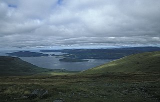
Loch na Keal, meaning Loch of the Kyle, or Narrows, also Loch of the Cliffs, is the principal sea loch on the western, or Atlantic coastline of the island of Mull, in the Inner Hebrides, Argyll and Bute, Scotland. Loch na Keal extends over 20 kilometres (12 mi) inland, almost bisecting Mull, and extending to within 5 km (3 mi) of the eastern shore. The loch gives its name to the Loch na Keal National Scenic Area, one of forty national scenic areas in Scotland.

Loch Doine is a small freshwater loch that lies to the west of Balquhidder in the Trossachs and Teith ward within Stirling council area of Scotland. It is a short, narrow loch. It is separated from Loch Voil to the east by a small channel. The Loch can be reached by a small single track road from Balquhidder leading to Inverlochlarig.


