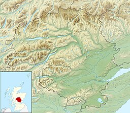
Soay is an island just off the coast of Skye, in the Inner Hebrides of Scotland.
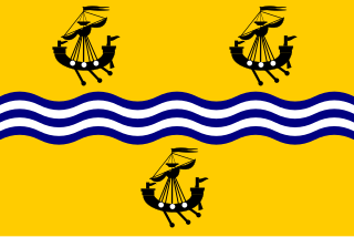
The Outer Hebrides or Western Isles, sometimes known as the Long Isle/Long Island, is an island chain off the west coast of mainland Scotland. The islands are geographically coextensive with Comhairle nan Eilean Siar, one of the 32 unitary council areas of Scotland. They form part of the archipelago of the Hebrides, separated from the Scottish mainland and from the Inner Hebrides by the waters of the Minch, the Little Minch, and the Sea of the Hebrides. Scottish Gaelic is the predominant spoken language, although in a few areas English speakers form a majority.
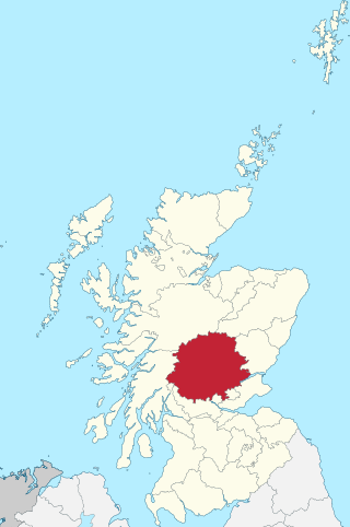
Perthshire, officially the County of Perth, is a historic county and registration county in central Scotland. Geographically it extends from Strathmore in the east, to the Pass of Drumochter in the north, Rannoch Moor and Ben Lui in the west, and Aberfoyle in the south; it borders the counties of Inverness-shire and Aberdeenshire to the north, Angus to the east, Fife, Kinross-shire, Clackmannanshire, Stirlingshire and Dunbartonshire to the south and Argyllshire to the west. It was a local government county from 1890 to 1930.

Harris is the southern and more mountainous part of Lewis and Harris, the largest island in the Outer Hebrides, Scotland. Although not an island itself, Harris is often referred to in opposition to the Isle of Lewis as the Isle of Harris, which is the former postal county and the current post town for Royal Mail postcodes starting HS3 or HS5.
Lismore is an island of some 2,351 hectares in the Inner Hebrides of Scotland. The climate is damp and mild, with over 166 centimetres (65 in) of rain recorded annually. This fertile, low-lying island was once a major centre of Celtic Christianity, with a 6th-century monastery associated with Saint Moluag, and later became the seat of the medieval Bishop of Argyll. There are numerous ruined structures including a broch and two 13th-century castles.
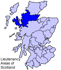
Ross and Cromarty, also referred to as Ross-shire and Cromartyshire, is a variously defined area in the Highlands and Islands of Scotland. There is a registration county and a lieutenancy area in current use, the latter of which is 8,019 square kilometres in extent. Historically there has also been a constituency of the Parliament of the United Kingdom, a local government county, a district of the Highland local government region and a management area of the Highland Council. The local government county is now divided between two local government areas: the Highland area and Na h-Eileanan Siar. Ross and Cromarty border Sutherland to the north and Inverness-shire to the south.

Argyll, sometimes called Argyllshire, is a historic county and registration county of western Scotland.
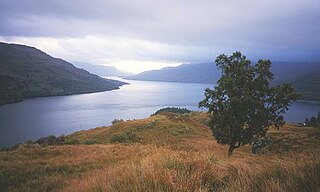
Loch Lomond and The Trossachs National Park is a national park in Scotland centred on Loch Lomond and the hills and glens of the Trossachs, along with several other ranges of hills. It was the first of the two national parks established by the Scottish Parliament in 2002, the second being the Cairngorms National Park. The park extends to cover much of the western part of the southern highlands, lying to the north of the Glasgow conurbation, and contains many mountains and lochs. It is the fourth-largest national park in the British Isles, with a total area of 1,865 km2 (720 sq mi) and a boundary of some 350 km (220 mi) in length. It features 21 Munros and 20 Corbetts.
Torsa is one of the Slate Islands in Argyll and Bute, Scotland. Lying east of Luing and south of Seil, this tidal island was inhabited until the 1960s. There is now only one house there, which is used for holiday lets. The underlying bedrock is slate but unlike Torsa's immediate island neighbours this has never been worked commercially. The island's name is of Norse origin but the most prominent historical structure on the island is the ruined Caisteal nan Con on the northeast shore, once held by Clan Campbell. The abundant sea life in the waters surrounding the island are protected by the Loch Sunart to the Sound of Jura Marine Protected Area.

Loch Shiel is a freshwater loch situated 20 kilometres (12 mi) west of Fort William in the Highland council area of Scotland. At 28 kilometres long it is the 4th longest loch in Scotland, and is the longest to have retained a natural outflow without any regulation of its water level, being 120 m (393 ft) deep. Its nature changes considerably along its length, being deep and enclosed by mountains in the north east and shallow surrounded by bog and rough pasture in the south west, from which end the 4 km River Shiel drains to the sea in Loch Moidart near Castle Tioram.
Oldany Island is an uninhabited island in Assynt, Sutherland, north-west Scotland.

Inverness-shire is a historic county, registration county and lieutenancy area of Scotland. Covering much of the Highlands and Outer Hebrides, it is Scotland's largest county, though one of the smallest in population, with 67,733 people or 1.34% of the Scottish population.
Events from the year 1956 in Scotland.
Events from the year 1934 in Scotland.

Sandaig Bay is a coastal embayment, on a chord of 2.04 kilometres, on a 194° orientation, located on the northwestern end of the sea loch, Loch Nevis, facing the Sound of Sleat. The bay is within the western end of the Knoydart peninsula, in the Lochaber district in the historical county of Inverness-shire on the north west coast of Scotland.

Beinn nan Eun is a mountain in the Northwest Highlands of Scotland. It is located in Easter Ross, several miles northwest of Dingwall.

