
Càrn Mòr Dearg is the ninth-highest mountain in Scotland and the British Isles, with a height of 1,220 metres (4,000 ft). It stands a short distance northeast of Ben Nevis, the highest mountain in Britain, to which it is linked by the 'Càrn Mòr Dearg arête'. Along with Càrn Dearg Meadhanach and Càrn Beag Dearg, it makes up the eastern ridge of the horseshoe-shaped Ben Nevis massif in the Scottish Highlands.
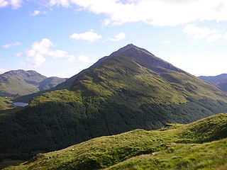
Beinn an Lochain is a mountain in the Arrochar Alps in western Scotland. A Corbett, reaching 901.7 metres (2,958 ft), Beinn an Lochain is situated within the Argyll Forest Park, which is itself within the Loch Lomond and the Trossachs National Park.

Glas Maol is a mountain in the Mounth, in the southeastern part of the Highlands of Scotland. The broad, flat summit is divided between the council area of Aberdeenshire, Angus and Perth and Kinross, though the highest point lies wholly within Angus; indeed Glas Maol is the highest point in that council area. Glas Maol is both a Munro and a Marilyn. The western slopes of Glas Maol form part of the Glenshee Ski Centre ski area. The most common route of ascent goes through the slopes, starting from the highest point of the A93 road, the Cairnwell pass. This is the highest public road in Scotland; hence only around 400 m of ascent is involved. Glas Maol is often climbed in conjunction with Creag Leacach to the south or Cairn of Claise to the north. The broad ridge linking these peaks is topped by a dry-stone dyke, which approximately corresponds to the border of the Angus council area.
Sgùrr na Cìche is a mountain in Knoydart, in the Northwest Highlands of Scotland. It lies on the edge of Knoydart in an area known as the Rough Bounds of Knoydart.

Meall a' Bhùiridh (IPA:[ˈmauɫ̪ˈaˈvuːɾʲɪʝ]) is a mountain on the edge of Rannoch Moor in the Highlands of Scotland. It lies near the top of Glen Coe and Glen Etive, overlooking the Kings House Hotel inn and the A82 road. The Glencoe Ski area is located on the northern slopes of the peak.
Meall Garbh is a mountain in the southern part of the Scottish Highlands. With Meall Greigh it forms the north-eastern end of the Ben Lawers range. Its craggy south face overlooks Lochan nan Cat.
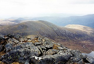
Meall Garbh is a mountain on the north side of Glen Lyon in the Scottish Highlands. The flat summit of the hill has two tops of almost equal height, the north-west one being considered the higher.

Stob Bàn is a Scottish mountain situated at the western end of the Mamores ridge, five and a half kilometres north-west of Kinlochleven. With a height of 999 metres it qualifies as a Munro. Stob Bàn is a distinctive sight when viewed from lower Glen Nevis with its sharp peak and capping of white quartzite rocks which are often mistaken for snow; its Gaelic name translates as White Peak or Light Coloured Peak.

Càrn a' Chlamain is a Scottish mountain situated roughly 12 kilometres north of Blair Atholl in the Forest of Atholl. It is the highest point of an undulating plateau lying northeast of Glen Tilt. The River Tarf, a tributary of the Tilt, rises on the northwestern slopes before curving round the northern side of the plateau, whilst a further Tilt tributary marks the plateau's western boundary.

Càrn a' Mhàim is a Scottish mountain situated in the inner part of the Cairngorms range, some 15 kilometres west of Braemar in the county of Aberdeenshire.

Creise is a mountain summit in the Black Mount range, in the Scottish Highlands. It overlooks the northern end of Glen Etive and its height is 1,100 metres (3,600 ft). Creise is one of four Munros in the Black Mount, along with Meall a' Bhuiridh, Stob Ghabhar and Stob a' Choire Odhair. The mountain is a long and flattish ridge, whose highest point was unnamed until 1981. It is popular with cross-country skiers, being near the White Corries ski area from where it is often climbed along with adjoining Meall a' Bhuiridh. The steep and craggy northern buttress, Sròn na Crèise, is well seen from the A82 road and the Kings House Hotel.
Càrn nan Gobhar is a mountain rising to 993 metres (3,258 ft) in the Northwest Highlands of Scotland. It stands on the northern side of Loch Mullardoch in the upper part of Glen Cannich, in a remote group of four Munros informally known as "The Mullardochs" which form the high ground between Loch Mullardoch and Loch Monar.

Càrn Aosda is a Scottish mountain situated 12.5 km south of the town of Braemar, in the county of Aberdeenshire. It stands near the summit of the Cairnwell Pass on the A93 road, in the midst of the Glenshee Ski Centre.

Càrn Mairg is a mountain in the Breadalbane region of the Scottish Highlands, with a height of 1,042 metres (3,419 ft). It stands in a group of four Munro mountains known as the 'Càrn Mairg group', on the north side of Glen Lyon, Perthshire.

Càrn Gorm is a mountain in the Breadalbane region of the Scottish Highlands, with a height of 1,029 metres (3,376 ft). It stands in a group of four Munro mountains known as the Càrn Mairg group or the Glen Lyon Horseshoe, on the north side of Glen Lyon, Perthshire.

Càrn a' Gheòidh or Càrn Gheòidh is a mountain in the Mounth region of the Scottish Highlands. It lies 15 km south of the town of Braemar. Its summit stands on the border between the council areas of Perth and Kinross and Aberdeenshire.

Chno Dearg is a mountain in the Lochaber area of the Scottish Highlands. It overlooks Glen Spean to the north and Loch Treig to the west. With a height of 1,046 metres (3,432 ft), it is classed as a Munro.

Beinn a' Bhùird is a Munro in the Cairngorm mountain range of Scotland.

Meall nan Tarmachan is a mountain in the Southern Highlands of Scotland near Killin just west of Ben Lawers. It is often climbed as part of the Tarmachan ridge, the other peaks of which are Meall Garbh, Beinn nan Eachan and Creag na Caillich ; these three peaks are Tops rather than Munros, and lie to the south-west of Meall nan Tarmachan.
Glas Tulaichean is a large, complex mountain in the Mounth, Scotland. It is about 18 kilometres (11 mi) south of Braemar in Perth and Kinross. It is the highest of a group of domed hills which lie in remote land between the head of Glen Tilt and Glen Shee to the east. It is most commonly climbed from the Spittal of Glenshee via Glen Lochsie to the south.


