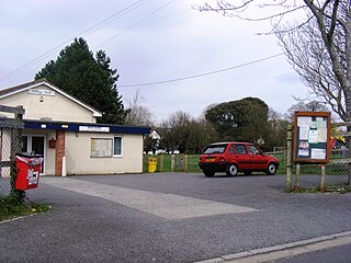
Locking is a village and civil parish in Somerset, England. It is a predominantly quiet residential area of North Somerset, 3.5 miles (5.6 km) south east of the town of Weston-super-Mare.

RAF Locking was a Royal Air Force station at Locking just outside Weston-super-Mare in Somerset, England.

Ashton Keynes Castle was in the village of Ashton Keynes, near to the town of Cricklade in Wiltshire, England. It is also known as Hall's Close, while locals call it The Battlefield. The scheduled monument consists of a ringwork and bailey 100 metres (330 ft) west of Kentend Farm.

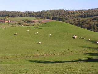
Cary Castle stood on Lodge Hill overlooking the town of Castle Cary, Somerset, England. It is a Scheduled Ancient Monument.

Crewkerne Castle was possibly a Norman motte and bailey castle on a mound that is situated north-west of the town of Crewkerne in Somerset, England.

Castle Neroche is a Norman motte-and-bailey castle on the site of an earlier hill fort in the parish of Curland, near Staple Fitzpaine, Somerset, England. It is a Scheduled Ancient Monument.

Ham Castle is located in Worcestershire at the bottom of a wooded escarpment, within the parish of Clifton-upon-Teme, about 1 mile (1.6 km) east of the village of Clifton-upon-Teme and 4 miles (6.4 km) south of Great Witley.

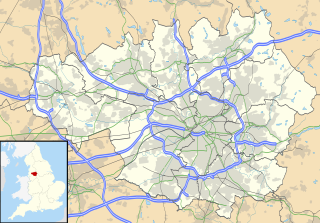
Watch Hill Castle is an early medieval motte-and-bailey on the border of Bowdon and Dunham Massey, England. It is a scheduled monument. As the only Scheduled Ancient Monument in Trafford, it is arguably the most important archaeological site in the borough. The castle is located north of the River Bollin and south of a deep ravine.

Burrow Mump is a hill and historic site overlooking Southlake Moor in the village of Burrowbridge within the English county of Somerset. It is a scheduled monument, with the ruined church on top of the hill a Grade II listed building.

While there are many castles in South Yorkshire, the majority are manor houses and motte-and-bailey which were commonly found in England after the Norman Conquest.

Stowey Castle was a Norman motte-and-bailey castle, built in the 11th century, in the village of Nether Stowey on the Quantock Hills in Somerset, England. It has been designated as a Scheduled Ancient Monument.

Castle Batch was a fortification at Worle that once stood overlooking the town of Weston-super-Mare in Somerset, England.

Down End Castle, also known as Downend Castle, Chisley Mount or Chidley Mount, was a motte-and-bailey castle at Down End, north of Dunball in the parish of Puriton, Somerset, England. It has been designated as a Scheduled Ancient Monument.

Whorlton Castle is a ruined medieval castle situated near the abandoned village of Whorlton in North Yorkshire, England. It was established in the early 12th century as a Norman motte-and-bailey associated with the nearby settlement. The castle is an unusual example of a motte-and-bailey that remained in use throughout the Middle Ages and into the early modern period.

Taunton Deane was a local government district with borough status in Somerset, England. It merged with West Somerset to form Somerset West and Taunton on 1 April 2019. Its council was based in Taunton. The district was formed on 1 April 1974, under the Local Government Act 1972, by a merger of the Municipal Borough of Taunton, Wellington Urban District, Taunton Rural District, and Wellington Rural District. Taunton Deane was granted borough status in 1975, enabling the mayoralty of Taunton to be continued, when other districts did not have mayors. The district was given the name of an alternate form of the Taunton Deane Hundred.

There are over 670 scheduled monuments in the ceremonial county of Somerset in South West England. The county consists of a non-metropolitan county, administered by Somerset County Council, which is divided into five districts, and two unitary authorities. The districts of Somerset are West Somerset, South Somerset, Taunton Deane, Mendip and Sedgemoor. The two administratively independent unitary authorities, which were established on 1 April 1996 following the breakup of the county of Avon, are North Somerset and Bath and North East Somerset. These unitary authorities include areas that were once part of Somerset before the creation of Avon in 1974.

Bury Castle near Brompton Regis in the English county of Somerset was an Iron Age univallate hillfort which was reused with the creation of a motte after the Norman Conquest. It has been scheduled as an ancient monument.

Edburton Castle Ring is an archaeological site in West Sussex, England, on the peak of Edburton Hill on the South Downs, near the villages of Edburton and Fulking. It is a Scheduled Monument.


