
Grantham is a market and industrial town in the South Kesteven district of Lincolnshire, England. It straddles the London–Edinburgh East Coast Main Line and the River Witham and is bounded to the west by the A1 north–south trunk road. It lies some 23 miles south of the county town, Lincoln, and 22 miles east of Nottingham. The population in 2016 was put at 44,580. Grantham is known as the birthplace of the UK Prime Minister Margaret Thatcher, for educating Isaac Newton at the King's School, as the workplace of the UK's first female police officer, Edith Smith in 1914, and for making the UK's first running diesel engine in 1892 and tractor in 1896. Thomas Paine worked there as an excise officer in the 1790s.
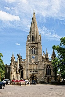
Sleaford is a market town and civil parish in the North Kesteven district of Lincolnshire, England, which includes Quarrington to the south-west, Holdingham to the north and Old Sleaford to the east. The town is on the edge of the fertile Fenlands, 11 miles north-east of Grantham, 16 mi (26 km) west of Boston, and 17 mi (27 km) south of Lincoln. Its population of 17,671 at the 2011 Census made it the largest settlement in the North Kesteven district. Bypassed by the A17 and the A15, it is linked to Lincoln, Newark, Peterborough and King's Lynn. Sleaford railway station is on the Nottingham to Skegness and Peterborough to Lincoln Lines.

Basildon is the largest town in the borough of Basildon, within the county of Essex, England. It has a population of 107,123.

Bourne is a market town and civil parish in the South Kesteven district of Lincolnshire, England. It lies on the eastern slopes of the limestone Kesteven Uplands and the western edge of the Fens, 11 miles north-east of Stamford, 12 miles west of Spalding and 17 miles north of Peterborough. The population at the 2011 census was 14,456. A 2019 estimate put it at 16,780.
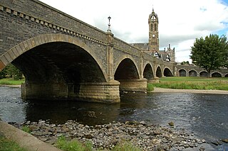
Peebles is a town in the Scottish Borders, Scotland. It was historically a royal burgh and the county town of Peeblesshire. According to the 2011 census, the population was 8,376 and the estimated population in June 2018 was 9,000.
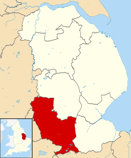
South Kesteven is a local government district in Lincolnshire, England, forming part of the traditional Kesteven division of the county. It covers Grantham, Stamford, Bourne and Market Deeping. The 2011 census reports 133,788 people at 1.4 per hectare in 57,344 households.

North Kesteven is a local government district in the East Midlands. Just over 100 miles (160 km) north of London, it is east of Nottingham and south of Lincoln. North Kesteven is one of seven districts in Lincolnshire, England and is in the centre of the county. Its council, North Kesteven District Council, is based in Sleaford in the former offices of Kesteven County Council.

Ancaster is a village and civil parish in the South Kesteven district of Lincolnshire, England, on the site of a Roman town. The population of the civil parish was 1,317 at the 2001 census increasing to 1,647 at the 2011 census. The civil parish includes the settlements of Sudbrook and West Willoughby.

The Lincolnshire Wildlife Trust,, covers the whole ceremonial county of Lincolnshire, England. It was founded in 1948 as a voluntary charitable organisation dedicated to conserving the wildlife and wild places of Lincolnshire and to promoting the understanding and enjoyment of the natural world.

Market Deeping is a market town and civil parish in the South Kesteven district of Lincolnshire, England, on the north bank of the River Welland and the A15 road. The population of the town at the 2011 census was 6,008.
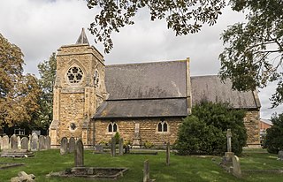
North Hykeham is a town in the North Kesteven district, in the county of Lincolnshire, England. It forms part of the Lincoln Urban Area. The population of the town at the 2011 census was 13,884.
The Near East Side is a neighborhood located near downtown Columbus, Ohio, made up of several neighborhoods: Mount Vernon, King-Lincoln Bronzeville, Eastgate, Franklin Park, Nelson Park, Olde Towne East, and Woodland Park.
Whisby Moor is a small moor situated close to the A46 road, west of North Hykeham, in the North Kesteven district of Lincolnshire, England.
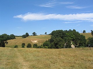
Careby Aunby and Holywell is a civil parish in the district of South Kesteven, south-west Lincolnshire, in England. It stretches from the county border with Rutland in the west to the River West Glen in the east. The B1176 road from Corby Glen passes through Careby and on past Aunby toward Stamford. The main London to Scotland railway line passes through the parish, the line upon which Mallard took the speed record for the LNER.

Potterhanworth is a village and civil parish in the North Kesteven district of Lincolnshire, England. The population of the civil parish at the 2011 census was 839. It is situated 6 miles (10 km) south-east from Lincoln.

Holdingham is a hamlet in the civil parish and built-up area of Sleaford, Lincolnshire. It is bisected by Lincoln Road (B1518) which joins the A17 and A15 roads immediately north of the settlement; those roads connect it to Lincoln, Newark, Peterborough and King's Lynn. Sleaford railway station is on the Nottingham to Skegness and Peterborough to Lincoln Lines.
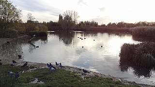
Sutcliffe Park is a 16.7 hectare public park in Eltham in the Royal Borough of Greenwich in London. It is located west of Eltham town centre, east of Lee Green, north of Horn Park and south of Kidbrooke. A large part of the park is a local nature reserve and a Site of Borough Importance for Nature Conservation, Grade II. The site attracts wildlife such as dragonflies, damselflies, herons, little egrets, kingfishers, reed warblers and snipe. Sutcliffe Park is roughly square in shape and approximately 400m across, the River Quaggy meanders through the park, from the southeast corner to the northwest corner. The park contains an athletics track, outdoor gym, children's play park, a car park and bicycle locking facilities mostly on the south side, several small lakes on the northwest side, and a larger lake on the northeast side, all close by to the River Quaggy. It received a Green Flag award for 2012-13.
Mareham Pastures is an 11-hectare Local Nature Reserve in Sleaford, a market town and civil parish in the North Kesteven district of Lincolnshire. It is owned by Lincolnshire County Council and managed jointly by Lincolnshire County Council and the Friends of Mareham Pastures. The reserve consists of wildflower meadows, new woodland, hedges and open grassland, providing a good habitat for butterflies and potentially barn owls; it is located westwards off Mareham Lane and is bounded to the north and north-west by residential developments at Quarrington and by farmland to the south; it is adjacent to a disused recycling centre, situated to its east. The site can be accessed by the public on foot via Bullock Pastures Lane, which begins at Sleaford Cricket Ground off London Road; visitors travelling by car can park next to the former recycling centre off Mareham Lane and gain access that way.
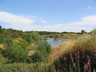
Stanton's Pit is an 8.05-hectare Local Nature Reserve situated between Little Bytham and Witham-on-the-Hill, villages in the South Kesteven district of Lincolnshire. It is owned and managed by Lincolnshire Wildlife Trust. The reserve mostly comprises a disused sand pit with adjacent grasslands which was donated by its former owner to the Lincolnshire Wildlife Trust so that it could be classified as a Local Nature Reserve. It has been designated as such on the basis of its ornithological interest, with 50 species of birds recorded visiting the site and 19 breeding, including little grebe, little ringed plover, sand martin, turtle dove and lesser whitethroat. Wading birds known to occupy the site in autumn include little stint, ruff and spotted redshank, greenshank, and common, curlew, green and wood sandpipers. Stanton's Pit is suspected to be situated on a migratory route from The Wash to Rutland Water. The site is bounded to the north by a minor road between Little Bytham and Witham-on-the-Hill, to the south and west by farmland and to the east by Bush Lees wood.


