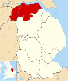
North Lincolnshire is a unitary authority area in Lincolnshire, England, with a population of 167,446 in the 2011 census. There are six significant towns: Scunthorpe, Brigg, Haxey, Crowle, Epworth and Barton-upon-Humber.

Humberside was a non-metropolitan and ceremonial county in Northern England from 1 April 1974 until 1 April 1996. It was composed of land from either side of the Humber Estuary, created from portions of the East Riding of Yorkshire, West Riding of Yorkshire, and the northern part of Lindsey, Lincolnshire. The county council's headquarters was County Hall at Beverley, inherited from East Riding County Council. Its largest settlement and only city was Kingston upon Hull. Other notable towns included Goole, Beverley, Scunthorpe, Grimsby, Cleethorpes and Bridlington. The county stretched from Wold Newton in its northern tip to a different Wold Newton at its most southern point.

Oxleas Wood is one of the few remaining areas of ancient deciduous forest in Eltham in the Royal Borough of Greenwich, in southeast London. Some parts date back over 8,000 years to the end of the last Ice Age, the Younger Dryas. It is part of a larger continuous area of woodland and parkland on the south side of Shooter's Hill: other parts are Jack Wood, Castle Wood, Oxleas Meadows, Falconwood Field, Eltham Common and Eltham Park North. Eltham Park North includes the ancient Shepherdleas Wood.
The ceremonial county of Lincolnshire is the second largest of the English counties and one that is predominantly agricultural in character. Despite its relatively large physical area, it has a comparatively small population. The unusually low population density that arises gives the county a very different character from the much more densely populated an urbanised counties of south-east and northern England, and is, in many ways, key to understanding the nature of the county.

Stanmore Common is a 49.2-hectare public park, Local Nature Reserve and Site of Metropolitan Importance for Nature Conservation in Stanmore in the London Borough of Harrow in England. It is owned by Harrow Council and managed by the council with a local group. It was a biological Site of Special Scientific Interest, but was de-notified in the early 1990s.
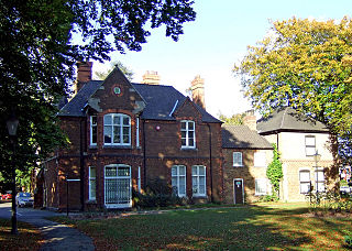
North Lincolnshire Museum is a local museum in the town of Scunthorpe, north Lincolnshire, England.

Ifton Meadows is a Local Nature Reserve north of Oswestry in the county of Shropshire, England.

Linder's Field is a 3.6 hectare Local Nature Reserve in Buckhurst Hill in Essex. It is owned and managed by Epping Forest District Council.
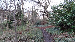
Barnsbury Wood is a Local Nature Reserve and Site of Borough Importance for Nature Conservation, Grade I, in Barnsbury in the London Borough of Islington. With an area of only 0.35 hectares, it is the smallest Local Nature Reserve in London It is owned and managed by Islington Council.
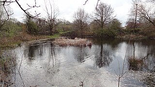
Cranmer Green is a 3.2 hectare local nature reserve and Site of Local Importance for Nature Conservation in Mitcham in the London Borough of Merton. It is owned and managed by Merton Council. It is a triangular area bounded by Cranmer Road, King George VI Avenue and a railway line.

Merton Park Green Walks is a linear walk along the line of a former railway line between Merton Park tram stop and Morden Road in Merton Park in the London Borough of Merton. It is a 1.5 hectare Local Nature Reserve and a Site of Borough Importance for Nature Conservation, Grade II, which is owned and managed by Merton Council.

Pevensey Road is a 10.2 hectare Local Nature Reserve in Hanworth in the London Borough of Hounslow. It is also part of the Crane Corridor Site of Metropolitan Importance for Nature Conservation. It is owned and managed by Hounslow Council.

Bocking Blackwater is a 13.1 hectare Local Nature Reserve in Braintree in Essex. It is owned and managed by Braintree District Council. In 2016 the council proposed to extend the boundaries of the site.

Hilly Fields is a 37.5 hectare Local Nature Reserve in Colchester, Essex. It is owned and managed by Colchester Borough Council. It is also a scheduled monument as it is in a late Iron Age site and Roman Camulodunum.
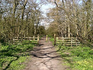
Bradley and Dixon Woods is a 41.77-hectare (103.2-acre) local nature reserve near the town of Grimsby in North East Lincolnshire. It is owned and managed by North East Lincolnshire Council. It is composed of ancient woodland, meadows, ponds and bird feeding sites, and is located south-west of Grimsby and south of the village of Bradley; the site is bounded to the north by Woodlands Farm and Bradley Woodlands Independent Hospital. The LNR can be accessed by the public via the B1444 off the A46 road. The woods are the subject of local folklore.

Brumby Wood is a 21.84-hectare Local Nature Reserve in the town of Scunthorpe in North Lincolnshire. It is owned and managed by North Lincolnshire Council. It is composed of ancient woodland which provides a good habitat for birds, mammals, invertebrates, bluebell, wild garlic and yellow archangel; the site is located in Scunthorpe and is bounded to the north by the South Humberside Main Line railway, to the east and west by playing fields and to the south by an industrial site, a crematorium and a cemetery; the wood is bisected by the A18 road.

Cleethorpes Country Park is a 62.01 hectares (0.6201 km2) Local Nature Reserve situated between the town of Cleethorpes and the village of Humberston in North East Lincolnshire. It is owned and managed by North East Lincolnshire Council. It is composed of woodland, grassland and a lake. The site is a good habitat for wildflowers, invertebrates, wildfowl and skylarks. Over winter, wading birds roost on the park at high tide. The LNR is bounded to the north by Cleethorpes, and forms the northern boundary of Humberston's residential area; it is bounded to the west by the A1031 road and to the east by Cleethorpes Golf Club.

Wouldham to Detling Escarpment is a 311.2-hectare (769-acre) biological and geological Site of Special Scientific Interest which stretches from Wouldham to Detling, north of Maidstone in Kent. Part of it is a Geological Conservation Review site, and it is part of the North Downs Woodlands Special Area of Conservation and the Kent Downs Area of Outstanding Natural Beauty. It is a Nature Conservation Review site, Grade I and it includes three Kent Wildlife Trust nature reserves and a Local Nature Reserve,

Boxley Warren is a 83-hectare (210-acre) Local Nature Reserve north of Maidstone in Kent. It is privately owned and managed by Maidstone Borough Council. It is part of North Downs Woodlands Special Area of Conservation and Wouldham to Detling Escarpment Site of Special Scientific Interest


