
Long Meg Mine is a disused gypsum mine just north of Little Salkeld, Cumbria in the area known as Cave Wood Valley. It was operated between 1880 and 1976.
Long Meg Mine is a disused gypsum mine just north of Little Salkeld, Cumbria in the area known as Cave Wood Valley. It was operated between 1880 and 1976.
The Long Meg Plaster Company Ltd. was established in 1880, driving an underground drift upon which operations commenced in 1885. In 1886 a standard gauge extension line was connected to the site from the Settle-Carlisle Railway (a distance of around 0.35 km). The workforce in this year is recorded as being 12 (all Surface), the name of the mine Long Meg Drift and agent A.K.Busby. [1]
In 1902 the workforce is recorded as being 26 (12 Underground and 14 Surface). By 1914 however this figure had dropped to 6 (4 Underground and 2 Surface) and the mine was abandoned on an unknown date in 1914/1915. The operator at this time was the Carlisle Plaster and Cement Company Ltd.
The mine was re-opened in 1922 for the extraction of anhydrite by the Long Meg Plaster and Mineral Company Ltd. This was purchased in 1939 by the British Plaster Board Ltd. (now known as British Gypsum). Until its closure in January 1976 its workforce fluctuated between 12 and 29 (4 and 22 Underground; 4 and 18 Surface).
The 1 millionth tonne of anhydrite was shipped to the plant in Widnes on 20 May 1959 [2] and before closure over 5 million tonnes were extracted.
The mine owned several locomotives used to shunt carts between the mine, the plaster mill and the Settle-Carlisle Railway junction. A 0-4-0 Barclay locomotive named "W.S.T." (after the plaster company's deputy chairman William Steuart Trimble) that was delivered to the site on 10 June 1954 and was transferred in 1969 now resides at the Bowes Railway in Tyne and Wear.
Today the mine is in a poor state of repair however much of the site can be viewed from the public footpath that runs along the banks of the River Eden from Little Salkeld to Lacy's Caves. The rail tracks have not been lifted in many places and the public footpath follows its path with metalwork and sleepers exposed. The signal box used for the branch line still exists but like the mine's buildings has been left to decay. Various objects have been left on the site, including train carts. What appears to be an entrance to the drift has been filled in. The newer buildings have "Danger - Keep out" signs, however in the area occupied by the older buildings there appear to be no fences or notices from the main footpath. The site has clearly been used by the public in recent years and various buildings are adorned with graffiti.

Gypsum is a soft sulfate mineral composed of calcium sulfate dihydrate, with the chemical formula CaSO4·2H2O. It is widely mined and is used as a fertilizer and as the main constituent in many forms of plaster, blackboard/sidewalk chalk, and drywall. A massive fine-grained white or lightly tinted variety of gypsum, called alabaster, has been used for sculpture by many cultures including Ancient Egypt, Mesopotamia, Ancient Rome, the Byzantine Empire, and the Nottingham alabasters of Medieval England. Gypsum also crystallizes as translucent crystals of selenite. It forms as an evaporite mineral and as a hydration product of anhydrite.

Plaster is a building material used for the protective or decorative coating of walls and ceilings and for moulding and casting decorative elements. In English "plaster" usually means a material used for the interiors of buildings, while "render" commonly refers to external applications. Another imprecise term used for the material is stucco, which is also often used for plasterwork that is worked in some way to produce relief decoration, rather than flat surfaces.
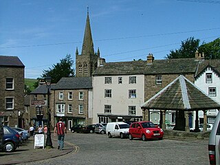
Alston is a town in Cumbria, England, within the civil parish of Alston Moor on the River South Tyne. It shares the title of the 'highest market town in England', at about 1,000 feet (300 m) above sea level, with Buxton, Derbyshire. Despite its altitude, the town is easily accessible via the many roads which link the town to Weardale, Teesdale, and towns in Cumbria such as Penrith via Hartside Cross, as well as Tynedale. Historically part of Cumberland, Alston lies within the North Pennines, a designated Area of Outstanding Natural Beauty. Much of the town centre is a designated Conservation Area which includes several listed buildings.

Calcium sulfate (or calcium sulphate) is the inorganic compound with the formula CaSO4 and related hydrates. In the form of γ-anhydrite (the anhydrous form), it is used as a desiccant. One particular hydrate is better known as plaster of Paris, and another occurs naturally as the mineral gypsum. It has many uses in industry. All forms are white solids that are poorly soluble in water. Calcium sulfate causes permanent hardness in water.
USG Corporation, also known as United States Gypsum Corporation, is an American company which manufactures construction materials, most notably drywall and joint compound. The company is the largest distributor of wallboard in the United States and the largest manufacturer of gypsum products in North America. It is also a major consumer of synthetic gypsum, a byproduct of flue-gas desulfurization. Its corporate offices are located at 550 West Adams Street in Chicago, Illinois.
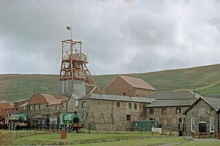
Big Pit National Coal Museum is an industrial heritage museum in Blaenavon, Torfaen, Wales. A working coal mine from 1880 to 1980, it was opened to the public in 1983 under the auspices of the National Museum of Wales. The site is dedicated to operational preservation of the Welsh heritage of coal mining, which took place during the Industrial revolution.
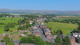
Kirkby Thore is a small village and civil parish in Cumbria, England, in the historic county of Westmorland. It is close to the Lake District national park and the Cumbrian Pennines. It includes the areas of Bridge End, in the south west by the A66, and Cross End in the north east of the village. At the 2001 census the parish had a population of 731, increasing to 758 at the 2011 Census.

Trimsaran is a community and former mining village which lies on the B4308 between Llanelli and Kidwelly, in the Welsh county of Carmarthenshire.

Little Salkeld is a small village and former civil parish, now in the parish of Hunsonby, in the Eden district of Cumbria, England, a few miles to the north east of Penrith. In 1931 the civil parish had a population of 91. On the 1 April 1934 the civil parish was merged with Hunsonby and Winskill to create Hunsonby.

Lacy's Caves are a series of 5 chambers in the red sandstone cliff of River Eden, just north of Little Salkeld, Cumbria, England, near Nunnery, at grid reference NY564383.

Shireoaks Colliery was a coal mine situated on the edge of the village of Shireoaks, near Worksop in North Nottinghamshire, close by the Yorkshire border.

Hallbankgate is a village in Cumbria, England, 13 miles (21 km) east of Carlisle. A former coal and lead mining village, it straddles the A689 Brampton to Alston road. Limestone is quarried here and it once had a gasworks and a forge. The village has a primary school, a village shop and tea room and a pub. There are three other hamlets in the civil parish, Farlam, Kirkhouse and Tindale.

The mines of Paris comprise a number of abandoned, subterranean mines under Paris, France, connected together by galleries. Three main networks exist; the largest, known as the grand réseau sud, lies under the 5th, 6th, 14th and 15th arrondissements, a second under the 13th arrondissement, and a third under the 16th, though other minor networks are found under the 12th, 14th and 16th for instance. The commercial product was Lutetian limestone for use as a building material, as well as gypsum for use in "plaster of Paris".

Cotehill railway station was a railway station on the Settle-Carlisle Railway in England between Armathwaite and Cumwhinton. The line opened for passengers in 1876. The station was designed by the Midland Railway company architect John Holloway Sanders.

Cave of the Crystals or Giant Crystal Cave is a cave connected to the Naica Mine at a depth of 300 metres (980 ft), in Naica, Chihuahua, Mexico.

Tindale or Tindale Fell is a hamlet in the parish of Farlam in the City of Carlisle district of the English county of Cumbria. It is to the south of the A689 Brampton to Alston road. It is a former mining village – both coal and lead were mined here. Limestone was quarried here.

Haig Colliery was a coal mine in Whitehaven, Cumbria, in north-west England. The mine was in operation for almost 70 years and produced anthracitic coal which is most useful for coking coal. Situated on the coast, the underground workings of the mine spread westwards out under the Irish Sea and mining was undertaken at over 4 miles (6.4 km) out underneath the sea bed.

Cocklakes is a hamlet in Cumbria, England. British Gypsum formerly had a plant in Cocklakes. It has a lake which is used for fishing. It is served by the A6 road.
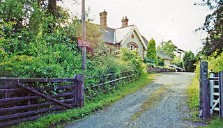
Little Salkeld was a railway station which served the village of Little Salkeld in Hunsonby parish and Great Salkeld, Cumbria, England. The Settle-Carlisle Line remains operational for freight and passenger traffic. The station was built by the Midland Railway and opened in 1876. It closed in 1970, when the local stopping service over the line was withdrawn by British Rail.
General
Gypsum in Cumbria by Ian Tyler (2000) - ISBN 0-9523028-4-5