Long Pond is an unincorporated community in Monroe County in the Pocono Mountains region of Pennsylvania, a part of the Appalachian Mountains. Long Pond is located within the Tunkhannock Creek Watershed. Its ZIP code is 18334.
Massasoit State Park is a public recreation area located on the southeast side of the city of Taunton, Massachusetts, with some parklands spilling into the adjacent town of Lakeville. The state park encompasses more than 1200 heavily wooded acres that include six lakes and ponds and numerous cranberry bogs.

Lake Chaubunagungamaug, also known as Webster Lake, is a lake in the town of Webster, Massachusetts. It is located near the Connecticut border and has a surface area of 1,442 acres. Since 1921, the lake has also been known by a much longer name having 45 letters comprising fourteen syllables: Lake Chargoggagoggmanchauggagoggchaubunagungamaugg. The lake has become famous beyond Central Massachusetts for having the longest name of any geographic feature in all of the United States.
Trout Pond — formerly called Old Pond — located near Wardensville in Hardy County, West Virginia, USA, is the state's only natural lake. The small "lake" is situated in the Trout Pond Recreation Area (TPRA) of the George Washington National Forest. Formerly, the pond had fluctuated in surface area between 2 and 3 acres, but recently it has appeared to be disappearing due to underground structural changes.

The Powwow River is a 22.8-mile-long (36.7 km) river located in New Hampshire and Massachusetts in the United States. It is a tributary of the Merrimack River, part of the Gulf of Maine watershed.

Brimfield State Forest is a Massachusetts state forest located in and around the town of Brimfield in Hampden County, Massachusetts. The forest includes Dean Pond Recreation Area, a popular spot for fishing, picnicking and swimming. The park is managed by the Department of Conservation and Recreation.

The North Branch of the Millers River is a river in southwestern New Hampshire and northern Massachusetts in the United States. It is a tributary of the Millers River, which flows west to the Connecticut River, which in turn flows south to Long Island Sound, an arm of the Atlantic Ocean.
The South Branch of the Souhegan River is a 5.8-mile-long (9.3 km) river located in northern Massachusetts and southern New Hampshire in the United States. It is a tributary of the Souhegan River, which flows to the Merrimack River and ultimately to the Gulf of Maine.
The Red Hill River is a 6.5-mile-long (10.5 km) river in the Lakes Region of central New Hampshire in the United States. It is a tributary of Lake Winnipesaukee, part of the Merrimack River watershed.
Lake Cochituate is a body of water in Natick, Wayland, and Framingham, Massachusetts, United States. Originally a reservoir serving Boston, it no longer serves that function, and is now a local recreational resource and home to Cochituate State Park.
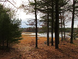
Mount Joy Pond Natural Area Preserve is a 274-acre (1.11 km2) Natural Area Preserve located in Augusta County, Virginia in the United States. Located on the western side of the Blue Ridge Mountains, it supports a large population of the rare Virginia sneezeweed. This and other plants are associated with a large sinkhole pond, the centerpiece of the property; fewer than two dozen such ponds remain in Augusta and neighboring Rockingham County. Much of the surrounding landscape consists of hardwoods and pines.

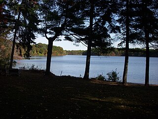
Burr Pond State Park is a public recreation area covering 438 acres (177 ha) adjacent to Paugnut State Forest in the town of Torrington, Connecticut. The state park surrounds Burr Pond, an 85-acre (34 ha), man-made body of water with facilities for swimming, boating, and fishing. It is managed by the Connecticut Department of Energy and Environmental Protection.

The Fish River is a 69.9-mile-long (112.5 km) river in northern Maine in the United States. It is a tributary of the Saint John River, which flows to the Bay of Fundy in New Brunswick, Canada.

The Moose River is an 83-mile-long (134 km) river in Maine. Its source is in Beattie, on the Canada–United States border, which runs along the height of land between the watersheds of the Kennebec River in Maine and the Chaudière River in Quebec. From there, the river runs east through Attean Pond and Wood Pond, past the town of Moose River, then through Long Pond and Brassua Lake. The Moose River empties into Moosehead Lake, the source of the Kennebec River, in Rockwood Strip. The International Railway of Maine was built along Moose River in 1889.
The North Branch Dead River is a 19.3-mile-long (31.1 km) tributary of the Dead River in Franklin County, Maine. It is paralleled by Maine State Route 27.

The Sebec River is a tributary of the Piscataquis River in Piscataquis County, Maine. From the outflow of Sebec Lake in Sebec, the river runs 10.0 miles (16.1 km) east and southeast to its confluence with the Piscataquis in Milo.

The Elizabeth A. Morton National Wildlife Refuge is a 187-acre (76 ha) National Wildlife Refuge in Noyack, New York. Much of the refuge is situated on a peninsula surrounded by Noyack and Little Peconic bays. The refuge is managed by the United States Fish and Wildlife Service as part of the Long Island National Wildlife Refuge Complex.
The Target Rock National Wildlife Refuge is located just east of the village of Lloyd Harbor, New York, on the north shore of Long Island, 25 miles (40 km) east of New York City. It is managed by the U.S. Fish and Wildlife Service as part of the Long Island National Wildlife Refuge Complex.
The Ellicott Slough National Wildlife Refuge is a United States National Wildlife Refuge located in the northern part of the Monterey Bay area of California.
Dyken Pond is a 134-acre (54 ha) lake in the towns of Grafton and Berlin in Rensselaer County, New York. The pond gets water primarily from precipitation and outflows westward into the Poesten Kill, a tributary of the Hudson River. It is located in northwest Berlin, south of Grafton Lakes State Park.
