
The St. Lawrence Seaway is a system of locks, canals, and channels in Canada and the United States that permits oceangoing vessels to travel from the Atlantic Ocean to the Great Lakes of North America, as far inland as Duluth, Minnesota, at the western end of Lake Superior. The seaway is named for the St. Lawrence River, which flows from Lake Ontario to the Atlantic Ocean. Legally, the seaway extends from Montreal, Quebec, to Lake Erie, and includes the Welland Canal. Ships from the Atlantic Ocean are able to reach ports in all five of the Great Lakes, via the Great Lakes Waterway.

The St. Marys River, sometimes written St. Mary's River, drains Lake Superior, starting at the end of Whitefish Bay and flowing 74.5 miles (119.9 km) southeast into Lake Huron, with a fall of 23 feet (7.0 m). For its entire length it is an international border, separating Michigan in the United States from Ontario, Canada.

The Lachine Rapids are a series of rapids on the Saint Lawrence River, between the Island of Montreal and the South Shore. They are located near the former city of Lachine. The Lachine Rapids contain large standing waves because the water volume and current do not change with respect to the permanent features in the riverbed, namely its shelf-like drops. Seasonal variation in the water flow does not change the position of the waves, although it does change their size and shape. The rapids are about 4.8 kilometres (3.0 mi) in length. In the past these represented a considerable barrier to maritime traffic. Until the construction of the Lachine Canal through Montreal, the rapids had to be portaged. Even with the canal, the difficulty was such that it was usually more convenient to ship goods by rail to Montreal, where they could be loaded at the city's port. Montreal remains a major rail hub and one of Canada's largest ports for that reason.

Eastern Ontario is a secondary region of Southern Ontario in the Canadian province of Ontario which lies in a wedge-shaped area between the Ottawa River and St. Lawrence River. It shares water boundaries with Quebec to the north and New York State to the east and south, as well as a small land boundary with the Vaudreuil-Soulanges region of Quebec to the east.

The Lost Villages were ten communities in the Canadian province of Ontario, in the former townships of Cornwall and Osnabruck near Cornwall, which were permanently submerged by the creation of the Saint Lawrence Seaway in 1958.

Dickinson's Landing is an underwater ghost town in the Canadian province of Ontario. It is one of Ontario's Lost Villages, which were permanently flooded by the creation of the St. Lawrence Seaway in 1958.

Farran's Point is an underwater ghost town in the province of Ontario, Canada. It is one of Ontario's Lost Villages, which were permanently flooded by the creation of the St. Lawrence Seaway in 1958.
Mille Roches is an underwater ghost town in the Canadian province of Ontario. It is one of Ontario's Lost Villages, which were permanently flooded by the creation of the St. Lawrence Seaway in 1958.

Moulinette is an underwater ghost town in the Canadian province of Ontario. It is one of Ontario's Lost Villages, which were permanently flooded by the creation of the St. Lawrence Seaway in 1958. Families and businesses in Moulinette were moved to the new town of Long Sault before the seaway construction commenced. The village was located as a strip community along Highway 2, on the St. Lawrence River. At the time of the flooding, Moulinette had a population of around 311 residents. The community would have been located in what is now South Stormont township.
Ault Park is a park on the St. Lawrence River in the Township of South Stormont, near Long Sault, Ontario, Canada.
Sheek Island is an island in the St. Lawrence River in the Canadian province of Ontario. It is considered to be one of Ontario's Lost Villages, which were permanently flooded by the creation of the St. Lawrence Seaway in 1958. While much of the island has been flooded, a portion of it remains above water, but is not populated.
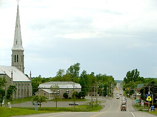
South Dundas is a municipality in eastern Ontario, Canada, in the United Counties of Stormont, Dundas and Glengarry along the north shore of the St. Lawrence River. It is located approximately 100 kilometres south of Ottawa and is midway between Kingston and Montreal, Quebec.
South Stormont is a township in eastern Ontario, Canada, in the United Counties of Stormont, Dundas and Glengarry. It is located 53 kilometres (33 mi) southeast of Ottawa. South Stormont borders on, but does not include, the city of Cornwall.

The Hog's Back Falls, officially known as the Prince of Wales Falls, but rarely referred to by this name, are a series of artificial waterfalls on the Rideau River in Ottawa, Ontario, Canada. The falls are located just north of Mooney's Bay and the point where the Rideau Canal splits from the Rideau River.
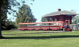
The Long Sault Parkway is a group of eleven islands west of Cornwall in the Canadian province of Ontario, as well as the name of the 10.1-kilometre (6.3 mi) scenic parkway connecting them. The islands, which include two public beaches and three campgrounds, were created by the flooding of the Long Sault rapids during construction of the St. Lawrence Seaway. The parkway, the islands, and their amenities are maintained by the St. Lawrence Parks Commission.

The Sault Ste. Marie Canal is a National Historic Site in Sault Ste. Marie, Ontario, and is part of the national park system, managed by Parks Canada. It includes a lock to bypass the rapids on the St. Marys River.

The Moses-Saunders Power Dam, short for Robert Moses-Robert H. Saunders Power Dam, is a dam on the Saint Lawrence River straddling the border between the United States and Canada. It is located between Massena in New York and Cornwall in Ontario. The dam supplies water to two adjacent hydroelectric power generating stations, the United States' 912 MW St. Lawrence-Franklin D. Roosevelt Power Project and Canada's 1,045 MW R.H. Saunders Generating Station. Constructed between 1954 and 1958 as part of the larger Saint Lawrence Seaway project, the dam created Lake St. Lawrence. Aside from providing significant amounts of renewable power, the dam regulates the St. Lawrence River and affords passage for the navigation of large vessels. Despite the enormous economic advantages to the dam, it required the relocation of 6,500 people and caused harm to the surrounding environment. Efforts have been made over the years to improve shoreline and fish habitats.
The Massena Power Canal, which connects the Saint Lawrence River to the lower Grass River.

The Cornwall Canal was built by the British government of Canada to bypass a troublesome rapids hindering navigation on the St. Lawrence at Cornwall, Ontario. Construction began in 1834 and was completed in 1843.
Cornwall Street Railway Light and Power Company Limited, operating as Cornwall Electric, is an electricity transmission and distribution utility, licensed by the Ontario Energy Board (OEB) to operate in Cornwall, Ontario, Canada. Originally established in 1887 as the Stormont Electric Light and Power Company and merged with the Cornwall Electric Street Railway Company in 1905, it is one of the oldest utilities in Canada.

