Longtown Castle

Last updated

Longtown Castle
Longtown, Herefordshire, England
Longtown Castle - geograph.org.uk - 392612.jpg
The keep and inner gatehouse, 2007
Herefordshire UK location map.svg
Red pog.svg
Longtown Castle
Coordinates 51°57′22″N2°59′28″W / 51.9562°N 2.9910°W / 51.9562; -2.9910
Grid reference grid reference SO320291
Site information
Owner English Heritage
Open to
the public
Yes
Site history
MaterialsStone

Longtown Castle, also termed Ewias Lacey Castle in early accounts, is a ruined Norman motte-and-bailey fortification in Longtown, Herefordshire. It was established in the 11th century by Walter de Lacy, reusing former Roman earthworks. The castle was then rebuilt in stone by Gilbert de Lacy after 1148, who also established the adjacent town to help pay for the work. By the 14th century, Longtown Castle had fallen into decline. Despite being pressed back into use during the Owain Glyndŵr rising in 1403, it fell into ruin. In the 21st century the castle is maintained by English Heritage and operated as a tourist attraction.

Contents

History

Earlier sites

The first fortification at Longtown was a Roman fort, close to a Roman road that ran along the borderlands. [1] The fort was square, and protected by a ditch and a timber palisade. [2] The Roman defences were reinforced, probably in 1055, after a Welsh attack on Hereford. [1]

Initial construction

Plan of the castle: A - northern town enclosure; B - motte; C - eastern bailey; D - inner western bailey; E - outer western bailey; F - southern town enclosure Longtown Castle plan.png
Plan of the castle: A - northern town enclosure; B - motte; C - eastern bailey; D - inner western bailey; E - outer western bailey; F - southern town enclosure

After the Norman invasion of England and Wales in 1066, a small castle began to be built at Pont Hendre, close to the site of the current castle, by Walter de Lacy in order to protect the river crossing there. [3] Following Welsh attacks, Walter abandoned Pont Hendre and instead started to build a castle at Longtown, on the site of the old Roman fort. [1] The early castle was occasionally also called Ewias Lacey, named after the wider lordship; "Ewias" was a term meaning "sheep district". [4]

Longtown Castle was designed as a motte and bailey castle, on high ground alongside the River Monnow. [5] More defensible sites on higher ground existed nearby, but this location was strategically well located close to the River, an important transport route. [6] It had a 10-metre (33 ft) high motte and an unusual rectangular bailey design around 125 metres (410 ft) by 110 metres (360 ft), divided into three parts, two baileys in the west and one in the east, each capable of being defended independently and enclosing around 1.21 hectares (3.0 acres) in total. [7] The 12th-century castle was built primarily of timber with at least some stone in its design, but this stone was then reused when the castle was rebuilt in the 13th century. [8] Two circuits of earthworks to the north and south of the castle, possibly with wooden palisades, enclosed the early settlement of Longtown. [9] The region was troubled for the rest of the century, with revolts by the local Welsh against Anglo-Norman rule. [10]

The de Lacys lost their lands in the region after conspiring against William II, but around 1148, Gilbert de Lacy regained the estates. [1] Gilbert probably then rebuilt the castle in stone, at a considerable cost of £37, financed by the construction of a new borough alongside it. [11] The stone keep was constructed in the form of a circular great tower, with walls 5-metre (16 ft) thick and three turrets spaced evenly around the outside and a hall on the first floor. [12] This circular design is particular to the Welsh Marches, and is also seen at Skenfrith and Caldicot. [13] The reason for this choice is unclear, as it appears to have carried few military advantages. [14] The stonework is made up of sandstone rubble with cut ashlar detailing; the walls are around 4-metre (13 ft) thick, but the keep's foundations are extremely shallow. [15] An inner gate to the western baileys was built to a simple design with two small turrets, and seems to have been fitted with a portcullis, while a 2-metre (6 ft 7 in) thick wall encircled the rest of the inner western bailey; another stone wall seems to have protected the outer half of the bailey. [16] Inside the inner western bailey appears to have been the castle's great hall and other service buildings. [17]

Expansion and decline

Motte and keep in the snow, 1978 Longtown Castle, Herefordshire - geograph.org.uk - 62498.jpg
Motte and keep in the snow, 1978

The de Lacy family controlled Longtown Castle until Walter de Lacy's death in 1234. [18] John Fitzgeoffrey then acquired the castle, during a period of increased conflict and tension between the Welsh princes Llywelyn the Great and Dafydd ap Llywelyn and the English marcher lords. [19] The castle reverted to the de Lacy family and became part of the inheritance of Margery (or Margaret) de Lacy, daughter of Gilbert de Lacy, who had predeceased his father Walter de Lacy, Lord of Meath, and his wife Isabel Bigod, daughter of Sir Hugh Bigod, 3rd Earl of Norfolk. Marjory married John de Verdun of Alton, son of Theobald le Botiller and Roesia de Verdun. The de Verduns struggled with local lawlessness and the Welsh revolts which continued until the end of the century. [19] King Edward I temporarily confiscated the castle and estates from John's son, Theobald de Verdun, 1st Baron Verdun. On Theobald's death, the castle passed to his son Theobald de Verdun, 2nd Baron Verdun, who died in 1316 without surviving male heirs, whereupon the castle became part of the inheritance of his 2nd daughter Elizabeth and by right of his wife passed to her husband Bartholomew Burghersh, 1st Baron Burghersh. [19] The castle continued to be used as a fortification, and in 1317 orders were given to garrison it with 30 men. [19]

The castle began to decline in importance, however, and in 1369 passed to the Despensers and then the Beauchamps, neither of whom used the castle. [19] It was temporarily refortified by Henry IV in response to the Owain Glyndŵr uprising in North Wales in 1403. [20] The Nevilles acquired the property in the 15th century and it remained in the control of the Lords of Abergavenny until the 1970s. [19] After the Black Death the town's population fell away sharply as well, the protected area north of the castle was abandoned, and by the 16th century it was no longer a functioning trading centre. [21]

It is unclear if the castle and town played any part in the English Civil War between 1642–45, although cannonballs from the period have been discovered within the castle. [3] Local oral tradition states that the castle was slighted, or deliberately destroyed, during the war. [22] Stones from the castle were used for local building work by the 17th century onwards, and by the 18th century a house and shop had been constructed in the eastern bailey of the castle, along with a yard and garden. [22] A gallows operated at the castle until 1790. [22] Buildings continued to encroach on the castle. By the end of the 19th century a school and a house, Castle Lodge, had been built in the castle grounds. [22] Other buildings were built as lean-tos against the castle walls. [22]

20th - 21st centuries

Longtown Castle was acquired by the Ministry of Works in the 1970s. [23] It was in a poor condition and extensive restoration work was carried out, including the removal of many of the buildings that had encroached on the walls. [24] In the 21st century, the central parts of Longtown Castle, including the ruined keep, the internal gatehouse and fragments of the curtain wall, are maintained by English Heritage as a tourist attraction, although the wider earthworks lie on common land. [25] In 2016, the Longtown and District Historical Society obtained Heritage Lottery Funding for a community archaeology project to research Longtown Castle over the next two years. [26] The castle is protected as a scheduled monument. [27]

See also

Related Research Articles

<span class="mw-page-title-main">Hereford</span> City in Herefordshire, England

Hereford is a cathedral city and the county town of Herefordshire, England. It lies on the River Wye, approximately 16 miles (26 km) east of the border with Wales, 24 miles (39 km) south-west of Worcester and 23 miles (37 km) north-west of Gloucester. With a population of 53,112 in 2021, it is the largest settlement in Herefordshire.

<span class="mw-page-title-main">Worcester, England</span> Cathedral city in Worcestershire, England

Worcester is a cathedral city in Worcestershire, England, of which it is the county town. It is 30 mi (48 km) south-west of Birmingham, 27 mi (43 km) north of Gloucester and 23 mi (37 km) north-east of Hereford. The population was 103,872 in the 2021 census.

<span class="mw-page-title-main">Stokesay Castle</span> Historic house museum in Shropshire, England

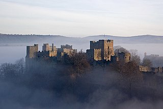
Stokesay Castle is one of the finest surviving fortified manor houses in England, and situated at Stokesay in Shropshire. It was largely built in its present form in the late 13th century by Laurence of Ludlow, on the earlier castle founded by its original owners the de Lacy family, from whom it passed to their de Verdun heirs, who retained feudal overlordship of Stokesay until at least 1317. Laurence 'of' Ludlow was one of the leading wool merchants in England, who intended it to form a secure private house and generate income as a commercial estate. Laurence's descendants continued to own the castle until the 16th century, when it passed through various private owners. By the time of the outbreak of the First English Civil War in 1642, Stokesay was owned by William Craven, 1st Earl of Craven (1608–1697), a supporter of King Charles I. After the Royalist war effort collapsed in 1645, Parliamentary forces besieged the castle in June and quickly forced its garrison to surrender. Parliament ordered the property to be slighted, but only minor damage was done to the walls, allowing Stokesay to continue to be used as a house by the Baldwyn family until the end of the 17th century.

<span class="mw-page-title-main">Leominster</span> Town in Herefordshire, England

Leominster is a market town in Herefordshire, England; it is located at the confluence of the River Lugg and its tributary the River Kenwater. The town is 12 miles north of Hereford and 7 miles south of Ludlow in Shropshire. With a population of 11,700, Leominster is the largest of the five towns in the county; the others being Ross-on-Wye, Ledbury, Bromyard and Kington.

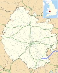
The history of Herefordshire starts with a shire in the time of King Athelstan, and Herefordshire is mentioned in the Anglo-Saxon Chronicle in 1051. The first Anglo-Saxon settlers, the 7th-century Magonsætan, were a sub-tribal unit of the Hwicce who occupied the Severn valley. The Magonsætan were said to be in the intervening lands between the Rivers Wye and Severn. The undulating hills of marl clay were surrounded by the Welsh mountains to the west; by the Malvern Hills to the east; by the Clent Hills of the Shropshire borders to the north, and by the indeterminate extent of the Forest of Dean to the south. The shire name first recorded in the Anglo-Saxon Chronicle may derive from "Here-ford", Old English for "army crossing", the location for the city of Hereford.

<span class="mw-page-title-main">Leigh, Worcestershire</span> Human settlement in England

Leigh is a village and civil parish in the Malvern Hills district of the county of Worcestershire, England.

<span class="mw-page-title-main">Wychbold</span> Human settlement in England

Wychbold is a village in the Wychavon district of Worcestershire. The village is situated on the A38 between Droitwich Spa and Bromsgrove, and by Junction 5 of the M5 motorway.

de Lacy

de Lacy is the surname of an old Norman family which originated from Lassy, Calvados. The family took part in the Norman Conquest of England and the later Norman invasion of Ireland. The name is first recorded for Hugh de Lacy (1020–1085). His sons, Walter and Ilbert, left Normandy and travelled to England with William the Conqueror. The awards of land by the Conqueror to the de Lacy sons led to two distinct branches of the family: the northern branch, centred on Blackburnshire and west Yorkshire was held by Ilbert's descendants; the southern branch of Marcher Lords, centred on Herefordshire and Shropshire, was held by Walter's descendants.

<span class="mw-page-title-main">Hartlebury Castle</span> Fortified manor house near Worcester, England

Hartlebury Castle, a Grade I listed building, near Hartlebury in Worcestershire, central England, was built in the mid-13th century as a fortified manor house, on manorial land earlier given to the Bishop of Worcester by King Burgred of Mercia. It lies near Stourport-on-Severn in an area with several large manors and country houses, including Witley Court, Astley Hall, Pool House, Areley Hall and Hartlebury and Abberley Hall. Later, it became the bishop's principal residence.

<span class="mw-page-title-main">British Camp</span>

British Camp is an Iron Age hill fort located at the top of Herefordshire Beacon in the Malvern Hills. The hill fort is protected as a Scheduled Ancient Monument and is owned and maintained by Malvern Hills Conservators. The fort is thought to have been first constructed in the 2nd century BC. A Norman castle was built on the site.

<span class="mw-page-title-main">Bewdley Bridge</span> Bridge in Bewdley, Worcestershire

Bewdley Bridge is a three-span masonry arch bridge over the River Severn at Bewdley, Worcestershire, designed by civil engineer Thomas Telford. The two side spans are each 52 feet (16 m), with the central span 60 feet (18 m). The central arch rises 18 feet (5.5 m). Smaller flood arches on the bank bridge the towpath. The bridge is 27 feet (8.2 m) wide.

Ewyas was a possible early Welsh kingdom which may have been formed around the time of the Roman withdrawal from Britain in the 5th century. The name was later used for a much smaller commote or administrative sub-division, which covered the area of the modern Vale of Ewyas and a larger area to the east including the villages of Ewyas Harold and Ewyas Lacy.

<span class="mw-page-title-main">Roger Mortimer, 1st Baron Mortimer of Chirk</span>

Roger Mortimer, 1st Baron Mortimer of Chirk was a 14th-century Marcher lord, notable for his opposition to Edward II of England during the Despenser War.

<span class="mw-page-title-main">Berkhamsted Castle</span> Norman castle in Hertfordshire, UK

Berkhamsted Castle is a Norman motte-and-bailey castle in Berkhamsted, Hertfordshire. The castle was built to obtain control of a key route between London and the Midlands during the Norman conquest of England in the 11th century. Robert of Mortain, William the Conqueror's half brother, was probably responsible for managing its construction, after which he became the castle's owner. The castle was surrounded by protective earthworks and a deer park for hunting. The castle became a new administrative centre of the former Anglo-Saxon settlement of Berkhamsted. Subsequent kings granted the castle to their chancellors. The castle was substantially expanded in the mid-12th century, probably by Thomas Becket.

<span class="mw-page-title-main">Pain fitzJohn</span> 12th century Norman baron in England

Pain fitzJohn was an Anglo-Norman nobleman and administrator, one of King Henry I of England's "new men", who owed their positions and wealth to the king.

<span class="mw-page-title-main">History of Worcester</span>

Worcester's early importance is partly due to its position on trade routes, but also because it was a centre of Church learning and wealth, due to the very large possessions of the See and Priory accumulated in the Anglo-Saxon period. After the reformation, Worcester continued as a centre of learning, with two early grammar schools with strong links to Oxford University.

<span class="mw-page-title-main">Castle Frome</span> Human settlement in England

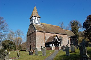
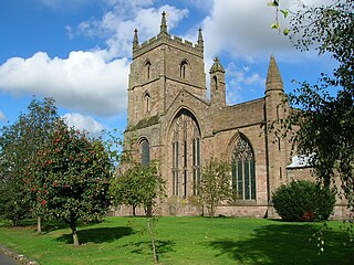
Castle Frome is a village and civil parish in the county of Herefordshire, England, and is 10 miles (16 km) north-east from the city and county town of Hereford. The closest large town is the market town of Bromyard, 5 miles (8 km) to the north. The Norman font in Castle Frome church is "one of the outstanding works of the Herefordshire school".

<span class="mw-page-title-main">Llancillo</span> Human settlement in England

Llancillo is a civil parish in south-west Herefordshire, England, and is approximately 13 miles (20 km) south-west from Hereford. The parish borders Wales at the south in which is the nearest town, Abergavenny, 7 miles (11 km) to the south-southwest. In the parish is the isolated Grade II* listed 11th-century Church of St Peter.

References

  1. 1 2 3 4 "History of Longtown Castle". English Heritage. 2018. Retrieved 22 September 2018.
  2. Smith 2003 , p. 5; Buteux, Victoria (2005). "Archaeological Assessment of Longtown, Hereford and Worcester" (PDF). English Heritage and Worcestershire County Council. p. 4. Retrieved 10 December 2012.; "History of Longtown Castle". English Heritage. 2018. Retrieved 22 September 2018.
  3. 1 2 Buteux, Victoria (2005). "Archaeological Assessment of Longtown, Hereford and Worcester" (PDF). English Heritage and Worcestershire County Council. p. 2. Retrieved 10 December 2012.; "History of Longtown Castle". English Heritage. 2018. Retrieved 22 September 2018.
  4. Buteux, Victoria (2005). "Archaeological Assessment of Longtown, Hereford and Worcester" (PDF). English Heritage and Worcestershire County Council. p. 2. Retrieved 10 December 2012.; Smith 2003 , p. 6
  5. Pettifer 1995 , p. 100
  6. Smith 2003 , p. 2
  7. Prior 2006 , p. 125; Smith 2003 , p. 12; Buteux, Victoria (2005). "Archaeological Assessment of Longtown, Hereford and Worcester" (PDF). English Heritage and Worcestershire County Council. p. 4. Retrieved 10 December 2012.; Pounds 1994 , p. 24; "History and Research: Longtown Castle". English Heritage. 2004. Retrieved 10 December 2012.
  8. Buteux, Victoria (2005). "Archaeological Assessment of Longtown, Hereford and Worcester" (PDF). English Heritage and Worcestershire County Council. p. 4. Retrieved 10 December 2012.; "History and Research: Longtown Castle". English Heritage. 2004. Retrieved 10 December 2012.; Smith 2003 , p. 27
  9. Buteux, Victoria (2005). "Archaeological Assessment of Longtown, Hereford and Worcester" (PDF). English Heritage and Worcestershire County Council. pp. 4–5. Retrieved 10 December 2012.
  10. Smith 2003 , p. 7
  11. "History and Research: Longtown Castle". English Heritage. 2004. Retrieved 10 December 2012.; "History of Longtown Castle". English Heritage. 2018. Retrieved 22 September 2018.
  12. Goodall 2011 , p. 181; "History and Research: Longtown Castle". English Heritage. 2004. Retrieved 10 December 2012.; Pettifer 1995 , p. 100
  13. Goodall 2011 , p. 181
  14. King 1991 , p. 99
  15. King 1991 , p. 50; Smith 2003 , p. 14; "Longtown Castle". Gatehouse. 2012. Retrieved 10 December 2012.
  16. King 1991 , p. 117; Smith 2003 , pp. 14–15; "History of Longtown Castle". English Heritage. 2018. Retrieved 22 September 2018.
  17. Buteux, Victoria (2005). "Archaeological Assessment of Longtown, Hereford and Worcester" (PDF). English Heritage and Worcestershire County Council. p. 4. Retrieved 10 December 2012.
  18. "History and Research: Longtown Castle". English Heritage. 2004. Retrieved 10 December 2012.; "Longtown Castle". English Heritage. Retrieved 10 December 2012.
  19. 1 2 3 4 5 6 Smith 2003 , p. 8
  20. Pettifer 1995 , p. 100; "History and Research: Longtown Castle". English Heritage. 2004. Retrieved 10 December 2012.
  21. Buteux, Victoria (2005). "Archaeological Assessment of Longtown, Hereford and Worcester" (PDF). English Heritage and Worcestershire County Council. pp. 2, 7. Retrieved 10 December 2012.
  22. 1 2 3 4 5 Smith 2003 , p. 9
  23. Smith 2003 , p. 3
  24. Smith 2003 , pp. 3, 9
  25. Smith 2003 , p. 1; "Longtown Castle". Gatehouse. 2012. Retrieved 10 December 2012.; "History and Research: Longtown Castle". English Heritage. 2004. Retrieved 10 December 2012.
  26. Cook, Martin (2016). "The Castle Studies Group Bulletin" (PDF). Castle Studies Group. Retrieved 21 April 2017.
  27. "Longtown Castle". Gatehouse. 2012. Retrieved 10 December 2012.

Bibliography