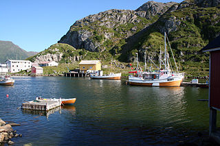
Bø is a municipality in Nordland county, Norway. It is part of the Vesterålen region. The administrative centre of the municipality is the village of Straume. Other villages in the municipality include Auvåg, the village of Bø, Eidet, Guvåg, Hovden, Klakksjorda, Malnes, Nykvåg, Utskor, and Vågen. The Litløy Lighthouse is located on the tiny island of Litløya off the coast of Bø.

Skudeneshavn (help·info) is a town in Karmøy municipality in Rogaland county, Norway. It is located on the southernmost tip of the island of Karmøy at the entrance to the Boknafjorden and Karmsundet strait. The town is part of the traditional district of Haugaland.

Orkanger is a town and the administrative centre of Orkdal municipality in Trøndelag county, Norway. The town is also a former municipality which existed from 1920 until 1963. The town sits at the end of the Orkdalsfjorden, and arm of the Trondheimsfjord. Orkanger is the commercial centre of the municipality of Orkdal and it is the site of the Orkanger Church. It was established as a "town" in 2014.

Søvik is a village and a regional service center in Haram Municipality in Møre og Romsdal county, Norway. It is located in the western part of Haram Municipality, along the sea, just southeast of the islands of Bjørnøya and Terøya. The area was part of the municipality of Borgund until 1965. The 0.74-square-kilometre (180-acre) village has a population (2013) of 728. The population density of the village is 984,838 inhabitants per square kilometre (2,550,720/sq mi). The population of Søvik and its hinterland includes about 1,050 people, almost twice the population of the village proper. The main church for Søvik is Hamnsund Church, located just outside the village in Hamnsund.
Vatne is a village and former municipality in Haram Municipality in Møre og Romsdal county, Norway. The village of Vatne is located at the southern end of the Vatnefjorden in the eastern part of Haram Municipality. The 1.64-square-kilometre (0.63 sq mi) village has a population (2013) of 1,876 which gives it a population density of 1,144 inhabitants per square kilometre (2,960/sq mi). Other villages in the Vatne area include Eidsvik and Tennfjord to the south of the village of Vatne and Helle to the north of it.

Figgjo is a borough of the city of Sandnes in Rogaland county, Norway. The borough is located in the southern part of the city. It has a population (2016) of 2,213. The borough is mostly rural, but the village of Figgjo lies in the southern edge of the municipality. About 90% of the population of the borough lives in the village of Figgjo.

Røkland is a village in the municipality of Saltdal in Nordland county, Norway. The village is located along the Saltdalselva river about 15 kilometres (9.3 mi) south of the municipal centre of Rognan. European route E06 and the Nordland Line both pass through the village. Røkland Station is a train station along the Nordland Line.

Bogen (Norwegian) or Ránda (Northern Sami) is the administrative centre of Evenes Municipality in Nordland county, Norway. The village is located along the shore of the Ofotfjorden, about 10 kilometres (6.2 mi) northeast of the village of Liland. The European route E10 highway passes through the village. Bogen Chapel is located in this village.
Hustad is a village in Fræna Municipality in Møre og Romsdal county, Norway. It lies along the Hustadvika coastal area. The village of Hustad is located in the Nerland urban area which covers about 0.25 square kilometres and has a population (2013) of 249.

Vatne is a village in Sandnes municipality in Rogaland county, Norway. The village lies in the borough of Hana, just about 3 kilometres (1.9 mi) northeast of the city centre of Sandnes. It is considered a part of the Stavanger/Sandnes urban area. The 0.5-square-kilometre (120-acre) village has a population (2015) of 936, giving the village a population density of 1,872 inhabitants per square kilometre (4,850/sq mi). The Vatneleiren military base is located in Vatne.
Eidsvik is a village in Haram Municipality in Møre og Romsdal county, Norway. The village is located between the villages of Tennfjord and Vatne at the end of the Grytafjorden, about 10 kilometres (6.2 mi) north of the village of Skodje. Since 2002, Eidsvik has been considered a part of the Vatne urban area, so its population is no longer separately tracked.
Varhaugvika is a village in Aukra Municipality in Møre og Romsdal county, Norway. It is located on the eastern side of the island of Gossa along the Julsundet strait, just north of the village of Aukrasanden. The municipal centre of Aukra is at Falkhytta, just south of Varhaugvika. It is located about 6 kilometres (3.7 mi) southwest of the Nyhamna gas processing facility. The village of Røssøyvågen lies about 5 kilometres (3.1 mi) northwest of Varhaugvika.

Tennebø is a village in Vågsøy Municipality in Sogn og Fjordane county, Norway. It is located about 1 kilometre (0.62 mi) southeast of the village of Deknepollen and about 3 kilometres (1.9 mi) from the municipal center of Måløy. The lake Degnepollvatnet is just north of the village of Tennebø. The village sits along the Skavøypollen, a small bay off the main Nordfjorden. To the east, the village of Bryggja is about 15 kilometres (9.3 mi) away.
Giske is an island in Giske Municipality in Møre og Romsdal county, Norway. It covers an area of 2.67 square kilometers (1.03 sq mi) and had 717 residents in 2010. It is flat, with the highest point 23 meters (75 ft) above mean sea level. The island is connected by the Giske Bridge to the neighbouring island of Valderøya to the east and by the Godøy Tunnel to the island of Godøy to the south-west. Giske Church, dating back to the year 1180, sits on the southern coast of the island.

Hermansverk or Leikanger is a large village in the municipality of Leikanger in Sogn og Fjordane county, Norway. The village serves as the administrative centre of both the municipality of Leikanger and also Sogn og Fjordane county.

Harstad is a town in Harstad Municipality in Troms county, Norway. The town is also the administrative centre of the municipality of Harstad. The 11.15-square-kilometre (2,760-acre) town has a population (2017) of 20,953 which gives the town a population density of 1,879 inhabitants per square kilometre (4,870/sq mi). It is the second-largest town in Troms county, after the city of Tromsø, and it is the largest town in Central Hålogaland.

Eikefjord is a village in Flora Municipality in Sogn og Fjordane county, Norway. The village is located at the end of the Eikefjorden along the Norwegian National Road 5 highway. The town of Florø lies about 30 kilometres (19 mi) to the west and the village of Naustdal lies about 20 kilometres (12 mi) to the southeast (through the Naustdal Tunnel. The lake Endestadvatnet lies about 5 kilometres to the east. The villages of Nyttingnes and Steinhovden lie about 15 kilometres west of Eikefjord. The 0.4-square-kilometre village has a population of 368, giving the village a population density of 920 inhabitants per square kilometre.


