Lonneker

Last updated • 1 min readFrom Wikipedia, The Free Encyclopedia
Lonneker
Village
Lonneker Luchtfoto 2.jpg
Aerial view of Lonneker
Lonneker wapen.svg
Nickname(s): 
Droadneagels, Papsleevn
2010-NL-P04-Overijssel-positiekaart-gemnamen.jpg
Red pog.svg
Lonneker
Location in the Netherlands
Netherlands location map.svg
Red pog.svg
Lonneker
Lonneker (Netherlands)
Coordinates: 52°15′2″N6°54′43″E / 52.25056°N 6.91194°E / 52.25056; 6.91194
Country Netherlands
Province Overijssel
Municipality Enschede
Area
[1]
  Total0.89 km2 (0.34 sq mi)
Elevation
[2]
51 m (167 ft)
Population
 (2021) [1]
  Total1,895
  Density2,100/km2 (5,500/sq mi)
Time zone UTC+1 (CET)
  Summer (DST) UTC+2 (CEST)
Postal code
7524 [1]
Dialing code 053

Lonneker (Dutch pronunciation: [ˈlɔnəkər] ) is a village in Twente, in the province of Overijssel. It is located in the municipality of Enschede, about 3 km north of the city centre.

Contents

History

The village was first mentioned in the late 10th century as "in Loningheri", and means "settlement on a sandy ridge of the people of Lono (person)". [3] Lonneker is an esdorp which developed in the Early Middle Ages. [4]

The Catholic St. Jacobus de Meerdere was built between 1911 and 1912 as a replacement for the 1820 church. [4] Lonneker was home to 1,546 people in 1840. [5]

In 1811, five marke  [ nl ] (predecessor of municipality) were split into the municipalities of Lonneker and Enschede. Lonneker used to encircle Enschede. In 1884, a part of the municipality was given to the city. [4] It remained an independent municipality until 1934, when it became part of Enschede. [6]

In 1927, the 4th Anarchist Pinksterlanddagen or "pinkster-mobilisatie" where held in Lonneker. Amongst the speakers where T.Wessels, H. Schuurman and Albert de Jong. On the last day there was a demonstration that got stopped by police violence. [7]

Related Research Articles

<span class="mw-page-title-main">Enschede</span> City and municipality in Overijssel, the Netherlands

Enschede is a city and municipality in the province of Overijssel. It is located in the Twente region of the eastern Netherlands. The east of the urban area reaches the border of the German city of Gronau.

<span class="mw-page-title-main">Hengelo</span> Municipality in Overijssel, Netherlands

Hengelo is a city in the eastern part of the Netherlands, in the Twente region, in the province of Overijssel. It is part of a larger urban area that also includes Enschede, Borne, Almelo and Oldenzaal.

<span class="mw-page-title-main">Koewacht</span> Village

Koewacht is a village on the border between the Netherlands and Belgium.

<span class="mw-page-title-main">Heeswijk</span> Village in North Brabant, Netherlands

Heeswijk is a Dutch village. It is located in the province of North Brabant, in the south of the Netherlands.

<span class="mw-page-title-main">Goor</span> City in Overijssel, Netherlands

Goor is a city in the Dutch province of Overijssel. It is located about 20 kilometres (12 mi) west of Enschede. Goor received city rights in 1263.

<span class="mw-page-title-main">Twente</span> Region of the Netherlands

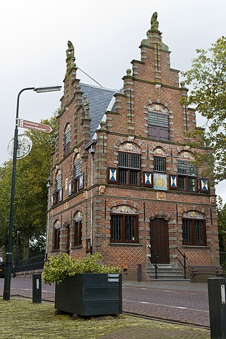
Twente is a region in the eastern Netherlands. It encompasses the most urbanised and easternmost part of the province of Overijssel. Twente is most likely named after the Tuihanti or Tvihanti, a Germanic tribe that settled in the area and was mentioned by the Roman historian Tacitus. The region's borders are defined by the Overijssel region of Salland in the northwest and west, the German County of Bentheim in the northeast and east and the Gelderland region of the Achterhoek in the south.

<span class="mw-page-title-main">Diever</span> Village in Drenthe, Netherlands

Diever is a village in the Dutch province of Drenthe. It is a part of the municipality of Westerveld, and lies about 18 km northwest of Hoogeveen.

<span class="mw-page-title-main">Kortgene</span> Small city in Zeeland, Netherlands

Kortgene is a small city in the southwest Netherlands. It is located in the municipality of Noord-Beveland, Zeeland, about 15 km northeast of Middelburg. It received city rights in 1431, but was flooded in 1530 and 1532. The new settlement received city rights in 1684.

<span class="mw-page-title-main">Graft, Netherlands</span> Village in North Holland, Netherlands

Graft is a village in the Dutch province of North Holland. It is a part of the municipality of Alkmaar, and lies about 11 km (6.8 mi) south of the city of Alkmaar.

Beek is a village in the Dutch province of Gelderland. It is located in the municipality of Berg en Dal, about 5 km east of Nijmegen. It was sometimes referred to as "Beek " or "Beek-Ubbergen" because there are several villages in the Netherlands called Beek.

<span class="mw-page-title-main">Geulle</span> Village in Limburg, Netherlands

Geulle is a village in the Dutch province of Limburg. It is located in the municipality of Meerssen, about 8 km southwest of Geleen.

<span class="mw-page-title-main">Grubbenvorst</span> Village in Limburg, Netherlands

Grubbenvorst is a village in the Dutch province of Limburg. It is located in the municipality of Horst aan de Maas, about 6 km northwest of Venlo.

<span class="mw-page-title-main">Herten, Netherlands</span> Village in Limburg, Netherlands

Herten is a village in the southeastern Netherlands. It is located in the municipality of Roermond, Limburg.

<span class="mw-page-title-main">Jabeek</span> Village in Limburg, Netherlands

Jabeek is a village in the Dutch province of Limburg. It is located in the municipality of Beekdaelen, on the German border about 8 km east of Geleen. Jabeek borders on the German village Süsterseel.

<span class="mw-page-title-main">Roosteren</span> Village in Limburg, the Netherlands

Roosteren is a village in the Dutch province of Limburg. It is located in the municipality of Echt-Susteren.

<span class="mw-page-title-main">Kessel, North Brabant</span> Village in North Brabant, Netherlands

Kessel is a village in the southern Netherlands. It is located in Oss, North Brabant about 12 km northeast of 's-Hertogenbosch on the river Maas.

<span class="mw-page-title-main">Linden, Netherlands</span> Village in North Brabant, Netherlands

Linden is a village in the Dutch province of North Brabant. It is located in the former municipality of Cuijk, about 10 km south of Nijmegen.

<span class="mw-page-title-main">Maren, Netherlands</span> Village in North Brabant, Netherlands

Maren is a village in the Dutch province of North Brabant. It is located in the municipality of Oss, about 10 km northeast of 's-Hertogenbosch.

<span class="mw-page-title-main">Velp, North Brabant</span> Village in North Brabant, Netherlands

Velp is a village in the Dutch province of North Brabant. It is located in the former municipality of Grave, about 2 km southwest of the city. Until 1794, it was part of the Land van Ravenstein, a Catholic enclave of Palatinate-Neuburg within the Dutch Republic.

<span class="mw-page-title-main">Westmaas</span> Village in South Holland, Netherlands

Westmaas is a village in the Dutch province of South Holland. It is located about 14 km south of the city of Rotterdam, next to Mijnsheerenland in the municipality of Hoeksche Waard. In 2020, the population was 2,065.

References

  1. 1 2 3 "Kerncijfers wijken en buurten 2021". Central Bureau of Statistics. Retrieved 12 April 2022.
  2. "Postcodetool for 7524AA". Actueel Hoogtebestand Nederland (in Dutch). Het Waterschapshuis. Retrieved 12 April 2022.
  3. "Lonneker - (geografische naam)". Etymologiebank (in Dutch). Retrieved 12 April 2022.
  4. 1 2 3 Ronald Stenvert & Jan ten Hove (1998). Lonneker (in Dutch). Zwolle: Waanders. ISBN   90-400-9200-1 . Retrieved 12 April 2022.
  5. "Lonneker". Plaatsengids (in Dutch). Retrieved 12 April 2022.
  6. Ad van der Meer and Onno Boonstra, Repertorium van Nederlandse gemeenten , KNAW, 2011.
  7. https://resources.huygens.knaw.nl/watermarker//pdf/cid/0800-0899/815.pdf . Retrieved 9 September 2024.{{cite web}}: Missing or empty |title= (help)