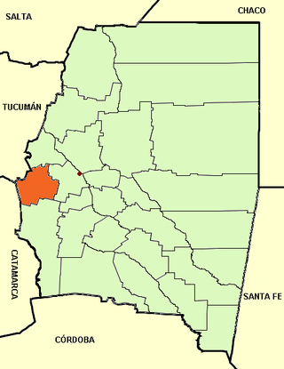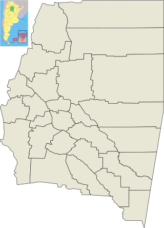
Santiago del Estero, also known simply as Santiago, is a province in the north of Argentina. Neighboring provinces, clockwise from the north, are Salta, Chaco, Santa Fe, Córdoba, Catamarca and Tucumán.

San Fernando del Valle de Catamarca is the capital and largest city in Catamarca Province in northwestern Argentina, on the Río Valle River, at the feet of the Cerro Ambato. The city name is normally shortened as Catamarca.

Santiago del Estero is the capital of Santiago del Estero Province in northern Argentina. It has a population of 252,192 inhabitants, making it the twelfth largest city in the country, with a surface area of 2,116 km2. It lies on the Dulce River and on National Route 9, at a distance of 1,042 km north-northwest from Buenos Aires. Estimated to be 455 years old, Santiago del Estero was the first city founded by Spanish settlers in the territory that is now Argentina. As such, it is nicknamed "Madre de Ciudades". Similarly, it has been officially declared the "mother of cities and cradle of folklore."

Guasayán Department is a departamento of the province of Santiago del Estero, Argentina.

Luján is a city in the Buenos Aires province of Argentina, located 68 kilometres north west of the city of Buenos Aires. The city was founded in 1755 and has a population of 106,899.

Termas de Río Hondo is a spa city in Santiago del Estero Province, Argentina. It has 27,838 inhabitants as per the 2001 census [INDEC]. It is located on the banks of the Dulce River, 65 km north of the provincial capital Santiago del Estero, near the artificial Río Hondo Lake.

La Banda is a city in the province of Santiago del Estero, Argentina. It has about 95,000 inhabitants as per the 2001 census [INDEC], making it the second largest in the province. It is the head town of the Banda Department.

Villa Mercedes is a city in the province of San Luis, Argentina. It lies on the center-east of the province, on the left-hand banks of the Quinto River, 32 km from the border with Córdoba, on National Route 148, and near the intersection of National Routes 8 and 7. National Route 7 links the city to the provincial capital San Luis, 90 km to the north-west. It had 96,781 inhabitants during the 2001 census [INDEC].
Bernardo de Irigoyen is a town (comuna) in the center-east of the province of Santa Fe, Argentina. It has 1,899 inhabitants as per the 2001 census [INDEC]. It is located 82 km (51 mi) south-southwest from the provincial capital Santa Fe, on Provincial Route 10.

Añatuya is a city in the province of Santiago del Estero, Argentina. It has 23,286 inhabitants as per the 2010 census [INDEC], and is the head town of the General Taboada Department. It lies on the southeast of the province, east of the Salado River, and about 150 km from the provincial capital Santiago del Estero. La Añatuya is the seat of the Catholic Diocese of Añatuya, and it was the birthplace of the renowned tango composer Homero Manzi and basketball player Gabriel Deck.
Villa de María del Río Seco is a town in the province of Córdoba, Argentina. It has 3,819 inhabitants per the 2001 census [INDEC], and is the head town of the Río Seco Department. It lies in the north of the province, by National Route 9, about 27 km (17 mi) south of the provincial border with Santiago del Estero and 170 km (106 mi) north-northeast of the provincial capital Córdoba.
Sunchales is a city in the province of Santa Fe, Argentina. It has 21,304 inhabitants per the 2010 census [INDEC]. It lies in the center-west of the province, 135 km (84 mi) from the provincial capital Santa Fe, on National Route 34.
Zavalla is a town (comuna) in the south of the province of Santa Fe, Argentina. It has 4,659 inhabitants per the 2001 census [INDEC]. It is located on National Route 33, immediately west of Pérez, 22 km south-west of the center of Rosario, and 187 km south of the provincial capital Santa Fe.
Recreo is a city in Catamarca Province, Argentina. It is the head town of the La Paz Department. Recreo is also referred to the name of the Carts Recreo.
Coronel Vidal is a city in Buenos Aires Province, Argentina. It is the administrative centre for Mar Chiquita Partido. Its main commercial activity is agriculture. Every year, in February, the city is host of one of the biggest festivals in Buenos Aires, called "Fiesta Nacional del Potrillo"
Quimilí is a town in Santiago del Estero Province, Argentina. The capital city of the Moreno Department, it lies about 200 km east of the provincial capital city, Santiago del Estero, and 70 km west of the border with Chaco Province, to which it is connected by National Route 89.
Averías is a municipality and village in the General Taboada department, province of Santiago del Estero Province in Argentina. It is located approximately 229 km from the provincial capital city of Santiago del Estero.

Bandera (Santiago del Estero) is a municipality and town in Santiago del Estero Province in Argentina. It is the capital of the Belgrano Department, at the edge of National Route 98. Bandera is located some 272 km from the provincial capital, which is reached by National Route No. 34 and Provincial Route No. 21. The town has 5,335 inhabitants, according to the 2001 census, 67% of the total population of the department.

Frías is a city in Argentina, located southwest of the province of Santiago del Estero, near the border with the province of Catamarca, and is the head of the Choya Department. It is located on the banks of the river Albigasta at coordinates: 28 ° 38'60 "S 65 ° 09'05" W.

Jiménez Department is a department of Argentina in Santiago del Estero Province. The capital city of the department is situated in Pozo Hondo. As of the 2010 census [INDEC], it counted with a population of 14,352 inhabitants.


