Santiago del Estero, also known simply as Santiago, is a province in the north of Argentina. Neighboring provinces, clockwise from the north, are Salta, Chaco, Santa Fe, Córdoba, Catamarca and Tucumán.

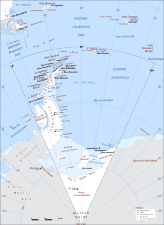
Argentine Antarctica is an area on Antarctica claimed by Argentina as part of its national territory. It consists of the Antarctic Peninsula and a triangular section extending to the South Pole, delimited by the 25° West and 74° West meridians and the 60° South parallel. This region overlaps with British and Chilean claims in Antarctica. None of these claims have widespread international recognition.

Maynas is one of the eight provinces in the Loreto Region in northeastern Peru. Its capital, Iquitos, is also Loreto's regional capital and the largest city in the Peruvian Amazon Rainforest.

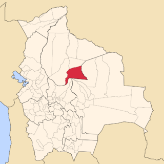
Marbán is a province in the Beni Department, Bolivia. The capital is Loreto.

Loreto College, Victoria is an independent Roman Catholic secondary day school for girls, located in central Ballarat, Victoria, Australia.
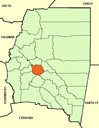
Loreto is a city located in central Argentina in the southwest of the province of Santiago del Estero, Argentina. It has 9,854 inhabitants as per the 2001 census [INDEC], and is the head town of the Loreto Department. It is located 59 km south from the provincial capital Santiago del Estero, on National Route 9.

Lagunas District is one of six districts of the Alto Amazonas Province, in the Department of Loreto, in Peru. It is bordered by the districts of Alto Pastaza, Pastaza, Jeberos, Santa Cruz, Urarinas and Parinari.
Loreto Municipality is a municipality of the Marbán Province in the Beni Department in Bolivia. Its seat is Loreto.
Ayuncha is a municipality and village in the Loreto Department in the Province of Santiago del Estero in Argentina. It is located 30 kilometers from Loreto, on Provincial Road 159, which provides access to the towns of Villa Atamisqui and Estación Atamisqui.

Jenner Glacier is a glacier 3 nautical miles (6 km) long flowing southwest from the Solvay Mountains between Paprat Peak and Kondolov Peak into the eastern arm of Duperré Bay, in the southern part of Brabant Island in the Palmer Archipelago, Antarctica.

Koch Glacier is a glacier 3 nautical miles (6 km) long immediately east of Jenner Glacier on the south side of Brabant Island, in the Palmer Archipelago, Antarctica. It drains the south slopes of Solvay Mountains and flows south-southwestwards into Chiriguano Bay southeast of Paprat Peak.
Deville Glacier is a glacier flowing along the south side of the Laussedat Heights into Andvord Bay, on the west coast of Graham Land. The glacier is shown on an Argentine government chart of 1952. It was named by the UK Antarctic Place-Names Committee in 1960 for Edouard G. Deville, Surveyor-General of Canada, 1885–1924, who introduced and developed photogrammetric methods of survey in Canada from 1888 onward.

Grubb Glacier is a glacier flowing into Lester Cove, Andvord Bay, to the west of Bagshawe Glacier, on the west coast of Graham Land, Antarctica. The glacier appears on an Argentine government chart of 1952. It was named by the UK Antarctic Place-Names Committee in 1960 for Thomas Grubb, an Irish optician who designed and introduced the first aplanatic camera lens, in 1857.
Green Glacier is a glacier on the east side of Graham Land, Antarctica, 15 nautical miles (28 km) long and 4 nautical miles (7 km) wide, flowing from the plateau northeast between Dugerjav Peak and Rugate Ridge, and then east into Vaughan Inlet next north of Pirne Peak and south of the terminus of Hektoria Glacier.
Miethe Glacier is a glacier 3 nautical miles (6 km) long, flowing northwest into Gerlache Strait to the south of Mount Banck, on the west coast of Graham Land, Antarctica. The glacier appears on an Argentine government chart of 1952. It was named by the UK Antarctic Place-Names Committee in 1960 for Adolf Miethe, a German chemist who introduced the first panchromatic emulsion for photographic plates in 1903.

Hippocrates Glacier is a glacier at least 3 nautical miles (6 km) long and 2 nautical miles (4 km) wide, draining the southeast slopes of Stribog Mountains and flowing southeast between Solvay Mountains and Gutsal Ridge into Buls Bay on the east side of Brabant Island, in the Palmer Archipelago, Antarctica. It was shown on an Argentine government chart in 1953, but not named. The glacier was photographed by Hunting Aerosurveys Ltd in 1956–57, and mapped from these photos in 1959. It was named by the UK Antarctic Place-Names Committee for Hippocrates, a Greek physician and author of numerous works on medicine, who also established a professional code of medical conduct.

San Martín is a department of Santiago del Estero Province (Argentina), and one of the twenty-seven administrative units of the province.

Lister Glacier is a glacier 5 nautical miles (9 km) long and 1 nautical mile (2 km) wide, draining the northeast slopes of Stribog Mountains and flowing into Bouquet Bay just south of Duclaux Point on the northeast side of Brabant Island, in the Palmer Archipelago, Antarctica.

Silípica Department is a department of Argentina in Santiago del Estero Province. The capital city of the department is Árraga.


