Candela is a city in the central region (Región Centro) of the northern Mexican state of Coahuila. It is the municipal seat of the surrounding municipality of Candela. There were 1,669 inhabitants in 2000. In 2011, according to Wolfram Alpha, it had a population of 1,672.

Chalatenango is a department of El Salvador, located in the northwest of the country. The capital is the city of Chalatenango. The Chalatenango Department encompasses 2,017 km² and contains more than 204,000 inhabitants. Las Matras Archaeological Ruins contains the relics of prehistoric populations and caves in which rock writing is found. The "5 de Noviembre" Hydroelectric Dam is found in Chalatenango Department, near the border with Cabañas. The highest point in the country, El Pital with an elevation of 2730.06 m, is also located in Chalatenango Department.

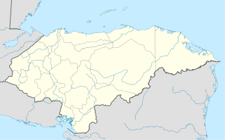
Santiago de Puringla is a municipality in the Honduran department of La Paz. The municipality is situated on a plain bordered by the River Puringla. South of the municipality runs the River Lepasale.

Andalgalá is a central department of Catamarca Province in Argentina.

Redwood Creek is a 9.5-mile-long (15.3 km) perennial stream located in San Mateo County, California, United States which discharges into South San Francisco Bay. The Port of Redwood City, the largest deepwater port in South San Francisco Bay, is situated on the east bank of Redwood Creek near its mouth, where the creek becomes a natural deepwater channel.

San Juan Bautista Tuxtepec, or simply referred to as Tuxtepec, is the head of the municipality by the same name and is the second most populous city of the Mexican state of Oaxaca. It is part of the Tuxtepec District of the Papaloapan Region. As of the 2020 census, the city is home to a population of 103,609 and 159,452 in the municipality, though census data are often under reported for various reasons. The municipality resides in the region called La Cuenca, is located 36 feet above sea level, and occupies an area of approximately 580 square miles (1,500 km2). The city itself is surrounded by the Papaloapan River, and lies a few kilometers south of the Cerro de Oro Dam on its tributary the Santo Domingo River. The municipality is bordered by the state of Veracruz in the north, the municipalities of Loma Bonita to the east and San José Chiltepec to the south. It is almost 100 miles (160 km) to the port of Veracruz, 130 miles (210 km) to Oaxaca City, the state capital, and 310 miles (500 km) to Mexico City.
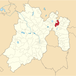
Ojo de Agua is the largest town in the municipality of Tecámac in State of Mexico, [[Mexico], also known as “Tierra de heroes”. It is located in the northeastern part of the state, northeast of the Federal District and within the Greater Mexico City urban area. It had a 2010 census population of 242,272 inhabitants, or 66.45 percent of its municipality's total of 364,579. Ojo de Agua is the largest locality in Mexico that is not a municipal seat. Ojo de Agua lies at an elevation of 2,248 m above sea level.

Lampazos de Naranjo is a city and municipality located in Nuevo León, Mexico. Its name is composed of two parts: the first honors the local plant Xanthosoma robustum, called lampazos in Spanish; the second, de Naranjo, means "of General Naranjo". According to the Mexican Statistics Authority 2000 Census, the municipality had 5,305 inhabitants.

Tlaxiaco is a city, and its surrounding municipality of the same name, in the Mexican state of Oaxaca. It is located in the Tlaxiaco District in the south of the Mixteca Region, with a population of about 17,450.

San Jose Ojos de Agua is a municipality is located in the department of Chalatenango in the North of El Salvador

Ojos de Agua is a municipality in the Chalatenango department of El Salvador. It is about 1700 feet from the border of Honduras and El Salvador, which is formed by the Rio Sumpul.

Ojos de Agua is a municipality in Comayagua Department in Honduras.
The following radio stations broadcast on AM frequency 800 kHz: 800 AM is a Mexican clear-channel frequency. XEROK Ciudad Juárez, Mexico, is the dominant station on 800 AM. See also List of broadcast station classes.

Tecámac is a municipality in State of Mexico in Mexico. The municipality covers an area of 157.34 km². The municipal seat lies in the town (locality) of Tecámac de Felipe Villanueva. Its largest town, Ojo de Agua, with a population of 242,283 inhabitants, is the largest locality in Mexico that is not a municipal seat.
Rancho Ojo de Agua de la Coche was a 8,927-acre (3,613 ha) Mexican land grant in present-day Santa Clara County, California given in 1835 by Governor José Figueroa to Juan María Hernandez. The name means "pig's spring". The grant extended south from Rancho Laguna Seca (Alvires) between Coyote Creek and Llagas Creek, and encompassed present-day Morgan Hill.

Villa Ojo de Agua is a municipality and village in Santiago del Estero Province in Argentina.
The Ojo de Agua Raid was the last important military engagement between Mexican Seditionistas and the United States Army. It took place at Ojo de Agua, Texas. As part of the Plan of San Diego, the rebels launched a raid across the Rio Grande into Texas on October 21, 1915 aimed at harassing the American outposts along the Mexican border and disrupting the local economy. After moving across the border, the Seditionistas began an assault against the United States Army Signal Corps station at Ojo de Agua. The small group of American defenders was cornered into a single building and suffered heavy casualties before reinforcements arrived driving the Seditionist force back into Mexico. The raid proved to be the tipping point in the American conflict with the Seditionistas, as its severity convinced American officials to send large numbers of American troops to the area in order to deter any further serious border raids by the Mexican force.
Ojo de Agua Dam is a dam located southeast of the town of El Tepehuaje de Morelos, Jalisco, Mexico. It is the apparently largest dam in the municipality of San Martín de Hidalgo.

Mexibús is a bus rapid transit (BRT) system that is located in the Greater Mexico City part of the State of Mexico, which surrounds Mexico City proper through 97 stations.
Events from the year 1915 in Mexico.


