Lorteburn

Last updated

The Lorteburn or Langbourne is a lost stream or river, which ran in the east of the City of London, arising near to Aldgate, flowing south near to the Tower of London, and discharging into the River Thames. The stream appears to have been covered over or dry by the early 14th century [1] but its course has been discovered during archaeological digs in the area [1] and the watershed can be traced in the street level contours of that part of the city as mapped by Kelsey in 1841. [2] The stream gave its name to the Langbourn ward of the city. The river is seldom included on maps or lists of London's lost rivers, and its existence is denied by Nicholas Barton, in his 1962 book Lost Rivers of London, [3] but in more recent work David Bentley argues for its existence. [1] [4]

Contents

Toponymy

The name Lorteburn is attested in a deed of 1288, when the stream was still extant. [1] The name Langbourne is attested in Stow in 1603, [5] when it had been dry for nearly two centuries.

In English River Names, Eilert Ekwall identifies several instances of Lorteburn. He gives the derivation as from an Old English word meaning dirt or filth. [6] Related to the Old Norse lortr ("excrement, faeces"), this implies a dirty or filthy stream, possibly one used for a sewer.

There is a second possibility given by Ekwall, a derivation from either the brook name Hlōra, or the mythical Norse female name Hlóra. The brook name derived from the Old English hlōwan meaning "The roaring one". This implies a swift stream with foaming water. [7] This derivation may seem unlikely given the short length of the stream, but the watercourse was steep, and 'roaring' does correspond with Stow's description. [5]

Burn or Bourne is a standard name for smaller streams and river, common in the area of London, for example the nearby rivers Ravensbourne, Tyburn and Westbourne. In place names it normally means 'stream'. [7]

Archaeological evidence

In 1981, David Bentley assembled evidence for the stream's existence, relying on archaeological and map evidence, especially in the records of the Museum of London. He first points out there is a shallow linear valley in that part of the city, first identified by Richard Kelsey's topographical survey in 1841. [2] The topography of this part of London has been changed almost beyond recognition since the 1841 survey, especially by the construction of the London, Tilbury and Southend Railway and its terminus at Fenchurch Street railway station, and thus this valley can no longer be seen in the modern contours.

Bentley then goes on to provide detailed evidence for the Lorteburn's existence. Archaeological evidence has identified dried stream beds in this part of the city. Discoveries include:

Bentley interprets this evidence as a stream called the Lorteburn recorded east of Seething Lane in the late 13th century. [1] [4]

Early references

Bentley has identified that:

A reference in the Husting Roll to a property described in relation to a stream in Seething Lane provides more tangible evidence that a water-course continued into medieval times. A deed of 1288(?) refers to a property within the parish of All Hallows' Barking which adjoined a street to the west and a stream, called Lorteburn, to the east. Other deeds of the same period show that the street was Seething Lane, and that the Lorteburn must therefore have flowed along a course east of, and more or less parallel to, the Lane

Bentley (1984) [1]

A very different course is described in 1603 by John Stow, [5] [11] giving the name as 'Langborne' and describing the route as running along Fenchurch Street, Lombard Street, and Sherbourn Lane. Stow states that the river gave its name to the Langbourn ward of the City of London. The stream was either covered over or dry by his time.

Langborne.; Shareborne lane. Langbourne ward. Langborne water, so called of the length thereof, was a great streame breaking out of the ground, in Fen Church street, which ran downe with a swift course, west, through that streete, thwart Grastreete, and downe Lumbard streete, to the west ende of S. Marie Wolnothes Church, and then turning the course South down Shareborne lane, so termed of sharing or diuiding, it brake into diuerse rilles or rillets to the Riuer of Thames: of this bourne that warde took the name, and is till this day called Langborne warde. This Bourne also is long since stopped vp at the head, and the rest of the course filled vp and paued ouer, so that no signe thereof remayneth more then the names aforesaid.

A Survey of London. Reprinted From the Text of 1603 By John Stow Edited by C L Kingsford. [12]

In 1770 John Noorthouck gives a similar description to Stow, with some additional details. [13]

Near Magpie-alley adjoining to the church of St. Catherine Coleman in Aldgate-ward was antiently a spring that produced a rivulet or bourn, which ran down the street westward, and through Lombard-street as far as the church of St. Mary Woolnoth. Here parting into several shares, or rills, and turning Southward, it left a name to Share-bourn-lane, or South-bourn-lane from its running southward to the Wallbrook, uniting with which it ran to the Thames. By this stream spreading near the Spring-head, the contiguous street became so swampy, or fenny, especially about the church, which stood in the broad way between Mincing-lane and Rood-lane, that it was then called Fenchurch-street. The Ward also partook of the name, and was enrolled in the city records by the appellation of Langbourne and Fenny-about.

A New History of London Including Westminster and Southwark by John Noorthouck, Book 2, Ch. 23: Langbourn Ward [14]

The church of St Katherine Coleman is indeed at the head of the course of the Lorteburn described by Bentley, but the rest of Stow and Noorthuck's descriptions are problematic given that they would require the water to flow uphill in the vicinity of Mincing Lane [3] (see below).

Nicholas Barton's disbelief

The 1962 book Lost Rivers of London by Nicholas Barton [3] is considered by many to be the foundational work on London rivers. Barton refutes the existence of the Langbourne for three reasons:

  1. "It does not fit in with the contours, and actually involves the proposed stream's flowing uphill to the extent of three feet, both in the ancient and modern ground levels."
  2. "During the construction of the Gracechurch Street sewer the builders specifically looked for it and found no traces."
  3. "Stow more or less admits that he himself has nothing more to go on than the name."

Barton's denial of the stream thus rests on Stowe's description, which describes a route far to the west of the one proposed by Bentley.

Inclusion on modern maps

The Lorteburn is included on some modern maps of Roman Londinium and early Medieval London.

Related Research Articles

<span class="mw-page-title-main">City of London</span> Central business district of London, England

The City of London, widely referred to simply as the City, is a city, ceremonial county and local government district that contains the ancient centre, and constitutes, alongside Canary Wharf, the primary central business district (CBD) of London and one of the leading financial centres of the world. It constituted most of London from its settlement by the Romans in the 1st century AD to the Middle Ages, but the modern area referred to as London has since grown far beyond the City of London boundary. The City is now only a small part of the metropolis of Greater London, though it remains a notable part of central London. The City of London is not one of the London boroughs, a status reserved for the other 32 districts. It is also a separate ceremonial county, being an enclave surrounded by Greater London, and is the smallest ceremonial county in England.

<span class="mw-page-title-main">River Fleet</span> Subterranean river in London, England

The River Fleet is the largest of London's subterranean rivers, all of which today contain foul water for treatment. It has been used as a sewer since the development of Joseph Bazalgette's London sewer system in the mid-19th century with the water being treated at Beckton Sewage Treatment Works. Its headwaters are two streams on Hampstead Heath, each of which was dammed into a series of ponds—the Hampstead Ponds and the Highgate Ponds—in the 18th century. At the southern edge of Hampstead Heath these descend underground as sewers and join in Camden Town. The waters flow 4 miles (6 km) from the ponds.

<span class="mw-page-title-main">Londinium</span> Settlement established on the current site of the City of London around 43–50 AD

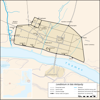
Londinium, also known as Roman London, was the capital of Roman Britain during most of the period of Roman rule. Most twenty-first century historians think that it was originally a settlement established shortly after the Claudian invasion of Britain, on the current site of the City of London around 47–50 AD, but some defend an older view that the city originated in a defensive enclosure constructed during the Claudian invasion in 43 AD. Its earliest securely-dated structure is a timber drain of 47 AD. It sat at a key ford at the River Thames which turned the city into a road nexus and major port, serving as a major commercial centre in Roman Britain until its abandonment during the 5th century.

<span class="mw-page-title-main">Pudding Lane</span> Street in the City of London

Pudding Lane is a small street in London, widely known as the location of Thomas Farriner's bakery, where the Great Fire of London started in 1666. It runs between Eastcheap and Thames Street in the historic City of London, and intersects Monument Street, the site of Christopher Wren's Monument to the Great Fire.

<span class="mw-page-title-main">London Wall</span> Defensive wall built around London

The London Wall is a defensive wall first built by the Romans around the strategically important port town of Londinium in c. AD 200, as well as the name of a modern street in the City of London, England.

<span class="mw-page-title-main">Moorfields</span> Former London open space

Moorfields was an open space, partly in the City of London, lying adjacent to – and outside – its northern wall, near the eponymous Moorgate. It was known for its marshy conditions, the result of the defensive wall acting as a dam, impeding the flow of the River Walbrook and its tributaries.

<span class="mw-page-title-main">Billingsgate</span> Ward of the City of London

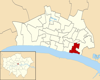
Billingsgate is one of the 25 Wards of the City of London. This small City Ward is situated on the north bank of the River Thames between London Bridge and Tower Bridge in the south-east of the Square Mile.

<span class="mw-page-title-main">Amounderness Hundred</span> Subdivision of the historic county of Lancashire

The Amounderness Hundred is one of the six subdivisions of the historic county of Lancashire in North West England, but the name is older than the system of hundreds first recorded in the 13th century and might best be described as the name of a Norse wapentake. In the Domesday Book of 1086, it was used for some territories north of the River Ribble included together with parts of Yorkshire. The area eventually became part of Lancashire, sitting geographically between the Rivers Lune and Ribble, in the strip of coast between the Irish Sea and Bowland Forest.

<span class="mw-page-title-main">River Misbourne</span> River in Buckinghamshire, England

The River Misbourne rises in a field on the outskirts of Great Missenden in Buckinghamshire, passing through Little Missenden, Old Amersham, Chalfont St Giles, Chalfont St Peter and under the Chiltern railway line and the M25 motorway to its confluence with the River Colne just north of where the Colne is crossed by Western Avenue, the A40 road. It falls by around 94 m (310 ft) in the course of its 27 km (17 mi) length.

<span class="mw-page-title-main">River Tyburn</span> Stream in London, England

The River Tyburn was a stream in London, England. Its main successor sewers emulate its main courses, but it resembled the Colne in its county of Middlesex in that it had many distributaries. It ran from South Hampstead, through Marylebone, Mayfair, St James's parish/district and Green Park to meet the tidal Thames at four sites, grouped into pairs. These pairs were near Whitehall Stairs, and by Thorney Street, between Millbank Tower and Thames House. Its much smaller cousin, the Tyburn Brook, was a tributary of the Westbourne and the next Thames tributary.

<span class="mw-page-title-main">River Walbrook</span> Subterranean river in the City of London, England

The Walbrook is a subterranean river in London. It gives its name to the Walbrook City ward and to a nearby street. It played an important role in the Roman settlement of Londinium.

<span class="mw-page-title-main">Threekingham</span> Village in the North Kesteven district of Lincolnshire, England

Threekingham is a village in the North Kesteven district of Lincolnshire, England. The population of the civil parish at the 2011 census was 233. It is situated on the A52 Grantham to Boston road, 6 miles (10 km) south from Sleaford, and close to the A15 Threekingham Bar roundabout. Mareham Lane, the Roman Road aligned with King Street, crosses the A15 at Threekingham.

In common with all old cities, the City of London has experienced numerous serious fires in the course of its history.

<span class="mw-page-title-main">Ironmonger Lane</span>

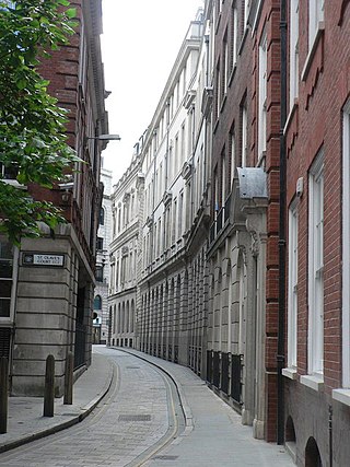
Ironmonger Lane is a narrow one-way street in the City of London running southbound between Gresham Street and Cheapside.

<span class="mw-page-title-main">St Edmund, King and Martyr</span> Church in London , England

St Edmund, King and Martyr, is an Anglican church in Lombard Street, in the City of London, dedicated to St Edmund the Martyr. From 2001 it housed the London Centre for Spirituality, renamed the London Centre for Spiritual Direction, but is still a consecrated church. Since 2019, Imprint Church organises regular worship inside of the building.

<span class="mw-page-title-main">Langbourn</span> Ward of the City of London

Langbourn is one of the 25 ancient wards of the City of London. It reputedly is named after a buried stream in the vicinity.

<span class="mw-page-title-main">Vintry</span> Ward of the City of London

Vintry is one of the 25 wards of the City of London. Located within it is the City end of Southwark Bridge and, adjacent to that, the hall of the Worshipful Company of Vintners, the City livery company for the wine trade.

<span class="mw-page-title-main">St Gabriel Fenchurch</span> Church in London, England

St Gabriel Fenchurch was a parish church in the Langbourn Ward of the City of London, destroyed in the Great Fire of London and not rebuilt.

<span class="mw-page-title-main">Lombard Street, London</span> Street in the City of London

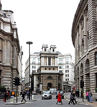
Lombard Street is a street notable for its connections with the City of London's merchant, banking and insurance industries, stretching back to medieval times.

<span class="mw-page-title-main">Ea Beck</span> River in South Yorkshire, England

The Ea Beck, also spelled Eaubeck or Eau Beck, is a small river in South Yorkshire, England, that flows eastwards into the River Don at Thorpe-in-Balne. The Environment Agency lists the beck as starting at South Elmsall, but mapping lists the beck with several names along its course. The beck has twice flooded areas and villages that it passes through in the 21st century.

References

  1. 1 2 3 4 5 6 Bentley, David (1984). "A recently identified valley in the City" (PDF). London Archaeologist. 05 (01): 13–16. Retrieved 2022-12-27.
  2. 1 2 Kelsey, Richard (1841), Original Plan of Contours, City of London Record Office, cited by Bentley (1984)
  3. 1 2 3 Barton, Nicholas (1962). Lost Rivers of London. Historical Publications Ltd. p. 60. ISBN   9780948667152.
  4. 1 2 Bentley, David (2000). "Recovering the Rivers of London" (PDF). London Topographical Society Newsletter. 50 (May 2000). Retrieved 2022-12-27.
  5. 1 2 3 Stow, John (1908). Kingsford, C L (ed.). A Survey of London. Reprinted From the Text of 1603. Oxford: Clarendon. pp. 11–19.
  6. Ekwall, Eilert (1928). English River Names. Oxford: Clarendon Press.; cited in Bentley (1984)
  7. 1 2 Ekwall, Eilert (1960). The Concise Oxford Dictionary of English Place-names. Oxford: Clarendon Press. p. 304. ISBN   0198691033.
  8. Marsden, Peter R V (1967). "Archaeological finds in the City of London, 1963-4". Transactions of the London and Middlesex Archaeological Society. 21 (3): 214.
  9. Museum of London D.U.A. Archive notes CAS75
  10. Museum of London D.U.A. Archive Report RAG82.
  11. "British History report". British-history.ac.uk. 2003-06-22. Retrieved 2022-12-27.
  12. https://www.british-history.ac.uk/no-series/survey-of-london-stow/1603/pp11-19
  13. Noorthuck, John (1773). A New History of London Including Westminster and Southwark. London: R Baldwin. pp. 656–661.
  14. http://www.british-history.ac.uk/no-series/new-history-london