Lovčić

Last updated
Lovčić
Village
Croatia location map.svg
Red pog.svg
Lovčić
Coordinates: 45°12′N17°48′E / 45.200°N 17.800°E / 45.200; 17.800
Country Flag of Croatia.svg  Croatia
County Flag of Brod-Posavina County.svg Brod-Posavina
Municipality Brodski Stupnik
Population (2011) [1]
  Total 63
Time zone CET (UTC+1)
  Summer (DST) CEST (UTC+2)
Postal code35253 Brodski Stupnik
Area code(s) 035

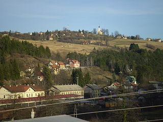
Lovčić is a village in municipality of Brodski Stupnik in the central part of Brod-Posavina County.

Village Small clustered human settlement smaller than a town

A village is a clustered human settlement or community, larger than a hamlet but smaller than a town, with a population ranging from a few hundred to a few thousand. Though villages are often located in rural areas, the term urban village is also applied to certain urban neighborhoods. Villages are normally permanent, with fixed dwellings; however, transient villages can occur. Further, the dwellings of a village are fairly close to one another, not scattered broadly over the landscape, as a dispersed settlement.

Municipality An administrative division having corporate status and usually some powers of self-government or jurisdiction

A municipality is usually a single administrative division having corporate status and powers of self-government or jurisdiction as granted by national and regional laws to which it is subordinate. It is to be distinguished (usually) from the county, which may encompass rural territory or numerous small communities such as towns, villages and hamlets.

Brodski Stupnik Village in Brod-Posavina, Croatia

Brodski Stupnik is a municipality in Brod-Posavina County, Croatia part of Slavonski Brod built-up area. There were 3,036 inhabitants at the 2011 census in which 95% declare themselves Croats. Brodski Stupnik is a centre for wine making.

Demographics

Historical populations of Lovčić 1857.-2011. [2] [3]

Lov%C4%8Di%C4%87


Related Research Articles

Karlovac County County in Croatia

Karlovac County is a county in central Croatia, with the administrative center in Karlovac.

Petlovac Municipality in Osijek-Baranja, Croatia

Petlovac is a village and municipality in the western part of Baranja, which comprise the northern part of Osijek-Baranja County in Croatia. Petlovac is underdeveloped municipality which is statistically classified as the First Category Area of Special State Concern by the Government of Croatia.

Moravice, Croatia Village in Primorje-Gorski Kotar, Croatia

Moravice is a settlement in north-western Croatia, situated at the far east of the mountainous region of Gorski kotar in the Primorje-Gorski Kotar County. It is part of the Vrbovsko municipality. The population is 664.

Moštanica Village in Croatia

Moštanica is a village in central Croatia, in the municipality/town of Petrinja, Sisak-Moslavina County. It is connected by the D30 highway.

Bokane Village in Continental Croatia, Croatia

Bokane is a village in Croatia, in the municipality of Voćin, Virovitica-Podravina County. It is connected by the D69 highway.

Macute Village in Continental Croatia, Croatia

Macute is a village in Croatia, in the municipality of Voćin, Virovitica-Podravina County. It is connected by the D69 highway.

Veliki Šušnjar Village in Central and Eastern Croatia, Croatia

Veliki Šušnjar is a village in central Croatia, in the municipality/town of Petrinja, Sisak-Moslavina County.

Gornja Mlinoga Village in Croatia

Gornja Mlinoga is a village in central Croatia, in the municipality/town of Petrinja, Sisak-Moslavina County. It is connected by the D30 highway.

Mala Gradusa Village in Continental Croatia, Croatia

Mala Gradusa is a village in central Croatia, in the municipality of Sunja, Sisak-Moslavina County. It is located in the Banija region.

Velika Popina Village in Croatia

Velika Popina is a village in Croatia. The settlement is administered as a part of Gračac municipality, Zadar County.

Pješčanica Village in Central and Eastern (Pannonian) Croatia, Croatia

Pješčanica is a village in central Croatia, in the municipality of Gvozd, Sisak-Moslavina County. It is connected by the D6 highway.

Podgorje, Sisak-Moslavina County Village in Central and Eastern Croatia, Croatia

Podgorje is a village in central Croatia, in the municipality of Gvozd, Sisak-Moslavina County. It is connected by the D6 highway.

Stipan Village in Continental Croatia, Croatia

Stipan is a village in central Croatia, in the municipality of Gvozd, Sisak-Moslavina County. It is connected by the D6 highway.

Šljivovac, Croatia Village in Central and Eastern (Pannonian) Croatia, Croatia

Šljivovac is a village in central Croatia, in the municipality of Gvozd, Sisak-Moslavina County. It is connected by the D6 highway.

Trepča, Sisak-Moslavina County Village in Central and Eastern (Pannonian) Croatia, Croatia

Trepča is a village in central Croatia, in the municipality of Gvozd, Sisak-Moslavina County. It is connected by the D6 highway.

Bobovac, Croatia Village in Continental Croatia, Croatia

Bobovac is a village in central Croatia, in the municipality of Sunja, Sisak-Moslavina County. It is located in the Banija region.

Staza Village in Continental Croatia, Croatia

Staza is a village in central Croatia, in the municipality of Sunja, Sisak-Moslavina County. It is located in the Banija region.

Slovinci Village in Continental Croatia, Croatia

Slovinci is a village in central Croatia, in the municipality of Sunja, Sisak-Moslavina County. It is located in the Banija region.

Malička Village in Continental Croatia, Croatia

Malička is a village in central Croatia, in the municipality of Topusko, Sisak-Moslavina County.

Končarev Kraj Village in Adriatic Croatia, Croatia

Končarev Kraj is a village in central Croatia, in the municipality of Plitvička Jezera, Lika-Senj County. It is connected by the D1 highway. It is a birthplace of Rade Končar, Croatian Serb antifascist, communist and People's Hero of Yugoslavia.

References

Coordinates: 45°11′N17°51′E / 45.183°N 17.850°E / 45.183; 17.850

Geographic coordinate system Coordinate system

A geographic coordinate system is a coordinate system that enables every location on Earth to be specified by a set of numbers, letters or symbols. The coordinates are often chosen such that one of the numbers represents a vertical position and two or three of the numbers represent a horizontal position; alternatively, a geographic position may be expressed in a combined three-dimensional Cartesian vector. A common choice of coordinates is latitude, longitude and elevation. To specify a location on a plane requires a map projection.