
Batu, officially the City of Batu, is a city in the East Java Province of Indonesia. It is about 20 km to the northwest of Malang. Formerly, it was a part of Malang Regency; but on 21 June 2001, Batu became an independent city, with its own mayor and council.

Mataram is a city and the capital of the Indonesian province of West Nusa Tenggara. The city is surrounded on all the landward sides by West Lombok Regency and lies on the western side of the island of Lombok, Indonesia. It is also the largest city of the province, and had a population of 402,843 at the 2010 Census and 429,651 at the 2020 Census; the official estimate as at mid 2023 was 441,147.

Cilegon is a major coastal industrial city in Banten province, Indonesia, covering 162.51 km2 (62.75 sq mi). It is located on the island of Java. The city had a population of 374,464 at the 2010 Census and 434,896 at the 2020 Census; the official estimate as at mid 2023 was 450,507 - comprising 228,360 males and 222,150 females.

Pasuruan is a city in East Java Province of Java, Indonesia. It had a population of 186,262 at the 2010 Census and 208,006 at the 2020 Census; the official estimate as at mid 2023 was 212,466.

Madiun is a landlocked city in the western part of East Java, Indonesia, known for its agricultural center. The city has been administratively separate from the surrounding Madiun Regency since the formation of the two bodies in 1950, but the city remained the seat of the regency administration until 2010. Madiun is commonly known as "Kota Gadis", which is an acronym for "Trading, Education and Industrial City" in Indonesian and sometimes known as Milaan van Java in Dutch language.

Mojokerto is a city in East Java Province of Indonesia. It is located 40 km southwest of Surabaya, the provincial capital, and constitutes one of the component units of the Surabaya metropolitan area which comprises Gresik Regency, Bangkalan Regency, Mojokerto Regency, Mojokerto City, Surabaya City, Sidoarjo Regency, and Lamongan Regency. The city covers an area of 20.21 km2, and had a population of 120,196 at the 2010 census and 132,434 at the 2020 Census; the official estimate as of mid-2023 was 141,785.

Klaten Regency is a regency in Central Java province in Indonesia. It covers an area of 701.52 km2 and had a population of 1,130,047 at the 2010 Census and 1,260,506 at the 2020 Census; the official estimate as at mid 2023 was 1,284,386. Its administrative centre is in the town of the same name; the town extends over 35.85 km2 to encompass three of the regency's districts, with a combined total of 135,681 inhabitants in mid 2023; a fourth district (Kalikotes) is part of its urban area.
Banjar, is a city located in the east of West Java, Indonesia, on the border between West Java and Central Java. It was originally administered as part of Ciamis Regency, which surrounds it, but was split off to become an independent city on 11 December 2002. It covers a land area of 131.97 km2, and had a population of 175,157 at the 2010 Census and 200,970 at the 2020 Census; the official estimate as of mid-2023 was 207,510. This city is also known as Banjar Patroman or Pataruman.
Blitar is a landlocked city in East Java, Indonesia, about 73 km from Malang and 167 km from Surabaya. The area lies within longitude 111° 40' – 112° 09' East and its latitude is 8° 06' South. The city of Blitar lies at an altitude on average 167 metres above sea level, and is an enclave within Blitar Regency which surrounds the city on all sides. It covers an area of 32.57 km2, and had a population of 131,968 at the 2010 Census and 149,149 at the 2020 Census; the official estimate as at mid 2023 was 159,781.

Lamongan Regency is a regency of the East Java Province of Indonesia. It has a total land area of approximately 1,812.8 km2 (699.9 sq mi) or + 3.78% of the area of East Java Province. With a length of 47 km (29 mi) along the coastline, the sea area of Lamongan Regency is about 902.4 km2 (348.4 sq mi), if calculated to a distance of 12 miles (19 km) across the ocean surface. At the 2010 census it had a population of 1,179,059; the 2020 Census produced a total of 1,379,628 and the official estimate as at mid-2023 was 1,385,835. The regency seat is the town of Lamongan, situated on the Solo River which passes from west to east through the regency, effectively dividing it in two.

Malang Regency is the second largest regency in East Java, Indonesia, with a total area of 3,530.65 km (2,193.84 mi). It is rich in potential for agriculture, medicinal plants and tourism.

Serang is a city and the capital of Banten province and was formerly also the administrative center of Serang Regency in Indonesia. The city is located towards the north of Banten province, on the island of Java; the north part of the city contains the coast zone facing onto Banten Bay, and includes the historical site of Old Banten, after which the province is named. Before Banten province was formed in 2000, Serang city was part of West Java province.
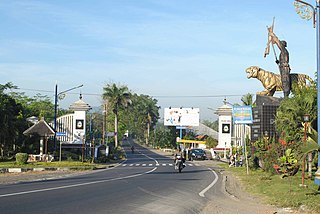
Rembang Regency is a regency on the extreme northeast coast of Central Java Province, on the island of Java in Indonesia. The regency covers an area of 1,036.70 km2 on Java, and it had a population of 591,359 at the 2010 Census and 645,333 at the 2020 Census; the official estimate as of mid-2023 was 660,166, of whom 331,870 were males and 328,296 were females. Its administrative capital is the town of Rembang.
Sragen Regency is a regency in the eastern part of Central Java province in Indonesia. It covers an area of 994.57 km2 and had a population of 858,266 at the 2010 Census and 976,951 at the 2020 Census; the official estimate as at mid 2023 was 997,485. Its capital is the town of Sragen, located about 30 km to the northeast of Surakarta. Sragen is bordered by East Java Province to the east.

Postal codes in Indonesia, known in Indonesian as kode pos consist of 5 digits.

Blimbing is a district (kecamatan) in Malang, East Java, Indonesia. Blimbing is the entrance to northern side of Malang city proper.

Klojen is a district in city of Malang, East Java, Indonesia.

Kedungkandang is the easternmost district (kecamatan) in Malang City, East Java, Indonesia. Almost half of this area is dominated by paddy fields and other agricultural lands. Malang old town (kotalama) also located in Kedungkandang.

Sukun is a district (kecamatan) in Malang, East Java, Indonesia. Bentoel Group, one of oldest and most famous Indonesian tobacco company based in the district.

Greater Malang is a region in East Java, Indonesia, encompassing the municipality of Malang and its hinterland. About 3 million people in East Java reside in Greater Malang. The principal city, Malang is well known as the home of notable universities in Indonesia, and the nearby Batu, is well known as a tourism centre in East Java.


