Luao River

Last updated
Luao River
Democratic Republic of the Congo relief location map.jpg
Red pog.svg
Location
Countries Democratic Republic of the Congo, Angola
ProvincesMoxico, Angola, Lualaba, DRC
Physical characteristics
Mouth  
  location
Kasai River
  coordinates
10°35′55″S22°18′40″E / 10.598500°S 22.311109°E / -10.598500; 22.311109 Coordinates: 10°35′55″S22°18′40″E / 10.598500°S 22.311109°E / -10.598500; 22.311109
Basin features
River system Kasai River

The Luao River forms part of the boundary between Angola and the Democratic Republic of the Congo. It is a right tributary of the Kasai River.

Contents

Location

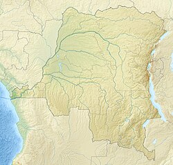
The Luao River flows from south to north along the border between Moxico Province of Angola and Lualaba Province of the Democratic Republic of the Congo (DRC). It flows between the towns of Luau in Angola and Dilolo in the DRC. [1] [ better source needed ]

Border settlement

The border agreement between Portugal and Belgium of 25 May 1891 defined part of the border as being a tributary of the Kasai up to Lago Dilolo. However, it was discovered that Lago Dilolo drained southeast into the Zambezi watershed rather than north to the Kasai. The Portuguese claimed that the Luao tributary of the Kasai should be taken as the boundary, while the Belgians were in favor of the Luacano River, a tributary of the Kasai farther to the west. Eventually Belgium ceded a large area west of the Luau River in an exchange of territories agreed on 22 July 1927. [2] In return for the "Dilolo Hook", Belgium gained a smaller area to the northwest which opened an easier railway route from Matadi to Léopoldville. [3]

Railway bridge

A bridge carries the Benguela railway and the EN230 highway across the river between Luau and Dililo. [1] [ better source needed ] The Benguela railway, built by a subsidiary of Tanganyika Concessions, was completed from Lobito on the Atlantic coast to Dilolo in August 1928. It took another 22 months to complete the 324 miles (521 km) line from Dilolo to Tenke, where it connected with the Katanga network run by the Compagnie du chemin de fer du bas-Congo au Katanga (BCK). The line was officially opened on 1 July 1931. [4] [5]

Notes

    1. 1 2 Way History: Luao (159813487).
    2. The Geographer 1972, p. 144.6.
    3. The Geographer 1972, p. 144.7.
    4. Ball 2015.
    5. Tanks Group Archive.

    Sources

    Related Research Articles

    <span class="mw-page-title-main">Kasai River</span> Tributary of the Congo River; part of the DR Congo-Angola border

    The Kasai River is a tributary of the Congo River, located in Central Africa. The river begins in central Angola and flows to the east until it reaches the border between Angola and the Democratic Republic of the Congo, where it turns north and serves as the border until it flows into the DRC. From Ilebo, between the confluences with Lulua river and Sankuru river, the Kasai river turns to a westerly direction. The lower stretch of the river from the confluence with Fimi river, is known as the Kwa(h) River, before it joins the Congo at Kwamouth northeast of Kinshasa. The Kasai basin consists mainly of equatorial rainforest areas, which provide an agricultural land in a region noted for its infertile, sandy soil. It is a tributary of Congo river and diamonds are found in it. Around 60% of diamonds in Belgium go from Kasai river for cutting and shaping.

    <span class="mw-page-title-main">Lobito</span> Municipality in Benguela Province, Angola

    Lobito is a municipality in Angola. It is located in Benguela Province, on the Atlantic Coast north of the Catumbela Estuary. The Lobito municipality had a population of 393,079 in 2014.

    <span class="mw-page-title-main">Benguela railway</span> Railway line in Angola

    The Benguela Railway is a Cape gauge railway line that runs through Angola from west to east, being the largest and most important railway line in the country. It also connects to Tenke in the Democratic Republic of the Congo (DRC), and to the Cape to Cairo Railway.

    <i>Société nationale des chemins de fer du Congo</i> National railway company for the inland railways of the Democratic Republic of the Congo

    The Société Nationale des chemins de fer du Congo is the national railway company for the inland railways of the Democratic Republic of the Congo.

    Luau is a town and municipality in Angola in the province of Moxico on the border with the Democratic Republic of Congo.

    Luacano is a town and municipality in Moxico Province, Angola. The municipality had a population of 20,755 in 2014.

    <span class="mw-page-title-main">Rail transport in Angola</span> Angolan railway lines and services

    Rail transport in Angola consists of three separate Cape gauge lines that do not connect: the northern Luanda Railway, the central Benguela Railway, and the southern Moçâmedes Railway (southern). The lines each connect the Atlantic coast to the interior of the country. A fourth system once linked Gunza and Gabala but is no longer operational.

    <span class="mw-page-title-main">Rail transport in the Democratic Republic of the Congo</span> Overview of rail transport in the Democratic Republic of the Congo

    Rail transport is provided in the Democratic Republic of the Congo by the Société Nationale des Chemins de Fer du Congo (SNCC), the Société commerciale des transports et des ports (SCTP) (previously Office National des Transports until 2011), and the Office des Chemins de fer des Ueles (CFU).

    <span class="mw-page-title-main">Beira–Lobito Highway</span>

    The Beira–Lobito Highway or TAH 9 is Trans-African Highway 9 in the transcontinental road network being developed by the United Nations Economic Commission for Africa (UNECA), the African Development Bank (ADB), and the African Union. The route has a length of 3,523 km (2,189 mi) crossing Angola, the most southerly part of the Democratic Republic of the Congo, Zambia, Zimbabwe, and central Mozambique.

    Dilolo is a town in Lualaba province, Democratic Republic of the Congo. It lies within five miles of the eastern bank of the Luao River, the DRC-Angolan border, and the Angolan town of Luau, at an altitude of 3510 ft.

    <span class="mw-page-title-main">Société Nationale des Chemins de Fer Zaïrois</span>

    The Société Nationale des Chemins de Fer Zaïrois (SNCZ) was the state railway company in Zaire formed in 1974 by combining several privately owned railways. It suffered from lack of maintenance of the tracks and rolling stock, weak management, and external factors such as the Angolan Civil War and the collapse of the economy of Zaire under President Mobutu Sese Seko. Despite two projects funded by the World Bank, it had virtually ceased to function by the 1990s. It was replaced in 1995 by the short-lived private company SIZARAIL, which in turn was replaced by the present Société nationale des chemins de fer du Congo.

    Luau International Airport is an airport serving Luau, a municipality in the Moxico Province of Angola. It is 6.5 kilometres (4.0 mi) west of the city, and may replace the Villa Teixeira de Sousa Airport, an unpaved airstrip that is within the city.

    <span class="mw-page-title-main">Geology of the Democratic Republic of the Congo</span>

    The geology of the Democratic Republic of the Congo is extremely old, on the order of several billion years for many rocks. The country spans the Congo Craton: a stable section of ancient continental crust, deformed and influenced by several different mountain building orogeny events, sedimentation, volcanism and the geologically recent effects of the East Africa Rift System in the east. The country's complicated tectonic past have yielded large deposits of gold, diamonds, coltan and other valuable minerals.

    <span class="mw-page-title-main">Angola–Democratic Republic of the Congo border</span> International border

    The Angola–Democratic Republic of the Congo border is 2,646 km in length and consists of two non-contiguous sections: a 225 km section along the border with Angola's province of Cabinda, running from the Atlantic Ocean to the tripoint with the Republic of Congo, and a much longer 2,421 km section running from the Atlantic to the tripoint with Zambia.

    <span class="mw-page-title-main">Compagnie du chemin de fer du bas-Congo au Katanga</span>

    The Compagnie du chemin de fer du bas-Congo au Katanga (BCK) was a railway operator in the Congo Free State, Belgian Congo and later in the Democratic Republic of the Congo and Zaire. Most of the lines were in the southern Katanga Province, with links to the Kasai River for transport of mineral exports down to Kinshasa and onward to the port of Matadi, and a link to the Angolan railway network for transport to Lobito on the Atlantic.

    <span class="mw-page-title-main">Compagnie de Chemin de fer du Katanga</span>

    The Compagnie de Chemin de fer du Katanga (CFK) was a railway company in the Congo Free State and Belgian Congo between 1902 and 1952. It held the railway concession that linked the port of Bukama on the navigable section of the Lualaba River through the mining region and the town of Elisabethville (Lubumbashi) to Sakania, where it connected with the Rhodesian railway network. Operations were subcontracted to the Compagnie du chemin de fer du bas-Congo au Katanga (BCK).

    The Société des Chemins de fer Léopoldville-Katanga-Dilolo (LKD) was a railway concession owner in the Congo Free State, Belgian Congo. The network was built, maintained and operated by the Compagnie du chemin de fer du bas-Congo au Katanga (BCK).

    <span class="mw-page-title-main">Tanganyika Concessions</span> Former British mining and railway company operating in Africa

    Tanganyika Concessions Limited was a British mining and railway company founded by the Scottish engineer and entrepreneur Robert Williams in 1899. The purpose was to exploit minerals in Northern Rhodesia and in the Congo Free State. Partly-owned subsidiaries included the Union Minière du Haut-Katanga (UMHK), which undertook mining in the Katanga portion of the copperbelt, and the Benguela railway, which provided a rail link across Angola to the Atlantic Ocean. Belgian banks eventually took over control of the company. The Angolan railway concession was returned to the state of Angola in 2001.

    The Tshilongo River is a river in the southeast of the Democratic Republic of the Congo.

    Odon Jadot was a Belgian railway engineer and administrator. He was responsible for building more than 1,650 kilometres (1,030 mi) of railroad in the Belgian Congo. The lines helped carry copper mined in the Katanga Province to the sea via the ports of Matadi in the Congo, Dilolo in Angola and Beira in Mozambique. They also supported troop movements during World War I (1914–1918) and World War II (1939–1045).