Coordinates: 39°13′09″N122°14′46″W / 39.21917°N 122.24611°W

A geographic coordinate system is a coordinate system that enables every location on Earth to be specified by a set of numbers, letters or symbols. The coordinates are often chosen such that one of the numbers represents a vertical position and two or three of the numbers represent a horizontal position; alternatively, a geographic position may be expressed in a combined three-dimensional Cartesian vector. A common choice of coordinates is latitude, longitude and elevation. To specify a location on a plane requires a map projection.
| Lurline | |
|---|---|
| Former settlement | |
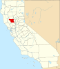
 Lurline Location in California | |
| Coordinates: 39°13′09″N122°14′46″W / 39.21917°N 122.24611°W | |
| Country | United States |
| State | California |
| County | Colusa County |
| Elevation [1] | 112 ft (34 m) |
Lurline is a former settlement in Colusa County, California. It lay at an elevation of 112 feet (34 m). It still appeared on maps as of 1918.

Colusa County is a county in the U.S. state of California. As of the 2010 census, the population was 21,419. The county seat is Colusa. It is in the Central Valley of California, northwest of the state capital, Sacramento.

California is a state in the Pacific Region of the United States. With 39.6 million residents, California is the most populous U.S. state and the third-largest by area. The state capital is Sacramento. The Greater Los Angeles Area and the San Francisco Bay Area are the nation's second and fifth most populous urban regions, with 18.7 million and 9.7 million residents respectively. Los Angeles is California's most populous city, and the country's second most populous, after New York City. California also has the nation's most populous county, Los Angeles County, and its largest county by area, San Bernardino County. The City and County of San Francisco is both the country's second-most densely populated major city after New York City and the fifth-most densely populated county, behind only four of the five New York City boroughs.