Stegeman, California

Last updated

Coordinates: 39°21′28″N122°01′43″W / 39.35778°N 122.02861°W / 39.35778; -122.02861

Geographic coordinate system Coordinate system

A geographic coordinate system is a coordinate system that enables every location on Earth to be specified by a set of numbers, letters or symbols. The coordinates are often chosen such that one of the numbers represents a vertical position and two or three of the numbers represent a horizontal position; alternatively, a geographic position may be expressed in a combined three-dimensional Cartesian vector. A common choice of coordinates is latitude, longitude and elevation. To specify a location on a plane requires a map projection.

Stegeman
Unincorporated community
California Locator Map with US.PNG
Red pog.svg
Stegeman
Location in California
Usa edcp location map.svg
Red pog.svg
Stegeman
Stegeman (the US)
Coordinates: 39°21′28″N122°01′43″W / 39.35778°N 122.02861°W / 39.35778; -122.02861
Country United States
State California
County Colusa County
Elevation [1] 79 ft (24 m)

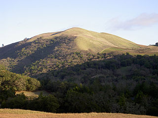
Stegeman (formerly, Stegemann) is an unincorporated community in Colusa County, California. It lies at an elevation of 79 feet (24 m).

Unincorporated area Region of land not governed by own local government

In law, an unincorporated area is a region of land that is not governed by a local municipal corporation; similarly an unincorporated community is a settlement that is not governed by its own local municipal corporation, but rather is administered as part of larger administrative divisions, such as a township, parish, borough, county, city, canton, state, province or country. Occasionally, municipalities dissolve or disincorporate, which may happen if they become fiscally insolvent, and services become the responsibility of a higher administration. Widespread unincorporated communities and areas are a distinguishing feature of the United States and Canada. In most other countries of the world, there are either no unincorporated areas at all, or these are very rare; typically remote, outlying, sparsely populated or uninhabited areas.

Colusa County, California County in California, United States

Colusa County is a county in the U.S. state of California. As of the 2010 census, the population was 21,419. The county seat is Colusa. It is in the Central Valley of California, northwest of the state capital, Sacramento.

California State of the United States of America

California is a state in the Pacific Region of the United States. With 39.6 million residents, California is the most populous U.S. state and the third-largest by area. The state capital is Sacramento. The Greater Los Angeles Area and the San Francisco Bay Area are the nation's second and fifth most populous urban regions, with 18.7 million and 8.8 million residents respectively. Los Angeles is California's most populous city, and the country's second most populous, after New York. California also has the nation's most populous county, Los Angeles County, and its largest county by area, San Bernardino County. The City and County of San Francisco is both the country's second-most densely populated major city after New York and the fifth-most densely populated county, behind only four of the five New York City boroughs.

Related Research Articles

Woodson Bridge State Recreation Area is a woodland park located along the Sacramento River in Tehama County, California.

Glenn, California Unincorporated community in California, United States

Glenn is an unincorporated community in Glenn County, California. It lies at an elevation of 98 feet. The town is located on the Sacramento River, at the intersection of State Route 45 and State Route 162. It is about ten miles (16 km) east of Interstate 5 and Willows on the U.S. Geological Survey 7.5-minute quadrangle, Glenn, California. The U.S. Geological Survey, National Geographic Names Database, calls its existence official with a feature ID of 1658621 and lists the NAD27 coordinates of the community as 39°31′19″N122°00′50″W. The ZIP Code, shared with Ordbend and Bayliss, is 95943. The community is inside area code 530. This area is flagged as rural by the U.S. Census Bureau.

Bald Mountain (California) name given to over fifty summits in California

Bald Mountain is a name given to over fifty summits in California.

Merrills Landing, California Unincorporated community in California, United States

Merrills Landing is an unincorporated community in Butte County, California, on the Sacramento River. It lies at an elevation of 177 feet.

Soto, California Former settlement in California, United States

Soto is a ghost town in Butte County, California, United States. It was located 14 miles (23 km) northwest of Chico on the Southern Pacific Railroad, at an elevation of 184 feet. It still appeared on maps as of 1904.

Mattos, California Unincorporated community in California, United States

Mattos is an unincorporated community in Alameda County, California. It is located 1.5 miles (2.4 km) northeast of downtown Newark, at an elevation of 39 feet.

Colusa Rancheria, California Unincorporated community in California, United States

Colusa Rancheria is an unincorporated community in Colusa County, California. It lies at an elevation of 59 feet. The inhabitants belong to the Wintun tribe. It was established in 1907. As of the 2010 Census the population was 76.

Cortena, California Unincorporated community in California, United States

Cortena is an unincorporated community in Colusa County, California. It lies at the junction of the Southern Pacific Railroad and the Colusa and Lake Railroad, at an elevation of 79 feet. Colusa Junction had a post office from 1886 to 1914.

Delevan, California Unincorporated community in California, United States

Delevan is an unincorporated community in Colusa County, California, 3.5 miles (5.6 km) south of Norman and 5 miles (8.0 km) north of Maxwell. It lies at an elevation of 92 feet. A post office was established at Delevan in 1902, closed in 1917, and reopened in 1922. As of 2016, Delevan had a population of 70.

Delphos, California Unincorporated community in California, United States

Delphos is an unincorporated community in Colusa County, California. It lies at an elevation of 75 feet. The community developed along the Southern Pacific Railroad.

Devils Elbow, California Unincorporated community in California, United States

Devils Elbow is an unincorporated community in Colusa County, California. It lies at an elevation of 919 feet.

Fouts Springs, California Unincorporated community in California, United States

Fouts Springs is an unincorporated community in Colusa County, California. It lies at an elevation of 1713 feet. It is best known for being the headquarters of the New Tribes Mission. The post office was established in 1882, closed in 1913, reopened in 1945, closed again in 1947, reopened in 1950 and closed for good in 1956. The place is named for John F. Fouts who discovered the springs here in 1873. The springs supported a resort capable of hosting 150 guests that operated here in the early part of the 20th century.

Genevra, California Unincorporated community in California, United States

Genevra is an unincorporated community in Colusa County, California. It lies at an elevation of 98 feet. The place was named Berlin in the 1870s by officials of the Southern Pacific Railroad on whose tracks it was established. The post office was established in 1876, and renamed from Berlin to Genevra during World War I; the post office closed in 1934.

Leesville, California Unincorporated community in California, United States

Leesville is an unincorporated community in Colusa County, California. It lies at an elevation of 1434 feet. It had a post office from 1874 to 1920. The town is named for Lee Harl, a pioneer landowner.

Prize, California Former settlement in California, United States

Prize is a former settlement in Colusa County, California. It lay at an elevation of 49 feet. A post office operated in Prize from 1900 to 1919.

Wilbur Springs, California Unincorporated community in California, United States

Wilbur Springs is an unincorporated community in Colusa County, California. It lies at an elevation of 1450 feet.

Deming Woods, Indiana Unincorporated community in Indiana, United States

Deming Woods is an unincorporated community in eastern Harrison Township, Vigo County, in the U.S. state of Indiana.

Creekwood Cove Estates is an unincorporated community in Gloucester County, in the U. S. state of Virginia.

Roberts, Montana Census-designated place in Montana, United States

Roberts is a census-designated place and unincorporated town in Carbon County, Montana, United States. As of the 2010 census it had a population of 361. It is home to the Roberts School District, which enrolls 64 students as of 2013.

Eastdale is an extinct town in Costilla County, in the U.S. state of Colorado. The GNIS classifies it as a populated place.

References