
The Paris Métro, operated by the Régie autonome des transports parisiens (RATP), is a rapid transit system in the Paris metropolitan area, France. A symbol of the city, it is known for its density within the capital's territorial limits, uniform architecture and unique entrances influenced by Art Nouveau. The system is 226.9 kilometres (141.0 mi) long, mostly underground. It has 308 stations of which 64 have transfers between lines. There are 16 lines, numbered 1 to 14, with two lines, 3bis and 7bis, named because they started out as branches of Line 3 and Line 7, respectively. Line 1, Line 4 and Line 14 are automated. Lines are identified on maps by number and colour, with the direction of travel indicated by the terminus.

The Réseau Express Régional, commonly abbreviated RER, is a hybrid regional rail and rapid transit system serving Paris and its suburbs. It acts as a combined city-center underground rail system and suburbs-to-city-center regional rail. In the city center, it acts as a faster counterpart of the Paris Métro, having fewer stops.

The Ligne de Sceaux was a railway line in France running from Paris, which initially linked the Place Denfert-Rochereau (then called the Place d'Enfer, in Paris, to the town of Sceaux.
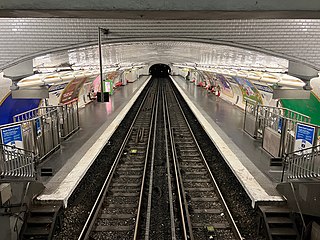
Ranelagh is a station on line 9 of the Paris Métro located in the 16th arrondissement.

Port-Royal station is a French railway station on the RER B line in Paris. It is located in the 5th arrondissement, not far from its tripoint border with the 6th and 14th arrondissements. It is named after Port-Royal Abbey, Paris.

RER B is one of the five lines in the Réseau Express Régional, a hybrid commuter rail and rapid transit system serving Paris, France and its Île-de-France suburbs. The 80-kilometre (50 mi) RER B line crosses the region from north to south, with all trains serving a group of stations in central Paris, before branching out towards the ends of the line.

RER C is one of the five lines in the Réseau Express Régional, a hybrid commuter rail and rapid transit system serving Paris and its suburbs. The 186-kilometre (116 mi) line crosses the region from north to south. Briefly, between September 1979 and May 1980, the line was known as the Transversal Rive Gauche. The line is operated by SNCF.

RER D is one of the five lines in the Réseau Express Régional, a hybrid commuter rail and rapid transit system serving Paris and its suburbs. The 190-kilometre (120 mi) line crosses the region from north to south, with all trains serving a group of stations in central Paris, before branching out towards the ends of the line.

Javel–André Citroën is a station of the Paris Métro, serving line 10 and offering transfer to the RER C via Javel RER station in the 15th arrondissement. West of this station, line 10 splits into separate eastbound and westbound sections until Boulogne–Jean Jaurès.

Denfert-Rochereau station is a railway station in Paris. It was one of the first stations of the French railway network, and is still in use as a station of Paris' RER line B.

Val de Fontenay station is a Réseau Express Régional station in the Paris suburb Fontenay-sous-Bois. It is on the Paris-Est–Mulhouse-Ville railway and provides an interchange between the RER lines A and E.
Torcy station is a railway station in Torcy, Seine-et-Marne, a suburb east of Paris.

Aéroport Charles de Gaulle 1 is one of two railway stations at Charles de Gaulle Airport, the primary airport for the Paris region and the largest in France. The station is served by RER B and CDGVAL.
Lognes station is a railway station on RER train network in Lognes, Seine-et-Marne.

Val d'Europe station is a railway station on the RER A line in Val d'Europe, the eastmost part of the new town of Marne-la-Vallée.
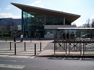
Noisy–Champs station is a railway station on the RER train network at the border between Champs-sur-Marne, Seine-et-Marne and Noisy-le-Grand, Seine-Saint-Denis, France.

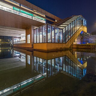
Noisiel station is a railway station on the Réseau Express Régional train network in Noisiel, Seine-et-Marne.

Noisy-le-Grand–Mont d'Est station is a train station in Noisy-le-Grand, Seine-Saint-Denis, under Les Arcades department store.

Gentilly station is a station on the line B of the Réseau Express Régional, a hybrid suburban commuter and rapid transit line. It is named after the city of Gentilly where the station is located.
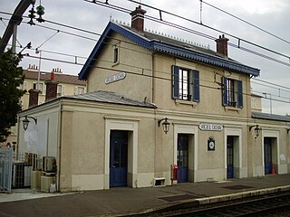
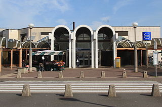
Arcueil–Cachan station is a station on the line B of the Réseau Express Régional, a hybrid suburban commuter and rapid transit line. This will also be a station for Paris Metro Line 15. The station takes its name from its location near the city of Arcueil and inside the town of Cachan.
