Annapolis County is a county in the Canadian province of Nova Scotia located in the western part of the province located on the Bay of Fundy. The county seat is Annapolis Royal.

Cape Breton Highlands National Park is a Canadian national park on northern Cape Breton Island in Nova Scotia. The park was the first national park in the Atlantic provinces of Canada and covers an area of 948 square kilometres (366 sq mi). It is one of 42 in Canada's system of national parks.
The Cabot Trail is a scenic highway on Cape Breton Island in Nova Scotia, Canada. It is a 298 km (185 mi) loop around the northern tip of the island, passing along and through the Cape Breton Highlands and the Cape Breton Highlands National Park.
Kejimkujik National Park is a National Park of Canada, covering 404 km2 (156 sq mi) in the southwest of Nova Scotia peninsula. Located within three municipalities, Annapolis, Queens, Digby, it consists of two separate land areas: an inland part, which is coincident with the Kejimkujik National Historic Site of Canada, and the Kejimkujik National Park Seaside on the Atlantic coast.

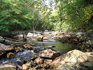
The Mersey River, formerly known as Rivière Rossignol by the Acadians, is a river in Nova Scotia, Canada. It is named after the River Mersey in Liverpool, England. The river proper flows from the eastern end of Eleven Mile Lake in Annapolis County southward to Kejimkujik Lake in Kejimkujik National Park, then through Lake Rossignol to empty into the Atlantic Ocean at the town of Liverpool, Nova Scotia. The true source of the river however is as far northwest as Sandy Bottom Lake or Tuskopeake Brook on the northern tributary.

The Tent Dwellers is a book by Albert Bigelow Paine, chronicling his travels through inland Nova Scotia on a trout fishing trip with Dr. Edward "Eddie" Breck, and with guides Charles "the Strong" and Del "the Stout", one June in the early 1900s. Originally published in 1908, The story starts at what is now known as the Legendary Milford House; Renowned author Albert Bigelow Paine,, chronicled his first impression of the Milford House Lodge in his famous book, in the following way … "Then at last came a church, a scattering string of houses, a neat white hotel and the edge of the wilderness had been reached." Those travelling today from Annapolis Royal will witness little change in the scenery or the impact from this turn of the century description. The book takes place in what is now Kejimkujik National Park and the adjacent Tobeatic Game Reserve. The Reserve later became the Tobeatic Wildlife Management Area, and in 1998 was included within the newly created Tobeatic Wilderness Area.
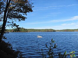
Kejimikujik lake is the namesake lake and the largest lake in Kejimkujik National Park and the second largest freshwater lake in Nova Scotia after Lake Rossignol. The word 'Kejimkujik' is agreed by all to be a word derived from the Mi'kmaq language, but depending on the source will be said to mean "attempting to escape" or "swollen waters". The park's official stance is that Kejimkujik is a Mi'kmaq word meaning "little fairies".

Caledonia, Nova Scotia is a community located in northern Region of Queens Municipality, Nova Scotia along Trunk 8. Caledonia is the major community in the area known as North Queens, which has a radius of approximately 30 kilometers and a population of approximately 1500.
The Tobeatic Wilderness Area is the largest protected area in the Canadian Maritimes, located in southwestern Nova Scotia. It contains nearly 120,000 hectares of land and spans parts of five counties, Annapolis, Digby, Queens, Shelburne and Yarmouth. Located adjacent to Kejimkujik National Park, it was formerly known as the Tobeatic Wildlife Management Area, and the Tobeatic Game Reserve.

Trunk 8 is part of the Canadian province of Nova Scotia's system of Trunk Highways. The route runs from Liverpool to Annapolis Royal, a distance of 113 kilometres (70 mi). Trunk 8 is also known as the Kejimkujik Scenic Drive.
Springfield, Nova Scotia is located between Middleton and Bridgewater. Springfield is in the centre of western Nova Scotia located on Trunk 10, 140 km west of Halifax.

Lake Charlotte is a rural cottage community on the Eastern Shore of the Halifax Regional Municipality, Nova Scotia, Canada. The community is located on the junction of Trunk 7 and Clam Harbour Road, 58.23 kilometers from Downtown Halifax.
Mill Village is a Canadian rural community in the Region of Queens Municipality, Nova Scotia. It developed in relation to the lumber industry. Located inland from the Atlantic coast, Mill Village was the site of Canada's first satellite earth station constructed in the 1960s.

Cape Chignecto Provincial Park is a Canadian provincial park located in Nova Scotia. A wilderness park, it derives its name from Cape Chignecto, a prominent headland which divides the Bay of Fundy with Chignecto Bay to the north and the Minas Channel leading to the Minas Basin to the east. The park, which opened in 1998, is the largest provincial park in Nova Scotia. It also anchors one end of the UNESCO Cliffs of Fundy Global Geopark.
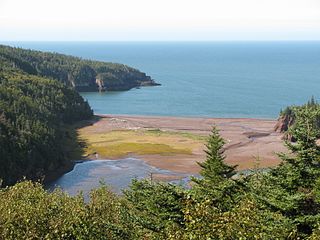
Eatonville is a former lumber and shipbuilding village in Cumberland County, Nova Scotia. It includes a large tidal harbour at the mouth of the Eatonville Brook beside several dramatic sea stacks known as the "Three Sisters". It was founded in 1826 and abandoned in the 1940s. The site of the village is now part of Cape Chignecto Provincial Park.
Northfield is a community in the Canadian province of Nova Scotia, located in the Region of Queens Municipality.

Uisge Ban Falls Provincial Park is a provincial park near New Glen, in the Canadian province of Nova Scotia on Cape Breton Island. Located on the North Branch Road 14.5 kilometres (9.0 mi) north of Baddeck, the civic address of the park entrance is 715 North Branch Road, Baddeck Forks, Nova Scotia, Canada B0E 1B0.

Nova Scotia has two major national parks, Cape Breton Highlands National Park and Kejimkujik National Park. Nova Scotia is also home to three UNESCO world heritage sites. The two cultural and one natural site are the town of Old Lunenberg, the Grand-Pré National Historic Site, and the Joggins fossil cliffs. Nova Scotia is also famous for its numerous historical sites, museums, and natural areas.

Bierstadt Lake is located in Larimer County, Colorado and within the Rocky Mountain National Park. Near McHenrys Peak and Longs Peak, there are "spectacular views" of the Continental Divide at the lake. The Bierstadt Lake Trailhead is located about 6.5 miles (10.5 km) from the turn-off at U.S. Route 36 into the Rocky Mountain National Park. During the summer, shuttle buses provide transportation to the trailhead.

The Eastern Shore Granite Ridge, also known as the Musquodoboit Batholith, is a range of prominent hills averaging 100-125m (330-410ft) in height, located just inland from the Eastern Shore of Nova Scotia. Geologically, it is related to the much larger South Mountain Batholith, but the two are geologically distinct areas. Many of the hills have steep cliffs on one or more of their sides, some featuring vertical drops in excess of 50m (160ft); as a result, many of the taller hills offer extensive views despite their relatively low elevation.