
Interstate 24 (I-24) is an Interstate Highway in the Midwestern and Southeastern United States. It runs diagonally from I-57, 10 miles (16 km) south of Marion, Illinois, to Chattanooga, Tennessee, at I-75. It travels through Illinois, Kentucky, Tennessee, and Georgia. As an even-numbered Interstate, it is signed as an east–west route, though the route follows a more southeast–northwest routing, passing through Nashville, Tennessee. The numbering deviates from the standard Interstate Highway System grid, lying further north than its number would indicate west of Nashville. The short segment within Georgia bears the unsigned designation State Route 409 (SR 409).

Interstate 40 (I-40) is a major east–west transcontinental Interstate Highway in the southeastern and southwestern portions of the United States. At a length of 2,556.61 miles (4,114.46 km), it is the third-longest Interstate Highway in the country, after I-90 and I-80. From west to east, it passes through California, Arizona, New Mexico, Texas, Oklahoma, Arkansas, Tennessee, and North Carolina. Its western terminus is at I-15 in Barstow, California, while its eastern terminus is at a concurrency with U.S. Route 117 (US 117) and North Carolina Highway 132 (NC 132) in Wilmington, North Carolina. Major cities served by the interstate include Flagstaff, Arizona; Albuquerque, New Mexico; Amarillo, Texas; Oklahoma City, Oklahoma; Little Rock, Arkansas; Memphis, Nashville, and Knoxville in Tennessee; and Asheville, Winston-Salem, Greensboro, Durham, Raleigh, and Wilmington in North Carolina.

Interstate 65 (I-65) is a major north–south interstate highway in the central United States. As with most primary interstates ending in 5, it is a major crosscountry, north–south route, connecting between the Great Lakes and the Gulf of Mexico. Its southern terminus is located at an interchange with I-10 in Mobile, Alabama, and its northern terminus is at an interchange with US 12 (US 12) and US 20 in Gary, Indiana, just southeast of Chicago. I-65 connects several major metropolitan areas in the Midwest and Southern US. It connects the four largest cities in Alabama: Mobile, Montgomery, Birmingham, and Huntsville. It also serves as one of the main north–south routes through Nashville, Tennessee; Louisville, Kentucky; and Indianapolis, Indiana, each a major metropolitan area in its respective state.

Interstate 640 (I-640) is an east–west auxiliary Interstate Highway in Knoxville, Tennessee. It serves as a bypass for I-40 around Downtown Knoxville and is also an alternative route for traffic passing between I-40 and I-75. All trucks carrying hazardous cargo through Knoxville are required to use I-640. It has a total length of 10.80 miles (17.38 km) and runs approximately three miles (4.8 km) north of downtown through the northern neighborhoods of Knoxville.
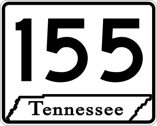
State Route 155, mostly designated as Briley Parkway, is a major freeway and parkway beltway around Nashville, Tennessee. It is 35.1 miles (56.5 km) long.
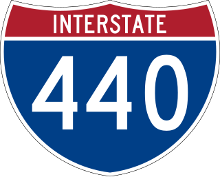
Interstate 440 (I-440) is an east–west auxiliary Interstate Highway that runs through Nashville, Tennessee. It serves as a southern bypass around downtown Nashville, and is located on average about three miles (4.8 km) from the center of the city. I-440 is also known locally as the Four-Forty Parkway, and is designated as the Debra K. Johnson Memorial Parkway. At a length of 7.64 miles (12.30 km), I-440 runs between I-40 and I-24, and connects to I-65 and multiple U.S. Routes. Combined, I-440 and Briley Parkway, a controlled-access segment of State Route 155 (SR 155), form a noncontiguous inner beltway around downtown Nashville.

U.S. Route 31E (US 31E) is the eastern parallel route for U.S. Highway 31 from Nashville, Tennessee, to Louisville, Kentucky.

U.S. Route 31W is the westernmost of two parallel routes for U.S. Route 31 from Nashville, Tennessee to Louisville, Kentucky.
Interstate 65 (I-65) in the US state of Indiana traverses from the south-southeastern Falls City area bordering Louisville, Kentucky, through the centrally located capital city of Indianapolis, to the northwestern Calumet Region of the Hoosier State which is part of the Chicago metropolitan area. The Indiana portion of I-65 begins in Jeffersonville after crossing the Ohio River and travels mainly north, passing just west of Columbus prior to reaching the Indianapolis metro area. Upon reaching Indianapolis, the route alignment of I-65 begins to run more to the northwest and subsequently passes Lafayette on that city's east and north sides. Northwest of there, in west-central Jasper County, the route again curves more northward as it approaches the Calumet Region. Shortly after passing a major junction with I-80 and I-94, I-65 reaches its northern national terminus in Gary at US Highway 12/US Highway 20 after an interchange on I-90. I-65 covers 261.27 miles (420.47 km) in the state of Indiana. This is one of the principal Interstate Highways that cross the state, and, more specifically, intersect at the city of Indianapolis, that has given the state the nickname of "Crossroads of America".

Interstate 55 (I-55) is part of the Interstate Highway System that runs from LaPlace, Louisiana, to Chicago, Illinois. In the state of Tennessee, the Interstate is located entirely within the state's second-largest city of Memphis, running 12.28 miles (19.76 km) from the Mississippi state line in the Whitehaven neighborhood to the Arkansas border across the Mississippi River. Of the six states that the Interstate passes through, the segment in Tennessee is the shortest, as well as the shortest mainline Interstate segment in Tennessee. I-55 serves a number of neighborhoods and industrial areas in the southwestern portion of Memphis, and also provides access to the Memphis International Airport, the second-busiest cargo airport in the world.
Interstate 40 (I-40) is part of the Interstate Highway System that runs 2,556.61 miles (4,114.46 km) from Barstow, California, to Wilmington, North Carolina. The highway crosses Tennessee from west to east, from the Mississippi River at the Arkansas border to the Blue Ridge Mountains at the North Carolina border. At 455.28 miles (732.70 km), the Tennessee segment of I-40 is the longest of the eight states through which it passes and the state's longest Interstate Highway.
Interstate 65 (I-65) is part of the Interstate Highway System that runs 887.30 miles (1,427.97 km) north–south from Mobile, Alabama, to Gary, Indiana. In Tennessee, I-65 traverses the middle portion of the state, running from Ardmore at the Alabama border to the Kentucky border near Portland. The route serves the state capital and largest city of Nashville, along with many of its suburbs. Outside of urban areas, the Interstate bypasses most cities and towns that it serves, instead providing access via state and U.S. Highways. The Interstate passes through the Highland Rim and Nashville Basin physiographic regions of Tennessee, and is often used as the dividing line between the eastern and western portions of the former.

Interstate 75 (I-75) in the US state of Tennessee runs from Chattanooga to Jellico by way of Knoxville. I-75 enters the East Tennessee region from Georgia, following the Tennessee Valley all the way through Knoxville to near Rocky Top, then climbs into the Cumberland Mountains before crossing over into Kentucky at Jellico.
Interstate 65 (I-65) is part of the Interstate Highway System that runs 887.30 miles (1,427.97 km) north–south from Mobile, Alabama, to Gary, Indiana. The highway crosses Kentucky from south to north, from the Tennessee state line near Franklin to the Indiana state line in Louisville. I-65 passes through three of Kentucky's ten largest cities—Bowling Green, Elizabethtown, and Louisville—and serves Mammoth Cave National Park and Fort Knox. Kentucky was the first state to complete its portion of I-65, with the final section, located near Franklin, opening in 1970.
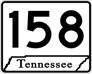
State Route 158 (SR 158) is a major east–west state highway in the city of Knoxville in the U.S. state of Tennessee. It runs 4.63 miles (7.45 km) from Kingston Pike (US 11/US 70) along the Tennessee River to Interstate 40. The western portion of the highway is a surface street known as Neyland Drive and the eastern part is a controlled-access highway called James White Parkway. The entire highway serves as a bypass of downtown Knoxville and as a direct connector to the University of Tennessee (UT) campus and athletic facilities. Serving as the primary means of access to facilities such as Neyland Stadium and Thompson–Boling Arena, the route experiences congestion on game days, with a contraflow lane reversal implemented to mitigate this. It also serves as a spur into downtown and provides access to a number of local landmarks and historic sites, including the Blount Mansion and James White's Fort.
APD-40 or APD 40 is a road composed of the U.S. Route 64 Bypass and a section of State Route 60 (SR 60) which forms a partial beltway around the business district of Cleveland, Tennessee. The route takes its name from its part of Corridor K of the Appalachian Development Highway System and is sometimes called Appalachian Highway or simply the Cleveland Bypass. The route is also designated as Veterans Memorial Highway. The US 64 Byp. section of the road is multiplexed with unsigned State Route 311 and US 74. The road is a four-lane divided highway its entire length, and parts are controlled-access. The bypass is an east–west route, and the state route runs north–south.
The Silliman Evans Sr. Memorial Bridges, most commonly referred to as the Silliman Evans Bridge, are a set of steel plate girder bridges which carry Interstate 24 across the Cumberland River in downtown Nashville, Tennessee. Until 2000, the bridges also carried Interstate 65. The bridges consist of two separate spans, which diverge into four separate spans at their southern end.
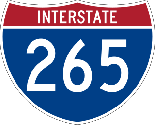
Interstate 265 (I-265) was an auxiliary Interstate Highway in Nashville, Tennessee. It ran on the northern part of the Nashville downtown loop from 1965 to April 7, 2000. It was replaced by a reroute of its parent highway, I-65. It ran for only 2.25 miles (3.62 km).
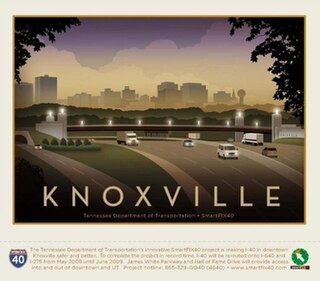
SmartFIX40 was a major transportation improvement project coordinated by the Tennessee Department of Transportation (TDOT) along Interstate 40 (I-40) in downtown Knoxville, Tennessee. The project, referred to as the most ambitious TDOT project at the time, consisted of two separate phases and contracts, started construction in 2005 and was completed in June 2009 at a cost of $190 million. The second phase of the project required the closure of 1.5 miles of I-40 in downtown for a 14-month period, rerouting traffic onto the Interstate 640 (I-640) northern bypass of downtown. At the time of its completion, SmartFIX40 was the largest awarded contract and construction project in Tennessee history, and in retrospective documentation has received acclaim for its methods of accelerated construction and project delivery, including nationwide awards from the American Association of State Highway and Transportation Officials (AASHTO).
