Texas District 12 in the United States House of Representatives is a Congressional district that serves the north portion of the state of Texas. As of 2017, the Twelfth District contained 806,551 people and had a median income of $67,703. It consists of the western half of Tarrant County, as well as all of Parker County and an eastern portion of Wise County. Fragments of the Dallas–Fort Worth metroplex are included in the district. As of 2018, Republican Kay Granger represents the district and has represented the district since her 1996 election.

The Mumbai Television Tower is the television tower owned by Doordarshan, the public-broadcaster located in the city of Mumbai in India. It stands at 300 metres and is the fourth-tallest man-made structure in the Indian subcontinent. The red and white tower is an open latticework structure. The tower, located at Worli, can be seen from most parts of South Mumbai.

Šávoľ is a village and municipality in the Lučenec District in the Banská Bystrica Region of Slovakia.

Bere is a village in Ghanzi District of Botswana. It is located in the southern part of the district, and it has a primary school. The population was 778 in 2011 census. Bere is now one of the few places in the Central Kalahari where Persistence hunting is still practised.

Świerszczów is a village in the administrative district of Gmina Hrubieszów, within Hrubieszów County, Lublin Voivodeship, in eastern Poland, close to the border with Ukraine. It lies approximately 2 kilometres (1 mi) east of Hrubieszów and 105 km (65 mi) south-east of the regional capital Lublin.

Karolinów is a village in the administrative district of Gmina Sulejów, within Piotrków County, Łódź Voivodeship, in central Poland. It lies approximately 8 kilometres (5 mi) south-west of Sulejów, 15 km (9 mi) south-east of Piotrków Trybunalski, and 60 km (37 mi) south-east of the regional capital Łódź.

Urszulin is a village in the administrative district of Gmina Zadzim, within Poddębice County, Łódź Voivodeship, in central Poland. It lies approximately 5 kilometres (3 mi) north-west of Zadzim, 14 km (9 mi) south-west of Poddębice, and 45 km (28 mi) west of the regional capital Łódź.
Bedlno Radzyńskie is a village in the administrative district of Gmina Radzyń Podlaski, within Radzyń Podlaski County, Lublin Voivodeship, in eastern Poland.

Wierzbie is a village in the administrative district of Gmina Pierzchnica, within Kielce County, Świętokrzyskie Voivodeship, in south-central Poland. It lies approximately 8 kilometres (5 mi) south-east of Pierzchnica and 30 km (19 mi) south-east of the regional capital Kielce.
Gadomiec-Wyraki is a village in the administrative district of Gmina Krzynowłoga Mała, within Przasnysz County, Masovian Voivodeship, in east-central Poland.

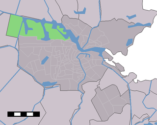
Westpoort is a borough (stadsdeel) of Amsterdam, Netherlands. The borough covers the Port of Amsterdam, the main harbour and industrial area of the city, and is located in the north-western part of Amsterdam. It is divided in the industrial areas of Teleport, Sloterdijk areas I, II and II, De Heining and the harbour area (Havengebied). It is home to over 1,500 companies, with an estimated 45,000 people employed in the area.
Magdalenów is a village in the administrative district of Gmina Ceków-Kolonia, within Kalisz County, Greater Poland Voivodeship, in west-central Poland.
Kopalina is a village in the administrative district of Gmina Domaszowice, within Namysłów County, Opole Voivodeship, in south-western Poland.

Nowe Lignowy is a village in the administrative district of Gmina Kwidzyn, within Kwidzyn County, Pomeranian Voivodeship, in northern Poland. It lies approximately 11 kilometres (7 mi) north-west of Kwidzyn and 63 km (39 mi) south of the regional capital Gdańsk.

Straszewo is a village in the administrative district of Gmina Ryjewo, within Kwidzyn County, Pomeranian Voivodeship, in northern Poland. It lies approximately 6 kilometres (4 mi) south-east of Ryjewo, 12 km (7 mi) north-east of Kwidzyn, and 67 km (42 mi) south-east of the regional capital Gdańsk.

Pustowo is a village in the administrative district of Gmina Kępice, within Słupsk County, Pomeranian Voivodeship, in northern Poland. It lies approximately 10 kilometres (6 mi) south-west of Kępice, 37 km (23 mi) south of Słupsk, and 120 km (75 mi) west of the regional capital Gdańsk.
Zazdrość is a village in the administrative district of Gmina Biskupiec, within Olsztyn County, Warmian-Masurian Voivodeship, in northern Poland.
Tamaya, Niger is a village and rural commune in Niger.
Nasrallah, Tunisia is a town and commune in the Kairouan Governorate, Tunisia. As of 2004 it had a population of 5,054.
Keskvere is a village in Lääne-Nigula Parish, Lääne County, in western Estonia.


