Brunswick is a town in Columbus County, North Carolina, United States. The population was 1,119 at the 2010 census.
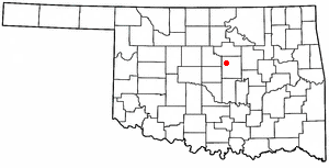
Carney is a town in Lincoln County, Oklahoma, United States. The population was 647 at the 2010 census.
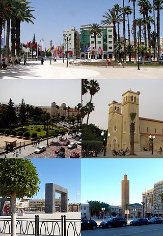
Oujda is a major Moroccan city in its northeast near the border with Algeria. Oujda is the capital city of the Oriental region of northeastern Morocco and has a population of about 558,000 people. It is located about 15 kilometres west of the Moroccan-Algerian border in the south of the Beni-Znassen Mountains and about 55 km south of the Mediterranean Sea coast.
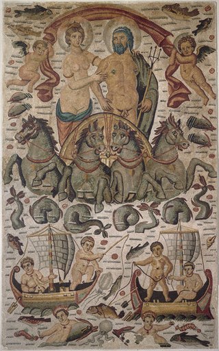
Cirta, also known by various other names in antiquity, was the ancient Berber and Roman settlement which later became Constantine, Algeria.

Tolga is a municipality in Biskra Province, Algeria. Located in south-east Algeria, 363 km south of the capital Algiers(34° 43' 00" N and 5° 23' 00" E). Tolga is well known internationally for high-quality dates. It has more than 500,000 date palm trees. Most dates produced are exported.

Ténès is a town in Algeria located around 200 kilometers west of the capital Algiers. As of 2000, it has a population of 65,000 people.
Messad is a town in Algeria. It was the Roman Castellum Dimmidi.

The 1 November 1954 Stadium is a multi-use stadium in Tizi Ouzou, Algeria. It is used mostly for football matches and is the home ground of JS Kabylie. The stadium holds 25,000 people.

Milevum was a Roman–Berber city in the Roman province of Numidia. It was located in present-day Mila in eastern Algeria.

Weaver, or Weaverville, is a former gold mining town, now a deserted ghost town, in Yavapai County, Arizona, United States. All that remains are some rusting mining machinery, a partially restored cemetery, and the ruins of a stone house.
El Idrissia is a town and commune in Djelfa Province, Algeria. According to the 2008 census it has a population of 29,856. It used to be known as Zenina, named after a wealthy woman who was married to a Roman officer called Serdoun. This name was given to the nearby mountain.

Zemmouri is a town and commune in the Bordj Menaïel District of Boumerdès Province, Algeria. As of 2008, the population of the municipality is 26,408.

Takhemaret is a town and commune in Tiaret Province in north-western Algeria, about 65 km. southwest of the city of Tiaret. The 2008 census population was 34,124 in the commune, with 20,827 in the city.

Aïn El Hammam is a town and commune in Tizi Ouzou Province in northern Algeria.

Azeffoun, the classical Rusazus and colonial Port Gueydon, is a town and commune in Tizi Ouzou Province in northern Algeria, located on Cape Corbelin 64 km (40 mi) north-east of Tizi Ouzou. The economy of the town of Azeffoun is based on tourism, fishing, and agriculture.

Fossatum Africae is one or more linear defensive structures claimed to extend over 750 km (470 mi) or more in northern Africa constructed during the Roman Empire to defend and control the southern borders of the Empire in Africa. It is considered to be part of the greater frontier system in Roman Africa.
Gemellae was a Roman fort and associated camp on the fringe of the Sahara Desert in what is today part of Algeria. It is now an archaeological site, 25 km south and 19 km west of Biskra, and 5 km southwest of the present-day village of M'Lili with which it probably shares an original Berber name. It was connected by military Roman road to Castellum Dimmidi and Capsa.
Bir el Ater is a city located in far eastern Algeria. It is located towards the border with Tunisia, around 87 kilometers south of Tebessa and just beyond the Sahara. The town has a population of approximately 80,000 inhabitants.
Sidi Aïch is a small town, located at 35° 13′ 47″ N, 9° 07′ 46″ E in south-central Tunisia, it belongs to Gafsa Governorate and it is located in 29 km in the north of Gafsa.
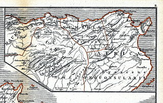
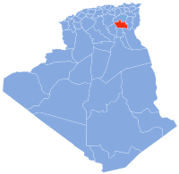
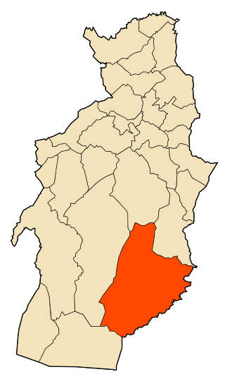
Numidia was a Roman province on the North African coast, comprising roughly the territory of north-east Algeria.