The commune is a level of administrative division in the French Republic. French communes are analogous to civil townships and incorporated municipalities in the United States and Canada, Gemeinden in Germany, comuni in Italy, or municipios in Spain. The UK's equivalent are civil parishes. Communes are based on historical geographic communities or villages and are vested with significant powers to manage the populations and land of the geographic area covered. The communes are the fourth-level administrative divisions of France.

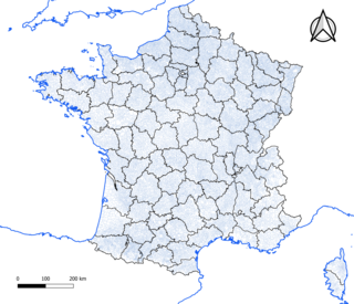
Pontivy is a commune in the Morbihan department in Brittany in north-western France. It lies at the confluence of the river Blavet and the Canal de Nantes à Brest. Inhabitants of Pontivy are called Pontivyens in French.
Barouéli is a town and commune and seat of the Cercle of Barouéli in the Ségou Region of southern-central Mali. In 1998 the commune had a population of 32,739.

La Teste-de-Buch is a commune in the Gironde department, Nouvelle-Aquitaine, Southwestern France.
Tominian is a small town and commune and capital of the Cercle of Tominian in the Ségou Region of Mali. In 1998 the commune had a population of 18,130. In 2004, the population in the main town was recorded at 3,119 people.
Gavinane is a small town and commune in the Cercle of Nioro du Sahel in the Kayes Region of south-western Mali. In 1998 the commune had a population of 21,986.
Kerela is a small town and commune in the Cercle of Dioila in the Koulikoro Region of southern Mali. In 1998 the commune had a population of 10,268.
Zantiébougou is a small town and commune in the Cercle of Bougouni in the Sikasso Region of southern Mali. In 1998 the commune had a population of 21,666.
Domba is a small town and commune in the Cercle of Bougouni in the Sikasso Region of south-western Mali. In 1998 the commune had a population of 8,107.
Keleya is a small town and commune in the Cercle of Bougouni in the Sikasso Region of south-western Mali. In 1998 the commune had a population of 17,267.
Faradiele is a small town and commune in the Cercle of Bougouni in the Sikasso Region of southern Mali. In 1998 the commune had a population of 2130.
Nangalasso is a small town and commune in the Cercle of Kolondieba in the Sikasso Region of southern Mali. In 1998 the commune had a population of 7,887.
Kolosso is a small town and commune in the Cercle of Kolondieba in the Sikasso Region of southern Mali. In 1998 the commune had a population of 5,246 people.
Mena is a small town and commune in the Cercle of Kolondieba in the Sikasso Region of southern Mali. In 1998 the commune had a population of 5014.
Baye is a small town and commune in the Cercle of Bankass in the Mopti Region of Mali. In 1998 the commune had a population of 21,859.
Ouenkoro is a small town and commune in the Cercle of Bankass in the Mopti Region of Mali. In 1998 the commune had a population of 18,123.
Bondo is a village and commune and seat of the Cercle of Koro in the Mopti Region of Mali. In 1998 the commune had a population of 15,872 In 2009, population was almost 20,000.
Machraa El Ain is a small town and rural commune in Taroudant Province of the Souss-Massa-Drâa region of Morocco. At the time of the 2004 census, the commune had a total population of 9832 people living within 1756 households. The administrative headquarter of the Commune is in Ain el Madiour.
Sidi Dahmane is a small town and rural commune in Taroudant Province of the Souss-Massa-Drâa region of Morocco. At the time of the 2004 census, the commune had a population of 8,414 living in 1,560 households.
